John Farley
Supporter
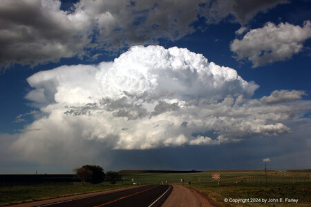
Thought I would start a thread today as I am sure I am not the only one that saw something interesting. After being tied up most of the day with a project, I got out around 4:30 and was able to get some eye candy east of Las Vegas, NM with only about an hour of driving to get there. I posted another picture in a different thread, so will post this one here:

This storm was marginally supercellular for a while as it drifted southeast from north of Las Vegas to northeast of there. Never any real chance of a tornado with this storm, but a nice, photogenic storm. Not long after I took this picture, a cluster of storms surged northeast, becoming SVR-warned and eventually merging with this storm. Full report and more pictures here:

This storm was marginally supercellular for a while as it drifted southeast from north of Las Vegas to northeast of there. Never any real chance of a tornado with this storm, but a nice, photogenic storm. Not long after I took this picture, a cluster of storms surged northeast, becoming SVR-warned and eventually merging with this storm. Full report and more pictures here:


