• While Stormtrack has discontinued its hosting of SpotterNetwork support on the forums, keep in mind that support for SpotterNetwork issues is available by emailing [email protected].

2016-04-25 EVENT: TX/OK

Joined
Mar 30, 2008
Messages
1,488
Location
Norman, OK
This appears to be the second chase day of the week, although less impressive than the days before and after on the latest (12Z 20160420) GFS. Moisture/Instability appears to be limited after Sundays cold front sweeps east, keeping moisture near the red river.

Shortwave ridging in the wake of Sunday's system will keep convection suppressed with eastern extent it seems, but some supercells in NW TX and SW OK seem possible to likely depending on timing of the main trough coming in.

Definitely a day to keep on the radar!
 
The NAM is now in range, and showing a pretty nice picture for tornadic supercells off the dryline under weaker flow as the first shortwave starts to eject into the plains. A very stout dryline in Western Oklahoma should be the focus for storm development by late afternoon. Increasing winds/lift aloft and good moisture should lead to almost 4000 MLCAPE east of the dryline over the I-35 corridor.

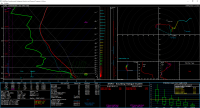
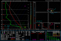
Some forecasted soundings are pretty good for tornadic supercells, including this one from OKC Will Rogers Airport at 7pm CDT

912a634b16c73fccd57dc9232eaf8674.png
 
Looked at this too. This looks to be one of those scenarios where extreme CAPE can overcompensate for weak shear. At the very least we could see some gigantic hail with that much MLCAPE. I was looking towards the Red River (Winstar Casino area).

Tds are in the 70s. Flow is weak but if cap breaks we could see a monster storm. These are fun to watch how quickly they blow up. 5/1/2008 was a day with extreme CAPE and mediocre shear. Great supercell with a very rapid rotating wall cloud formed (and brief tornado) over OKC metro that day. http://www.spc.noaa.gov/exper/archive/event.php?date=20080501
 
I'm with SPC and NWS OUN on this one. General lack of synoptic scale forcing (500 mb height changes negligible and disorganized pockets of weak WAA, mostly behind the dryline) and somewhat nebulous near-surface flow under the ridge make me think this will likely be a non event. Thermodynamics are fairly impressive, but according to the 18Z NAM, the extreme instability is dependent on 70+ dews showing up, and they have yet to this year, and I have doubts they will here. Even if they do, the poor mid-level flow results in deep layer shear that is generally below the threshold that would sustain supercells. There are certainly cases where extreme instability can make up for lackluster shear such that a supercell forms in an area with only 20-30 kts of 0-6 km shear. I've seen it before and I'll see it again. However, that doesn't mean every time a storm goes up in that environment it will definitely be a supercell. Also, some point soundings suggest rather weak mid-level flow, so storm mode could end up being messy anyway.
 
Agree with Jeff above. This day has no appeal anymore. One model run a forecast does not make.

That being said... if one does pop, it will have lots of CAPE.

SW Oklahoma at 00z

d75dd2e068ee24cfc2cdbf8345e17e74.png
 
Last edited:
Back
Top