samuel stone
EF3
Yeah If you live in Kansas or Oklahoma I don't know why you wouldn't want to give this a shot.
We have a N-S dryline with plenty of moisture/CAPE in front of it with a shear vector and storm motions quite normal to the boundary and sufficient deep layer shear. So discrete supercells are in play.
We have great LCLs and at least sufficient SRH in the effective layer (which is thick) so tornadoes are definitely in play to a degree
We have plenty of convergence and lift along the dryline so storms are in play..
That right there is enough to get me outa the house on a backyard chase. and honestly eastern Kansas has looked pretty good for several runs now..
We do have some definite uncertainties however, all of which have been covered above. I would throw in the weakness from 850 to 700mb as well (S-shaped hodos at least in KS) So we will see.. but I'm definitely gonna have a go at it.
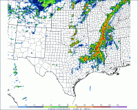
I really like how the dryline on the 4km NAM appears to have a few separate areas of max convergence along the dryline in KS, with areas of low convergence in between, screams discrete storms. Also the convection allowing 4km NAM has now consistently shown a supercell starting around Wichita and moving up towards Ottawa area over the last few runs for whatever thats worth..
Target: Still Emporia, KS (likely moving SW from there)

