Quincy Vagell
EF4
(The latest NAM thinks I should add MO to the title)
This event has evolved quite a bit over the last few days, but as we move into closer range with the higher resolution models getting a better grip on the setup, I think portions of the Mid-South and Ohio Valley could be looking at some severe thunderstorms Sunday afternoon into the early evening hours.
An upper level shortwave near the Four Corners region midday Saturday will swing east across the central Plains with an associated surface frontal boundary over MO/AR by midday Sunday. The models differ with the handling of low pressure along the front, where the ECMWF shows a subtle low developing over IN/OH, the GFS keeps any focused low pressure over the Great Lakes, and the RGEM and especially NAM develop and intensify a low over eastern IL/IN late in the day on Sunday.
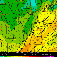
As is often the case, especially given its handling of the surface low, the NAM shows the most robust instability (1000-2000 J/kg SBCAPE) in a corridor from the Mississippi Valley up into the Ohio Valley at 21z Sunday. Models with a more focused low maintain a southerly or even south-southeasterly wind field ahead of the approaching cold front. Even the GFS is in agreement with favorable mid-level lapse rates in excess of 6.5 C/km across the region with models suggesting 40-50+ knots of bulk shear. Damaging winds and large hail appear to be the primary threats, but a few tornadoes could be possible, either embedded in a squall line or with discrete, pre-frontal cells.Timing of the shortwave is favorable to coincide with peak heating, so the biggest three questions in my mind are strength of any surface low, location and storm mode.
1. A more progressive solution favoring a front/elongated low pressure would work to mitigate the severe threat, favoring a linear mode, like the GFS depiction, suggesting mainly a wind threat. The NAM/RGEM are more robust with the low, ramping up the severe threat. The ECMWF is essentially a compromise between the two camps.
2. Location. Is the slower NAM right? If so, throw southeast MO into the mix and maybe even northeast AR. A NAM/RGEM solution generally focuses the greatest threat from southern IL to southern IN, western KY and western TN. A ECMWF/GFS compromise would be closer to middle TN/central-eastern KY/southeastern IN/southern OH.
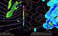
3. At this point, the NAM favors a broken line of storms initiating by mid to late afternoon from eastern MO into southwestern IL. While this model depiction shows no pre-frontal supercell activity, the structure of the line suggests bows/line segments and embedded semi-discrete cells. The environment ahead of the line may favor a few supercells given height falls and the thermodynamic/kinematic environment, but this threat is more conditional than a sure bet.
Keep in mind that model forecast radar solutions are not flawless and that this setup may evolve substantially different than the 4km NAM is showing.
A quick loop of the last four runs of the 12km NAM shows a trend toward a slower progression of the system. Also note the last run shows stronger heating in the warm sector, boosting instability.

After looking like I wasn't going to chase as of yesterday, the latest trends suggest that I may give it a shot. With the setup still coming into better focus, it probably won't be until late Saturday night or early Sunday morning that any specific target area becomes fairly clear.
This event has evolved quite a bit over the last few days, but as we move into closer range with the higher resolution models getting a better grip on the setup, I think portions of the Mid-South and Ohio Valley could be looking at some severe thunderstorms Sunday afternoon into the early evening hours.
An upper level shortwave near the Four Corners region midday Saturday will swing east across the central Plains with an associated surface frontal boundary over MO/AR by midday Sunday. The models differ with the handling of low pressure along the front, where the ECMWF shows a subtle low developing over IN/OH, the GFS keeps any focused low pressure over the Great Lakes, and the RGEM and especially NAM develop and intensify a low over eastern IL/IN late in the day on Sunday.
As is often the case, especially given its handling of the surface low, the NAM shows the most robust instability (1000-2000 J/kg SBCAPE) in a corridor from the Mississippi Valley up into the Ohio Valley at 21z Sunday. Models with a more focused low maintain a southerly or even south-southeasterly wind field ahead of the approaching cold front. Even the GFS is in agreement with favorable mid-level lapse rates in excess of 6.5 C/km across the region with models suggesting 40-50+ knots of bulk shear. Damaging winds and large hail appear to be the primary threats, but a few tornadoes could be possible, either embedded in a squall line or with discrete, pre-frontal cells.Timing of the shortwave is favorable to coincide with peak heating, so the biggest three questions in my mind are strength of any surface low, location and storm mode.
1. A more progressive solution favoring a front/elongated low pressure would work to mitigate the severe threat, favoring a linear mode, like the GFS depiction, suggesting mainly a wind threat. The NAM/RGEM are more robust with the low, ramping up the severe threat. The ECMWF is essentially a compromise between the two camps.
2. Location. Is the slower NAM right? If so, throw southeast MO into the mix and maybe even northeast AR. A NAM/RGEM solution generally focuses the greatest threat from southern IL to southern IN, western KY and western TN. A ECMWF/GFS compromise would be closer to middle TN/central-eastern KY/southeastern IN/southern OH.
3. At this point, the NAM favors a broken line of storms initiating by mid to late afternoon from eastern MO into southwestern IL. While this model depiction shows no pre-frontal supercell activity, the structure of the line suggests bows/line segments and embedded semi-discrete cells. The environment ahead of the line may favor a few supercells given height falls and the thermodynamic/kinematic environment, but this threat is more conditional than a sure bet.
Keep in mind that model forecast radar solutions are not flawless and that this setup may evolve substantially different than the 4km NAM is showing.
A quick loop of the last four runs of the 12km NAM shows a trend toward a slower progression of the system. Also note the last run shows stronger heating in the warm sector, boosting instability.

After looking like I wasn't going to chase as of yesterday, the latest trends suggest that I may give it a shot. With the setup still coming into better focus, it probably won't be until late Saturday night or early Sunday morning that any specific target area becomes fairly clear.

