2015 Southwest Monsoon

Jeremy Perez

Supporter
Joined
Aug 31, 2008
Messages
342
Location
Flagstaff, Arizona, USA
If anyone wants to post reports or photos from the 2015 monsoon season, please feel free.

It's been a pretty enjoyable storm season in the southwest this summer. A couple weeks ago, some really nice, unseasonal shear—along the bottom of the upper level high—even dealt us a few supercells for a couple days.

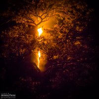
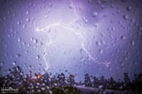
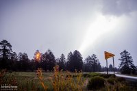
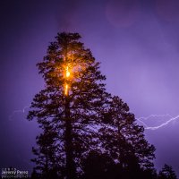
For tonight, 13 JULY 2015, a mass of pop-up storms crept eastward across central and northern Arizona. Flashes out the living room window got my attention and I headed a couple miles east of Flagstaff for a few shots. I managed to set up under the next batch of storms that brewed up. So I got the gift of heavy rain to keep me from even getting decent use of my window mount. Several really close strikes while I was waiting it out put me on edge. One of them apparently hit a ponderosa a couple hundred feet to my east and gave me something to photograph before the fire department cruised over to be sure it sputtered out on its own.

Lightning strike through spattered window
The fire is a couple minutes old at this point
img20150713_20150713-IMG_7587_md.jpg

A horribly overexposed strike
If only I had taken it down about 3 stops before this happened.
img20150713_20150713-IMG_7594_md.jpg

Anvil crawlers flicker as the tree burns
img20150713_20150713-IMG_7606_md.jpg

More fire, because—fire.
img20150713_20150713-IMG_8312_md.jpg
 
So i spent the last 20 minutes posting pictured and wla write up on my phone just for it not to work...go figure

Now running late for work so ill hqve to try again later

Sent from my SCH-I545 using Tapatalk
 
Monsoon just starting to kick off up here in CO...can't wait to get out on my nightly adventures of avoiding rain and catching some bolts. Hoping for a chance tonight and tomorrow to get started. Good luck to all this second season.

Thanks for starting this thread @Jeremy Perez
 
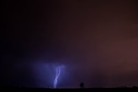
c95db03a4e2bd52539bfd49380360725.jpg
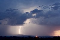
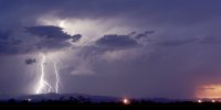
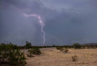
This was taken this past sunday as this storm went severe near Green Valley

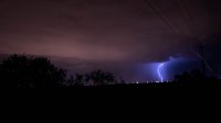
63a9a0c3bdbe8ea65b6afaee6e5008f1.jpg
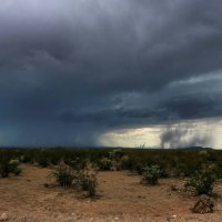
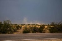
From a couple weeks ago from the desert museum. Birth of a dust storm

1d2e994391cbeba708fc1f819f68965a.jpg
Also from the desert nuseum. This also went severe shortly after. Was lucky enough to watch it go up right on top of us

d16349a1e938559a5befc1bfdab4a473.jpg

fbef8df675a02566c8dc5acb460f6015.jpg
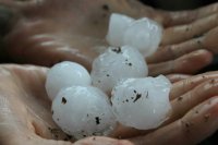
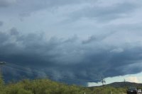
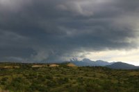
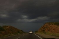
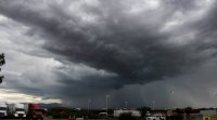
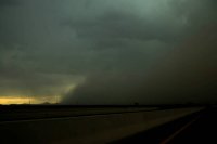
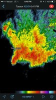
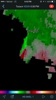
Some supercellular structure. Something you just don't see every day here. I love the second photo. My brother took this from the car. While my family was visiting from Connecticut, I just couldn't help but have to chase that day after looking at the sounding from that morning. Glad I chose that day to take my mom and brother chasing. We were treated to this as it rolled off of Mt. Lemmon. Sadly got trapped in traffic as we were traveling west to get ahead on rt 86 where it also produced a microburst, golf ball sized hail which a few also looked slightly smaller than tennis balls as they hit the ground, a rapidly rotating gustnado that caused a panic with traffic as it crossed 86, and 60+mph winds
d4b28c01edcadcaeb9e8f7d7417f54e0.jpg

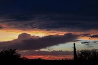
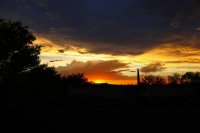
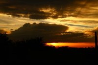
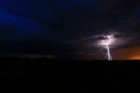
Of course mandatory AZ sunsets with my new camera

800c28f10728da114ef6fcc36591b04a.jpg

3c1c0ee039352a6eea86d1d446c1f9a9.jpg

676d5984b5a9296caa8c20bab497912c.jpg

c7af7bcd92a4276786c1bc4b740d990c.jpg

Sent from my SCH-I545 using Tapatalk
 
@Greg Campbell - Excellent lightning shots, Greg! Those desert vistas are perfect.
@Marc R. O'Leary - I hope you get some good storms, Marc. I'm looking forward to seeing what you catch.
@Kevin Rimcoski - Great collection of shots, Kevin—it's one of my favorite sights when you get an isolated view of a cell building almost overhead. And the structure on that Mt. Lemmon storm is awesome. It was really interesting having flow out of the east on those storms and watching how they behaved, winding up couplets and gaining supercell characterestics.
It was a bit weird watching the forward flank following the updraft. Both moving southwest. Especially after you're used to watching storms out in the plains. You get used to how those characteristics are and how theu behave, the structure and movement

Sent from my SCH-I545 using Tapatalk
 
Here are a few from the Pagosa Springs area in southwest Colorado:

a8d1e98b8e45ac4d77ddba3435f89995.jpg
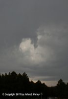
Possible shear funnel on June 27

7b39d177fd60340e58a321f6dd5c39c5.jpg
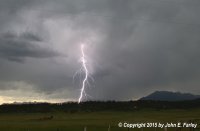
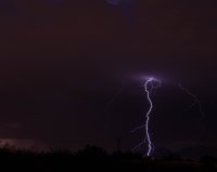
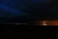
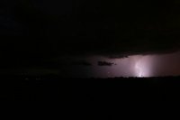
June 29 lightning

d6b18b215b467eeed694cf41db2b4f26.jpg
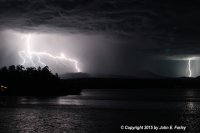
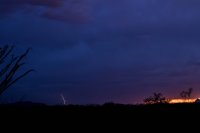
Nighttime lightning over the San Juans, June 30

16ad88a985f6820c736f54bdc9d1babe.jpg
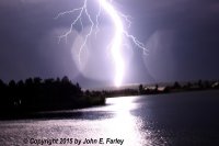
Intense bolt across Village Lake, also June 30. Despite the fact that it is blown out, I kind of like this image because it captures the intensity of the bolt.

566b69234cf0aaeeac4a3f17427725ab.jpg
July 1 lightning over the San Juans, northwest of Pagosa Springs near the Archuleta/Hinsdale County line.
 
The last few days have been pretty active. I covered about 1000 miles in just 4days. And everything was pretty local as well

de831fd20bb23331a2a7b141bbb8ca39.jpg

e6990529ac96cbdc449489028a600f7f.jpg

fcffcfa4cb39460a9e6af0c2fb26419b.jpg

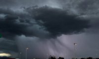
This cell was located a few miles north of Sonoita, AZ. Had some great structure with it for a while, scuddy base, and the last picture shows some scud in the front of the mountain under the base which was rising and had weak rotation with it

31181be215cf3ee1581d88ec10630320.jpg

Having to core punch to get ahead and catch a storm heading towards Benson

e44ee9c4d0075228117087205b9bf37e.jpg

f0df687c38661d132f491d370fa49c1e.jpg

All of these photos above were taken on Wednesday (7-29-15)
The two photos above were the storm we caught after punching through. Again, had a slight lowering off the base, nice structure, and decent hail core. You can see lit up by the lightning.
 
47169a81587d6e37caa0aef84f9e94d2.jpg


36739d1dc624aa2cf769bc0ddae6bb2b.jpg


09cae69b9bd517c7f707112511d52e18.jpg


8d45e7184dab89070de5dc0419f5d562.jpg


5aa465af688289fa44c49113b5d87187.jpg


And these were taken near Green Valley the same day


Friday was also another great chase day. I was lucky enough to get off work early enough that day. Thursday, I missed everything. It all gusted out just as I got to any storms


f47e25d170d0520b277c283b24242617.jpg

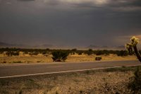
Some dust blowing over I-10


16c7c7c038318395215cd71f0444ffde.jpg

Dust being kicked up in my position


95d7fa93aea03bc545bb919e66072895.jpg

One of my favorite daytime bolts I've caught so far. These were taken off Park Link RD by the Catalinas


16cecf46f006a5c20e450b178646d80a.jpg

Heading north, this I believe was just past Eloy. Lots of dust storms that day
 
ba6461bc4bcc606d776c7e1e0b0e32ff.jpg


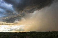
My favorite from Friday. Got my first haboob. Can't remember exactly were I qas, but this was somewhere right after getting on I8 and heading west


85af83fdd23dfb7e30fb6e1a477c4756.jpg


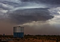
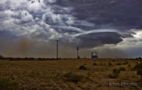
And the best from Saturday. Other than good contrast, a vibrant rainbow south from a storm south of Vail, this is probably one of my favorite shots so far. We were sitting directly under the base. This had a beautiful shelf, frequent CG, and another base way in the background which had a weak hook, and a decent couplet for a few scans. Just being too far away with no west option, this was all we could see


3b9bbf49d97c6981f7c4dd7254fee02f.jpg


bbfac4c3fc5691df5a89b8d1fe44730c.jpg


It was sitting near three points, but we were off to the east
 
@Kem Poyner

Kem, those are great shots! That looks like a very successful monsoon chase. It almost looks like a gustnado on left side of the bottom pic.
My interpretation of the cloud feature—
It seems like it wants to be an isolated storm base, but transitioning to a condensed shelf. Possibly, the line of outflow is making a more rapid push right beneath that feature and lifting the moist surface layer more rapidly than other parts of the surrounding gust front.
 
Back
Top