2015 Southwest Monsoon

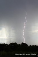
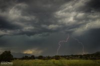
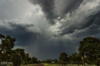
I raced a line of storms eastward along the north side of the Mogollon Rim on Sunday, August 2nd. I got to a point about 30 miles southwest of Winslow and gave my new lightning trigger its first field run. Shutter lag on my Canon T3i seems a bit long and tended not to catch the branching leaders on some exposures—just the return strokes. But one of the cells that popped up south of me was kind enough to fire off a lot of CGs in quick pairs. So, one strike would set off the exposure, and then another one would quickly follow off to the left or right and all the branches on that would get recorded.
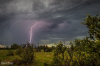
img20150802_20150802-IMG_7662_lg.jpg

I wound up capturing several good strikes on that storm. I usually don't do composite lightning images since they can tend to look kind of overdone. But this one seemed to work out all right. This is a composite of 7 exposures taken over about 5 minutes.
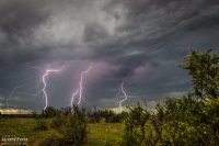
img20150802_20150802-IMG_7654-Edit_lg.jpg

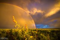
Then the ensuing rainbow opportunity once the sun finally got below the cloud deck.
img20150802_20150802-IMG_7687_lg.jpg

Meanwhile, about 30 miles further east, Mike Olbinski was on an isolated, severe-warned cell with a couplet and beautiful Arizona-style supercell structure.
 
I raced a line of storms eastward along the north side of the Mogollon Rim on Sunday, August 2nd. I got to a point about 30 miles southwest of Winslow and gave my new lightning trigger its first field run. Shutter lag on my Canon T3i seems a bit long and tended not to catch the branching leaders on some exposures—just the return strokes. But one of the cells that popped up south of me was kind enough to fire off a lot of CGs in quick pairs. So, one strike would set off the exposure, and then another one would quickly follow off to the left or right and all the branches on that would get recorded.

View attachment 9470

I wound up capturing several good strikes on that storm. I usually don't do composite lightning images since they can tend to look kind of overdone. But this one seemed to work out all right. This is a composite of 7 exposures taken over about 5 minutes.

View attachment 9471

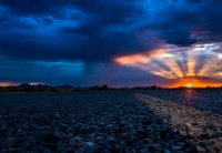
Then the ensuing rainbow opportunity once the sun finally got below the cloud deck.

View attachment 9472

Meanwhile, about 30 miles further east, Mike Olbinski was on an isolated, severe-warned cell with a couplet and beautiful Arizona-style supercell structure.
You and Mike both did pretty well that day. Even Bryan Snider had a funnel cliud reported. I toyed with the idea of trying up there as well but definitely needed the break
Nice shots :)

Sent from my SCH-I545 using Tapatalk
 
The Mogollon Rim Convergence Zone worked its magic the past 3 days with southwest flow leading to some especially favorable shear along the Colorado River Valley. I caught a supercell near Tuba City on Friday, but goofed up and missed the tornado-warned cell near Wupatki today.

Friday — 7 August 2015

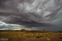
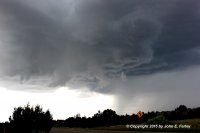
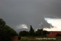
The first time I've caught Kelvin-Helmholtz waves along the elevated base of a supercell and it was a mile from home. This view faces northwest as the cell moves over the edge of the Painted Desert.
img20150807_20150807-IMG_7730_lg.jpg

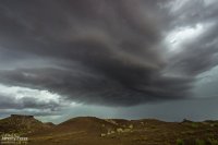
Another view as the storm starts to pass to the north
img20150807_20150807-IMG_7749_lg.jpg

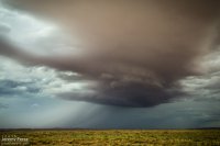
Further east, after it moved past Tuba City—
img20150807_20150807-IMG_7755_lg.jpg

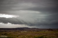
A nice roll cloud on a storm earlier in the day in the same area. I figured this one would have stabilized the air mass, so I was gradually making my way towards Page, but 3 hours later I raced back south to meet the supercell rolling through the same area.
img20150807_20150807-IMG_9011_lg.jpg
 
Saturday — 8 August 2015

More storms showing up with couplets this day, but I didn't manage to intercept them during prime structure. The landscape made up for a lot of those issues. These shots are from Hwy 89 north of Flagstaff along the Mogollon Rim/Colorado River Valley margin.
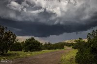
Scud bomb merging into the updraft between Sunset Crater and Wupatki National Monuments.
img20150808_20150808-IMG_7988_lg.jpg

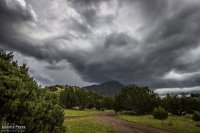
A benign updraft as the atmosphere begins to stabilize. Sunset Crater is trying to peek between the trees on the right.
img20150808_20150808-IMG_8421_lg.jpg

Convection has turned to mush almost everywhere, leaving a great sunset aftermath—just northwest of Sunset Crater National Monument, looking toward the San Francisco Peaks.
img20150808_20150808-IMG_8428_lg.jpg
 
Sunday — 9 August 2015

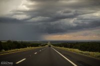
After noting a great supercell near Winslow, I opted to head toward Twin Arrows to see if some developing convection would take off there. It was good for a lot of heavy rain, but hardly any lightning and it didn't manage to organize.
img20150809_20150809-IMG_8439_lg.jpg

While I was toying with that mess, another storm north of Flagstaff crossed the threshold to the Colorado River Valley, west of Wupatki and went supercellular.
img20150810_IMG_6278-Edit_md.jpg

While I pondered my situation and whether I could race to that storm in time before it drifted into the extremely hard to navigate spaces west of Hwy 89, it picked up a tornado warning. So I dropped the slop I was on—to at least give it a try. By the time I had visibility on Hwy 89, it had the merest remnants of an elevated base.
img20150809_20150809-IMG_8445_lg.jpg

On the chance it might cycle up on some new convection to the south, I took a pretty decent forest service road along the cinder cones north of Sunset Crater. What did pop up didn't develop rotation but still managed to make for some nice storms and lightning.
img20150809_20150809-IMG_8451_lg.jpg

img20150809_20150809-IMG_8459_lg.jpg

img20150809_20150809-IMG_8464_lg.jpg
 
Sunday is a reason I don't think I'll pass up another setup like that to the north. The Flagstaff NWS apparently even said a likely tornado on the ground in their warning text. Would have been great to be on that storm during its lifecycle

Sent from my SCH-I545 using Tapatalk
 
Some updated thoughts on the monsoon activity in northern Arizona the past few days—

I posted a question to the NWS Flagstaff Facebook page:
"....Is there any connection to the Mogollon Rim Convergence Zone and storm organization in the area the past few days?"

The reply I received was:
"....At least a couple of storms over the last few days did develop along that convergence zone and were surely aided by it. Storms in the Cameron/Gray Mountain area have also likely been influenced by the southerly flow coming around the Peaks (some sort of vorticity advection/stretching, possibly...) and this seems to have ensured that nearly every storm in the area had some sort of rotation. Been an interesting past few days!"

As a Facebook post, this probably isn't considered the official word on the matter, but it’s still pretty informative.

So perhaps there wasn't quite as much of the activity influenced by the MRCZ as I was contemplating—but it seems at least a bit of it was.

The other interesting tidbit is considering vorticity generated by southerly flow past the peaks getting tilted into the passing updrafts.

Here is a link to the MRCZ paper:
http://www.stormresearch.com/pubs/sls2000.pdf
 
Yesterday I had a view of anticyclonic supercell structure right out the back door where I work.

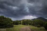
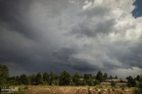
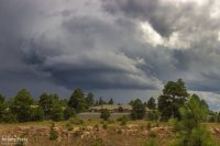
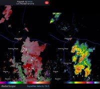
This cell was on the north side of a cluster of storms south of Flagstaff at 1:40 PM (August 12th), moving northeast. I thought maybe this storm was a left split, but I couldn't detect a cylonic partner. In fact, there appeared to be two anticylonic couplets in the mass of storms for a few scans. It's such an excellent puzzle.

Time lapse of the cell from 1:40-1:55 PM

A couple stills of the structure (facing south from central Flagstaff)
img20150812_20150812-IMG_8794_lg.jpg

img20150812_20150812-IMG_8744_lg.jpg

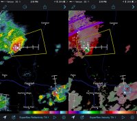
Velocity and Reflectivity at 1:40 PM
VelocityAndReflectivity.jpg

Animation of Velocity Scans

And a tidbit from the day before (August 11th) when a pretty spectacular gust front rushed through town—
img20150811_20150811-IMG_8512_lg.jpg
Animation of that—camera was hand-braced on the car window:
 
Big storms day and night here Tuesday. Of course work got in the way, and I wasn't on them until after 8pm. Wish I could have been north for phoenix dust storm and lightning show.

0d40cca6bf803e487685197d53b411cc.jpg
I liked this one until I noticed the light trails

1668dca703bf19686bd44297964e9148.jpg

233f66faa75bbff1649187fad39de239.jpg

dc4701671345b5e270ef8118a4cd4716.jpg
Sunset the day before

5611d424e8c044722908926ca270158f.jpg
Yesterday because no storms

Sent from my SCH-I545 using Tapatalk
 
There were some nice storms around the Santa Fe, NM area August 10 - first decent storms I had seen in nearly a month.


IMG_2613-e-FB.jpg
Lowered area under the updraft of a storm that formed right over Santa Fe.

IMG_2605-e-cr-FB.jpg IMG_2623-cr-e-FB.jpg
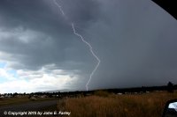
Lightning from 2 different cells that I viewed from the SE edge of Santa Fe. First one looking SW, second one looking E. In the second one, note a little branch coming out of the cloud but not reaching the ground to the right of the main bolt.

IMG_2639-e-FB.jpg
Mountain scud bomb, looking NE from the SE side of Santa Fe.
 
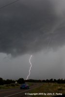
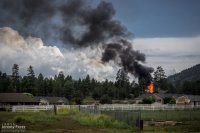
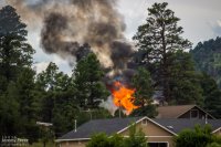
On my way home after photographing monsoon thunderstorms northeast of Flagstaff, I noticed smoke rising over the hills along Townsend-Winona Road. I thought it might be another tree fire, but as I rounded a bend, it turned out to be a terrible house fire. Checking radar, it looks like there were 3 lightning strikes over that location from 2:45-3:00 PM. Several fire trucks were on the scene but the fire was overwhelming and it took quite a while before it seemed to be brought under control. I'm afraid the house may have been completely lost.

A couple of the lightning strikes along Townsend-Winona Rd.

img20150815_20150815-IMG_9112_md.jpg
Link to Large Image

img20150815_20150815-IMG_9145_md.jpg
Link to Large Image


The house fire at Townsend-Winona and Bullion Hill Rd.

img20150815_20150815-IMG_9028_md.jpg
Link to Large Image

img20150815_20150815-IMG_9024_md.jpg
Link to Large Image
 
While I believe that seeing a waterspout out on Lake Michigan, or any of the Great Lakes would be the coolest thing, I think that seeing the ultra-cool weather phenomena that AZ has would rank right up there for me. Those lightning shots are amazing @Jeremy Pérez..
 
A few pics from across southern CO today. These storms were all west of the Front Range, so I think they are best described as monsoon storms, in contrast to the storms associated with the cold front on the plains.

IMG_2675-e-FB.jpg
Lightning looking northwest from about 5 miles west of Pagosa Springs.


SanLuis1-81615.jpg IMG_2682-e-cr-labeled.jpg
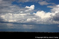
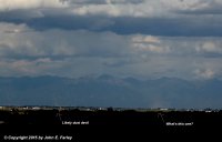
Farther east, I saw a couple swirlie-thingies in the San Luis Valley. Too far away to tell whether they were right under the updraft base, but would think they were pretty close, as the updraft base was over the valley near/west of the Great Sand Dunes, not over the mountains. I think the left one was likely a dust devil, but the larger one to the right - I am not so sure. I was big, and as the first picture shows, appears to be right under a strong updraft. Given how far away I was, not absolutely sure it was spinning, but it doesn't really look like an outflow plume. Wish I had been closer. These pictures were taken from a little west of Monte Vista, looking NE.
IMG_2685-e-FB.jpg
Strong storm near Ft. Garland, looking east from Alamosa.

IMG_2704-e-FB.jpg
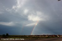
OK, this one was taken east of the Front Range, so probably a mixture of monsoon moisture and cold front. Looking NE from the east side of Pueblo.
 
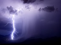
Tucson has enjoyed a few active nights over the last week or so.

I've been pushing the aperture in search of more 'wow' effect, with occasionally successful, occasionally blown-to-heck results.

This was right on the edge, f/4 at ISO 100 and reasonably close to the action. I usually don't go for outright blown-away areas, but here, where the rain shafts coincide with the blown highlights, I think it looks kinda cool. I only wish I'd guessed a few degrees further to the left....

c7b96f94c845c4491d067de5699c19d9.jpg

A few nights later, also shot as wide as I dared.
The 'Wow' is offset by a loss of subtle details. I'm not sure I really like this look, but I'm having fun playing with the idea, and that's what counts!
f0bccc2cef7fcf3202c650ba92c43018.jpg
 
Back
Top