• While Stormtrack has discontinued its hosting of SpotterNetwork support on the forums, keep in mind that support for SpotterNetwork issues is available by emailing [email protected].

2015-07-13 EVENT: IA/IL/IN/KY/MO

Joined
Jan 14, 2011
Messages
3,535
Location
St. Louis
Monday is the 11-year anniversary of the Roanoke, Illinois F4, and it's interesting that we will have a setup that shares some similarities with that day in 2004 - in the exact same area. A potent shortwave trough imbedded in northwest flow will overspread extreme instability across Illinois and Indiana on Monday afternoon. A linear storm mode/derecho event should quickly evolve. But, as with the Roanoke event, boundary interactions early in storm evolution could easily yield a couple of significant tornadoes.

The main drawback I see with Monday's event is weak surface flow, but the extreme instability in place should compensate. The 2004 event also had rather weak and ill-defined surface flow. The 2004 event also had a more diffluent upper air pattern than models are indicating for Monday.

http://www.spc.noaa.gov/exper/archive/event.php?date=20040713
 
Early CAM run from NAM 4K indicates a pretty stout supercell forming in SW Wisconsin forming on the periphery of a 5000-6000 cape environment and within just a couple of hours forming into a southward moving MCS that affects much of IL . There's also some possible regeneration of an ongoing overnight MCS entering a favorable environment in NW Indiana earlier in the day, just after noon that could result in a few embedded QLCS type tornadoes, but at the very least a damaging wind event would be evolving over much of Indiana from this convection. Those two scenarios stick out to me as the main tornado threat in the great lakes region.

Otherwise general parameters seems to be holding and there's only subtle differences apparent between GFS and NAM that I see. Perhaps with GFS shifting everything slightly eastward. Surface winds are move favorable into central and Northern IL where any convection could fire up in an environment where supercell modes might be sustainable just a little longer before the inevitable MCS that will likely form out of any significant convection in the area.

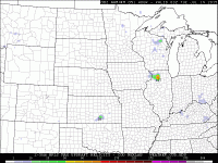
2ccb0fc3ac5eda5f53ed3d82c98bc033.gif
 
Last edited:
Managed to move my vacation schedule around and spend minimal money to chase instead of ride roller coasters, so here I am in Chicago waiting on tomorrow.

I can't recall the last time I saw a jet as strong as this in July with tons of CAPE and dewpoints in the mid to upper 70s. The RAP this afternoon is already showing nearly 100 knots at 250mb streaking across Iowa tomorrow at 12Z with the NAM showing somewhat similar numbers. Forecast hodographs look quite great when you consider storm motion to the S or SSE. I've found myself looking sideways a lot when looking at forecast soundings. Best hodographs show up in Central IL throughout the day tomorrow. Any supercells utilizing that environment will have huge hail accompanying them as well as tornadoes, some strong/significant.

With that said, storm mode is still in question. Fully expect the MCS that's going to blow up this evening to race southeastward overnight and slam into Chicago in the morning. That will leave a boundary to the west of Chicago metro that will slowly lift throughout the day. Any storm that can fire along that boundary and feed from the warm sector will have the potential to be supercellular. Any supercells have a distinct possibility of being HP with high moisture content. Morning soundings today show about 1.7" PW values and mixing ratios around 15g/kg from ILX and DVN.

TLDR: Could be a significant day in northern and especially central IL with all severe modes possible.
 
A few other thoughts. One of the things that stands out with the Roanoke event is that with extreme instability, storms can produce on even fresh outflow boundaries (still cold on one side). Rain-cooled air is no obstacle to that much CAPE. "Tail end charlie" in northwest flow is the northwesternmost storm, which really throws you off if you're not used to it. The southern storm in NW flow often gets seeded by storms to the NW. Updrafts on these storms are on the western side, meaning if you're due east of one, the forward flank precip will obscure your view of the base.

Also, the corn is high in IL right now. This can make some rural intersections dangerous. Soybean fields allow for good viewing, but seem to be fewer in number this year than in past summers.
 
Last edited:
It looks like today's MCS is moving a lot slower than expected. It's past 9PM and it hasn't even reached Minneapolis yet. I don't know how this will affect the timing of tomorrows storms.

Also for those traveling to Illinois keep in mind a lot of areas are flooded. It may be harder to find places to pull over because of soft, muddy shoulders. It will only take a little bit of rain on the already saturated soil to cause some serious flooding, as I found out yesterday.
 
Taking a look at the evening soundings/mesoanalysis has me pretty happy, with lapse rates at ILX around 7 and higher on the OAX sounding. DVN seems to be the outlier at 6.5.

With that said, I'm quite impressed with what appears to be quite the quality upper level impulse heading this way to IL tomorrow. A look at water vapor tonight shows the ridge/dome over the southern plains and the upper low over alberta. Between it squeezes a nice, strong, focused jet with multiple waves evident.

The evolution of the storms in Minnesota will definitely play out, but I still wouldn't rule out the cold front tomorrow, especially if the MCS tonight doesn't lay down any boundaries this far south. Boundary perpendicular flow should promote more isolated storm modes off the CF tomorrow.
 
Ben I am just west of Springfield in Jacksonville. The NAM and 4k NAM are hinting at discreet storms initiating off the cold front well after the MCS leaves IL tomorrow evening. With 5k plus cape and a favorable amount of shear near here that could lead to an interesting situation. The sim reflectivity shows very decent supercells moving though here around 10pm. I just have a hard time believing that the atmosphere would recover that fast. Are you seeing the same and what do you think?

Sent from my SAMSUNG-SM-G870A using Tapatalk
 
As expected, the overnight MCS raced through the Chicagoland area, and is currently over Indiana heading SE. A golden outflow boundary with what appears to be either a bore or gravity waves has eruped with a NW/SE orientation across IL. This should be a focus for storm development later this afternoon, with boundary parallel flow and storm motion, I'm not exactly sure what will happen. We could have monster supercells riding along this all day. 'Tail End Charlie' would be the most NW storm. Any favorable boundary interactions would result in quite the tornadic potential.

We could also just have a MCS light up in SW WI and move along the boundary in the wake of the previous one. This would spell less supercells and more of a linear mode.

Watervapor loop this morning shows the same focused jet as I mentioned above. It appears there was an impulse moving into NW IA as I write this. That would seem to focus storm intiation later on, perhaps as early as 20-21Z. Game plan for us is to get west on I80
 
The ongoing storms across SC IA/NC MO may throw somewhat of a wrench into the setup today. The storms are certainly elevated since they exist in a region with high SB/ML CIN. It looks like they may have formed along the 850 mb thermal axis in response to some amount of WAA, although SPC mesoanalysis shows they're also along the leading edge of a push of drier air at 850 mb...strange. They're in an environment characterized by extreme instability and more than enough effective shear to keep them going for a long time. I don't see much reason for these storms to simply die out as they press southeastward. The lead storms appear to be struggling to hold on, but the storms in the backside of the cluster seem to be holding their intensity and morphology pretty well. At their current pace they'll be in WC IL by 3-4 PM. Continued cloud development could cause the areas downstream (so over WC into C IL generally along and south of I-72) to become shaded by late afternoon, which may limit instability and make it more difficult for storms to form provided storms aren't already ongoing at that time. Recent op HRRR runs do not appear to have captured this convection very well. It looks like the storms have been assimilated into the ICs well enough, but the model wants to kill them off quickly. After even 1 hour of integration there's little sign of them remaining.

Meanwhile, the HRRR seems to focus most convective activity across far S WI through NE IL and into N IN throughout the afternoon and into the evening. It looks like it quickly washes out/lifts the boundary northeastward during the early afternoon to force storm development. However, current obs suggest the HRRR is too far northeast with the boundary and perhaps twisted a bit in orientation. The boundary is being sampled reasonably well as a fine line from KILX, although it is becoming less discernable as I type this. It seems to show the boundary currently running parallel to I-72 just west of Champaign, then curving northwestward, just northeast of Lincoln and towards Peoria. North of there it becomes impossible to discern on radar and surface obs don't appear to show much of a boundary in the area in NW IL. Inititation appears probable within a few hours along that boundary in C IL provided it doesn't wash out or become non-divergent. Thermodynamics with this setup are pretty incredible: SPC mesoanalyses already show 6000+ SBCAPE and 4500+ MLCAPE over areas of E IA and W IL, and I see some 80 F Tds scattered about in the area, with temps already encroaching on 90 F. I'm a little surprised to not be seeing more widespread CU development in these areas than is currently noted in vis satellite. The degree of capping may be holding things down for now, or that push of drier air at 850 mb may be working its way in.

We shall see.
 
With high temps/high dews, 7000 j/kg CAPES and northwest flow, reminds me of Plainfield 1990. It's interesting how the HRRR is showing convection breaking out north of Rockford and progressing SSE, while all the thermodynamics point to a Davenport to SE orientation, as Jeff pointed out. Was thinking of heading into Bureau Co. and points SW, now not sure.
 
18Z special sounding from KDVN suggests very strong capping in that area, so farther east like the HRRR is showing might make sense. Of course if something DOES break that cap . . .

http://kamala.cod.edu/ia/latest.fxus63.KDVN.html

That's interesting, John. I took a look at that sounding, and the CAP is over 6d C. I then took a look at ILX's 18z sounding, and the CAP is 3.1C, and the 500mb wind speeds are much more robust. I notice now that the 20z SPC outlooks do in fact pivot the corridor of most severe more NNW to SSE, and move it away from the River and more aligned with I39 corridor.
 
So what went wrong in IL yesterday?? No TOR reports, hardly any high wind reports except in the SW part of the state, and I don't remember even seeing any TOR warnings the couple of times I looked at radar but there could have been some when I wasn't looking...

And what about that TOR in KS?!? I was not looking at obs there at all yesterday, but I looked back at a MSD for the area and they mentioned temps over 100, I have to imagine the temp/dewpoint depressions were very large in that environment (even though the boundary layer probably cooled somewhat by the time of the tornado) so surprised to see anything other than a landspout, and that tornado was no landspout!!!
 
It was my observation yesterday that the storm that I chased near Mersalles/Ottawa, IL was sort of elevated. Lightning activity was quite low on this storm despite what I would expect with ~7000 SB CAPE in place. It had some great RFD structure and even what looked like perhaps an occluded mesocyclone at one point early in its life, but seemed to continuously struggle at the surface. I'm wondering if the morning outflow boundary actually was undercutting these storms killing their chances to produce anything tornadic. Otherwise, the inflow environment was fairly impressive and I would have expected more than just some hail to come out of these. Further southwest, I think capping was an issue with 850 temps being fairly toasty (~24C) and then the stuff moving in from Missouri eventually shielding much of WC IL in cloud cover. Them were just my observations yesterday, would be interesting to see what others think!
 
Back
Top