Going to be a negative Nancy here.
I think, like yesterday, this event is going to underperform. I'm surprised to see the addition of the 10% hatched tornado threat to the 1630 UTC convective outlook.
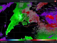
The one thing that is going great for this setup is low-level shear - there is gobs of it in a widespread area, and it is pretty intense. Experience tells me that even in the absence of other favorable conditions, strong low-level shear can still result in numerous tornadoes.
Now for the negatives.
-Deep layer shear: surprisingly weak given the flow magnitude. This is the result of a largely unidirectional wind profile, however. I don't see much indication that this will improve much throughout the day either. It's going to be a little harder to get tornadoes if the storm mode ends up being linear (outflowy).
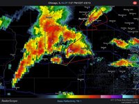
-Insolation: just like yesterday, there is an awful amount of cloudiness over much of the warm sector. Visible satellite is showing that the clear area between the dryline/cold front and some early elevated convection now east of the Mississippi River is rapidly filling in with what appears to be low stratus. Cloud height obs from MO suggest some of these are higher, but some areas are really socked in. There are a few bands of clearing, but they don't look to remain over any one area too long. This will limit the degree of destabilization and keep CAPE down. The good news about this is that convective temps on the ILX and SGF soundings from this morning were only in the upper 70s to around 80, and it looks like many locations are going to get either really close to that or exceed it with even a little bit of heating. However, I'm not sure convective temps will remain that low because...
-The thermal axis at 700 mb is colocated with the surface dryline/cold front and is still well west of the areas highlighted as being in the higher probabilities for severe weather. While the temperatures in that ridge are not overly warm, the 12Z TOP sounding, located right in it, had a convective temperature of 84. I'm not sure areas of MO/IL/SE IA are going to get quite that warm. So the mid-level CAA isn't going to help with any capping that occurs today. 850 mb temperatures are generally 13-15 C, but that doesn't sound too particularly bad.
I think if there's an area that gets lucky with enough clearing to warm to 80 or more, there could be something interesting there, but I think this is going to be a messy event and probably difficult to chase for many. With the unidirectional shear profile, storm speeds aren't going to be the most friendly either. I think the best chances, though, are indeed in SE IA/far NE MO and into WC IL where the deep layer shear is marginally better and current instability looks to be a little higher (also closer to the triple point). Unfortunately it's also one of the cloudiest areas right now, too.
Last thing: I don't think the threat will make it as far north as Cedar Rapids. Looking at the IEM Time Machine (
http://mesonet.agron.iastate.edu/timemachine/#1.201504091700), it's interesting to watch the KCID ob over the last few hours. It goes from saturated in the upper 40s with an east wind around sunrise followed by a rapid warming/moistening and veering of the winds to SEly by 11 AM, but then the wind flips back around to due N and the T/Td drops from 61/60 to 55/55 at noon, suggesting the boundary had moved back south. Keep an eye on the Iowa City ob to see if it does something similar soon.