• While Stormtrack has discontinued its hosting of SpotterNetwork support on the forums, keep in mind that support for SpotterNetwork issues is available by emailing [email protected].

2014-06-16 REPORTS: NE/ IA/ MN/ IL/ WI/ SD/ ND

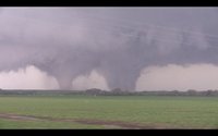
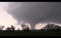
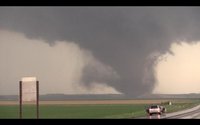
Not much to add...Pretty simple day for me, started literally right below where the first tower went up, sat in same spot for nearly an hour watching light sprinkles develop and dissipate in same area before eventually watching the storm develop to produce the first tornado not even 15 miles from where first sprinkle fell. Outside of getting held up by debris briefly between the first brief EF-0 and second eventual Stanton tornado it was a pretty easy day, where I was able to watch every tornado from this power cyclic monster! Had a very close encounter <.5 miles at the point both twins peaked and cross paths, overall a safe and effective chase day where I was able to actively communicate information to WFO, remain safe, have fun and shoot some stills and video along the way.

Probably some of my best tornado video ever...Video will be available on a DVD currently in the later stages of production that will be available soon!
<iframe width="560" height="315" src="
" frameborder="0" allowfullscreen></iframe>

First Tornado (before storm was even T-Warned) just outside of Madison
10269318_10101405946803303_7766921157953982328_o.jpg


The 1st EF-4 that just missed Stanton right after Developing
10426733_10101405946698513_7431909198345695610_n.jpg


View after getting held up by Debris and falling bit behind, big occluded barber poll just W of Stanton
10460783_10101405947656593_7776726119889502444_n.jpg


At intersection of Hwy 275 N of Stanton
10398097_10101405947282343_4894302572879622095_n.jpg


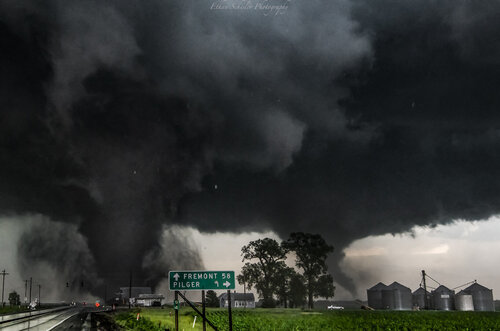
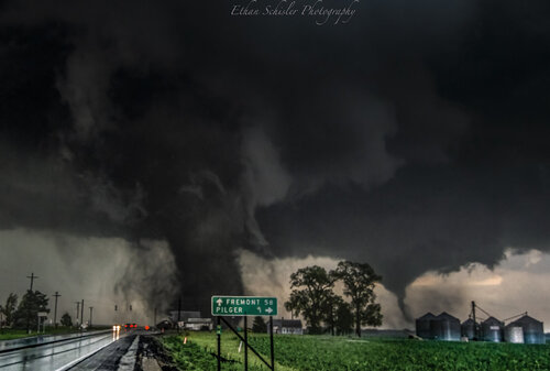
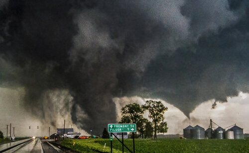
Second EF-4 or Pilger Tornado Just Exiting Town, 3rd EF-4 just developing just SE of Pilger
10379726_10101405946174563_4165117398935723771_o.jpg

Development of 4th EF-4 or Wakefield Tornado
1924336_670679789678698_4147426052813426684_n.jpg


1501822_750600811686595_7428104100471117142_n.jpg


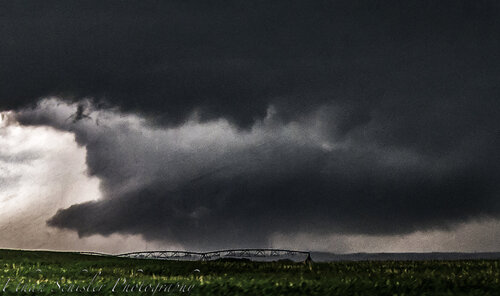
And I can't leave out the Gorgeous Conclusion to the day after bailing back West near Petersburg for another storm right at sunset!
BqS_rbZCAAAethv.jpg:large
 
Going to conjure up an old reports thread because I found an old memory card last night with some photos from the Pilger (6/16/14) day that I had not previously posted on here. I don't honestly think I ever even posted here after the madness of that stretch ensued, it never crossed my mind.

I remember starting off the day in Galesburg and then I drove to Sioux City, IA and noticed a warm front/outflow boundary intersection to the SW and the insane 19z Omaha sounding and knew it was on. A storm fired up and I was under it from rain shower to death documenting a number of intense tornadoes, multiple tornadoes at once/twin wedges, and other phenomena of such. Was a rather incredible day which was quickly stiffled by the sadness of hearing about the loss of life in Pilger. I had cell issues all day and didn't get data until that evening when I got from the Burwell storm and found out about exactly how everything unfolded. I guess it was sensory unoverload, I knew something major/a town had been hit, but I wasn't on social media and did not know the extent. Here are some of my captures from this day mostly shot at 24mm with some shot at 14mm (Nikon 14-24mm):

:
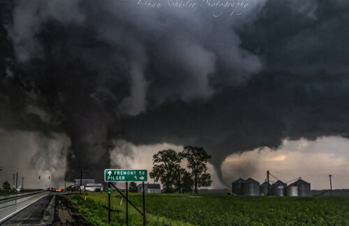
DSC_4396.jpg

DSC_4404.jpg

DSC_4391.jpg

DSC_4383.jpg
These were all taken within a minute or so of the tornado mowing through the center of town sadly. The roar was tremendous.

Here is a shot of the earlier violent tornado near Stanton, NE that I had never bothered posting and the Wakefield, NE tornado too:
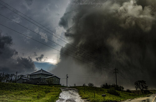
DSC_4142.jpg
Stanton, NE EF4 barely missing a farmhouse to the NW. The roar was incredible from this beast.
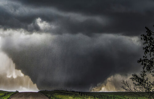
Wayne NE Monster F5 Wedge edit.jpg
The Wakefield, NE EF4 at maximum width before becoming rainrwrapped.
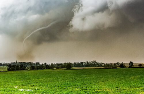
103322219_608149729803597_8884572815815647244_n.jpg
Tornado roping out near Winside, NE.

DSC_4019.jpg
Large violent (EF4) wedge tornado forming SW of Stanton, NE in the Elkhorn River valley.
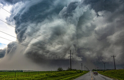
Stanton, NE EF4 Tornado.jpg
Fully mature EF4 wedge under impressive structure as it barely missed Stanton to the NW. I have a feeling Stanton would have fared worse than Pilger had this monster gone through town. Most residents seemed oblivious to the Bowdle-esque tornado going on to their NW as well....likely due to its low contrast until you got up close and personal.
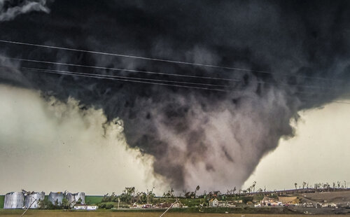
Wisner Tornado.jpg
Violent tornado after tearing through a farmstead near Wisner, Nebraska. This is where I end as I've reached my 10 image cap. Fun trip down memory lane on one of my top 5 chases of all time. I managed to make it back W to the Burwell storm after the Pilger storm died upon entering Iowa (ha) and get some awesome structure, mammatus, and a great sunset.
 
Thanks for twisting the knife again, @Ethan Schisler . Sioux City was my leaving-the-house target but that sounding you referenced was one of several things en route that led me to re-target TO Omaha taking I-35 south from 20 to I-80 west, which put me just far enough from the Pilger cell to miss the whole show.
 
Back
Top