2006-03-12 REPORTS: KS, MO, IL, IA, OK, AR

Mike Deason, Darin Brunin and I witnessed four tornadoes after dark, in the vicinity of where Shawna Helt and Brian Stertz were. Inflow was incredible. Full report and pictures will be up soon.
 
First of all our thoughts and prayers go out to all of those affected by the severe weather today.

Second, thank you Matt Jacobs, Eric B'Hymer, Jeremy Goodwin, and Marcus Opitz for the great nowcasting that you did today. I may have left out someone but I am too tired to remember.


Well, I don't really know where to start with this but here goes. Sorry about the length but so much happened today that there is no way that it could be short. Mike Deason, Dick McGowan, and I stayed the night last night in Joplin, MO. Learning of what happened back here in Lawrence I was pretty upset to say the least. We drove north with an initial target of Ottawa, KS. Sure enough storms fired northeast of Emporia and moved in that direction. After the storm finally got a nice looking wall cloud on it, it started to take on a more linear appearance. It surged eastward and buried us. We got pounded by hail up to baseball size. We hurried to get out of the hail and as soon as we were about ready to head southeast to catch the storms in Linn County we got word that the storm we had just ran from was intensifying into a supercell again. We then chased it through the KC metro area north as it produced several wall clouds and a nice anticyclonic funnel. After getting out of the KC metro area the storm seemed to have passed the warm front and got very grungy. We then finally decided to move to the southern storms. We tried to play catch up with this storm for what seemed like hours. We got close enough to the tornado near Sedalia that debris was falling out of the sky but we could never see the tornado. After passing through Columbia, MO we decided to call it quits on that storm. We then met up with Garry Wellman and Caleb Lawrence and chatted for a while.

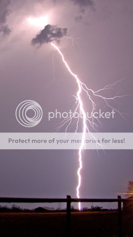
After this we decided to head back towards home keeping the thought of the storms firing to our west in the back of our minds and knowing if they went tornadic that we would be in good position to intercept them. Well, on our way back I70 was backed up for miles. We snailed down the interstate at a very slow pace. After about an hour we learned that there was a tornado warned storm heading directly towards us. Knowing this we did not want to be with the congested traffic on I70 if a tornado was bearing down on us. We pulled off I70 about a 1/2 mile to the north and shot lightning photography keeping in the back of our minds what could be coming. Sure enough after about 15 minutes we saw the RFB appear and then almost instantly a monster emerged. Winds at the surface changed almost instantly from cool damp air to warm muggy air and we could definitely tell that something big was happening. Just then a big tornado that looked very strong was moving the north about a mile to our west. It started to get even larger when a second wall cloud developed to the southeast of it and put down a second tornado on the ground. The inflow to all of this was incredible and made it hard for tripods to even stay standing. As the large tornado moved further north it was starting to approach a width of around 3/4 of a mile wide. The after about 10 minutes the meso started to occlude from what we could tell. We then moved morth as another wall cloud developed and put down tornado #3. After seeing the ground circulation with it we ran into muddy roads that we did not want to compete with.

THINGS HAPPEN
Oh what do you know? Another tornado warned cell was about 20 miles to our southwest near Whiteman AFB moving at us. We decided to move south of the interstate to intercept this storm. As we a approached it a beautiful lightning lit meso appeared to our southwest while we were getting slammed by some more large hail although we were not in the core. We then got to highway 65 just as it was approaching the highway. We then decided to race the storm to try and get south of it. As we moved south the meso started to move over us although we could not see a tornado on the ground. In an instant the wind picked up and definitely had circulation with it on the ground as the direction changed about 5 times in 5 seconds. Rocks, Grass, and many other objects were slamming our vehicle. We are thinking that we drove through a weak tornadic circulation. It was in no way on purpose and we shouldn't have made the mistake that we did but we sure as hell did not want to have the meso move directly over us. We finally got about a 1/2 mile down the road away from danger and turned around. Upon looking to the north there were power flashes. We then watched the meso move off to the east with a possible tornado although we could not confirm it. After this we decided that we had encountered enough for the night and decided to break off of the that storm. Again, quick decisions had to be made and after reading this section if you think that we made a bad decision. Well, I can guarantee you that you would see differently if you were put in the same situation.

After arriving back at I70 we started to head towards home. I70 was backed up again and after about 10 minutes of driving about 20 miles per hour we came up on the cause of the delay. The large tornado that passed over the interstate a while earlier had caused major damage. It was heartbreaking to see the car that had been crushed by a semi. The way we figured it had happened was that the car had pulled up on the shoulder under an OVERPASS. The semi apparently had pulled up beside the car. When the tornado hit the semi and car were both pushed against the side of the overpass with the semi ending up on top of the car. I don't see how anyone in the car could have survived because it was almost completely crunched. I hope to god that the people did though although we have not recieved word. It really made the whole night seem a lot less important because of what had happened. I can't even begin to describe how I felt when I saw that disturbing image. It really makes you look at how precious life really is. If we had not pulled off earlier I feel that we would have been almost in the same area as where the tornado moved over. Basically, the cars congested on I70 were slowly moving targets and there was nothing that I feel the targets could have done to get out of the way of the tornado. It's just a horrible feeling right now that I still have stuck in the back of my mind and I hope the people in that area and all over the best as this has been a horrible day for many areas.

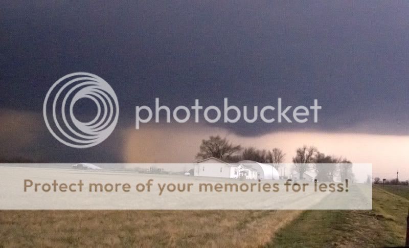
here is a quick still that I uploaded. two tornadoes on the ground. the tornado then got wider after this. I will post more tomorrow but am too tired right now after writing this.

[img]http://img.photobucket.com/albums/v226/bruninda/IMGA00013.jpg

large.jpg


After looking at this it looked like the tornado started to get rain wrapped
large2.jpg


DSCF1203.jpg
 
We got hit hard in Eastern Benton County, NW Arkansas. A large tornado touched down just out side of Siloam Springs and Ripped across parts of Centerton, and Gentry and dissipated shortly before moving in to Bentonville. I counted about 4-5 homes leveled. The path was about 2-300 yards wide, and luckily no one was killed. Trees and lines are down and we also can smell gas, and many houses have been damaged. I have spent the last several hours helping with the search and rescue in the area. Also Bentonville was hit hard by straight line winds and the tornado, and in my front yard I my grass was covered by hail, some the size of baseballs. The tornado also touched down next to the High School and ripped apart the indoor foot ball field and also severely damaged the new stadium. Before making it to the high school the tornado started skipping along Bentonville and destroyed much of the municipal airport. After it hit the high school the tornado continued to skip along, it then landed in the Collage Place sub division behind NWACC (Northwest Arkansas Community Collage) and destroyed several homes there as well as snapping the power polls like tooth picks. The "twister" then headed into little flock and, from what I have been told, ha leveled much of the city. Finally the storm headed out into the Pea Ridge area and stayed on the ground till it went into Barry County, Missouri where it finally dissipated around 11:00pm. The tornado track is about 75 miles long and it is being recorded as an F3. It has been around 36 years since Benton and Washington County have seen a tornado hit the area of that magnitude. The tornado also caused major damage in Delaware County in Oklahoma. In Oklahoma the Tornado leveled a sub division and took out many trees and power lines as well as driving a fully intact Snapple bottle through a fiberglass building with out breaking or spilling the contents of the unopened glass Snapple bottle. Power is also out on the south side of Fayetteville yet the Denny's I am at had emergency power as well as working wifi. We headed down here to get ahead of the rotating cell that moved into this county (Washington County, Ark.) from Adair County, Oklahoma. At times it was reported that there were two tornadoes on the ground as it skipped through Bentonville.

My case today went fairly well. I started heading out towards Claremore, Oklahoma around 2:00pm. By the time we got there the first line of storms was moving our way. We headed NW up Route 66 and followed a cell into Oswego. It was at that time we had another cell come up behind us and pelted us with quarter to golf ball sized hell. We followed that cell into Columbus and then it began to move out of reach, to our NW so we turned our attention to a now rotating cell to our south. We tried to get ahead of it but were unable to and thus we snuck in front of it by going towards Vinita and then jumped on I-44 and drove to Joplin, Mo, where we then took Hwy 71 south and got just ahead of the storm to see it spin through Benton County. It passed by us in Bentonville and then as we began to follow it we started to get reports of severe damage by Byers road (I think I spelt that right), just west of Centerton, and thus we went to the hit area to assist in the recover efforts. The funnel its self had that classic look to it, it was not a wedge. It looked a lot like a wide elephant’s trunk. Living in tornado alley I am used to hearing about tornadoes, and as a result of chasing them I am all to familiar with what they can do, but when I left my house today I couldn't even imagine that one would come with in about 2-3 miles of my home and threaten those who I love. I am just great full that no on got killed.

Well I am off to go help at the Red Cross shelter unless something else blows in. Stay safe out there, everybody.

EDIT: I forgot to mention that there have been several injuries, yet, thankfully there have not been any fatalities.
Also they are calling the Tornado an F3.
 
I headed up to se KS with a few fellow chasers (Robin T., Dan D., and Phil H.)... We weren't able to get on the initial supercells that developed in far eastern KS in the early afternoon, and we ended up waiting around Independence for most of the day. Convection did initiate about 5pm in se KS, but they looked incredibly sheared over and rather unimpressive. As night fell, convection filled in and moved eastward into MO. We dipped south a bit into extreme ne OK, but weren't able to really get onto anything. The storms were hauling to the E and NE, so we called the chase off. I was surprised it took so long to initiate dryline convection in eastern KS and OK... *shrug* ... It was nice to see a storm at least, but it really looked like the storms didn't have enough CAPE to really do much, at least until dark and until they moved into MO... Oh well.
 
Updated 3-13 to add video grabs of Tornado near Bentonville.

March12th2006chase0342.jpg

March12th2006chase0345.jpg


Further updates will added to my blog or website http://stormdriven.com/cblog/

12 hours and 460 miles so just a couple pics from west of Bentonville and some damage from S.W. of Kansas Ok. I havn't looked at any video yet maybe tommorow. I started off East of Stillwater,Ok. and headed into Osage County following storms up to Bartlesville then caught up almost to cells east of Oolagah then followed to Adair then went south and east to intercepted the one coming through Locust Grove and Kansas Ok. By the time I got a good view it was almost to Bentonville. There was a lot of damage reports from south west of Locust Grove all the way past Bentonville (long track?) I came across debris in Bentonville , even a hay bale in the road . Now to find some duct tape to pull this insulation out of my skin... More later once I get some video grabs
IMG_1741.jpg


1738.jpg


IMG_1753.jpg


IMG_1755.jpg
 
Very large, strong tornado with incredible ground circulations... The RFD was incredible, I have never felt anything like it in my life. A few of the gusts surpassed 100mph...

I left Detroit at around 2am to Jacksonville, IL -- and intercepted the Marion/Ralls, Co tornadic (confirmed yet?) supercell -- missed the tornadoes, but still got some excellent hail, and there was relatively decent cloud base rotation (can't believe the storm survived and produced tornadoes with that kind of CAPE). I then continue on, meandering through MO, only to decide to head back (after playing around with the Sedalia, MO storm -- and never being able to get into position). So, I get just to the southwest of Springfield, IL on I-72 only to get hammered with significant RFD gusts (>100mph)just south of the main large tornado, along with a few golfball hail stones smashing me. I got a few pretty decent views of the tornado as it ripped through the city of Springfield. This was the most intense supercell that I have ever witnessed.

A short clip of the Springfield, IL tornado and me screaming (!) as it gets illuminated by a powerflash:
http://www.midwestchase.com/march12th-spri...eld-tornado.wmv
 
I was *in* the Bentonville tornado

Well, last night I was "in" the Bentonville tornado.

The previous day (3/11/06) the supercell which came from Cherokee County Oklahoma (Tahlequah) went right over our business in Centerton, AR, just west of Bentonville. That one was an HP event, and the front sheared anvil looked very smooth angling from the southwest. The rain was the heaviest I can recall since moving to northwest Arkansas in 2002 but once it left all I saw was a "rock-hard" updraft to the east. A tornado warning was issued shortly thereafter for eastern Benton County, and the storm remained "warned" all the way into eastern Missouri south of St. Louis. (I believe this may have been the storm which killed two people near St. Mary's, MO, sadly). There was some lightning with this storm but it didn't seem that intense.

Well...

Yesterday, like Saturday, was quite warm. Convection was evident by mid-morning on Saturday, but there was far less cloud cover yesterday. Checking radar before leaving our store I saw from storms firing up over what appeared to be a weak dryline (at the time the storms were not connected) but the radar images were far less impressive for our area than the day before.

Driving to the Wal-Mart just across the border in McDonald County, MO, I saw some lightning in the cloud tops over what appeared to be the Joplin area 50 miles north. Listening to AM 740 in Tulsa there were reports of rain and hail all over the city and two storms with strong rotation...one in Rogers County (headed most likely for Joplin or north) and one in Wagoner County, OK (good chance that it was headed our way). Returning home and walking my dog around 8:30 pm I noticed a strong inflow from the south and figured it was feeding the Joplin area storms. I talked with a neighbor about how I'd ducked into her garage with my dog in November when I saw power flashes to the west and heard an oncoming "waterfall" noise (turned out to be high winds which snapped a few lines that night). I told her hopefully tonight wouldn't be THAT bad. :roll:

The missus and I were watching "Crossing Jordan" while our NBC affiliate had tornado warned areas (Adair and Delaware County, OK, immediately to the east). Suddenly, Benton County got "warned" as well and they cut to local continuous weather. The meteorologist (Rick Katzfey of KNWA) started saying they were receiving "tornado on the ground" reports on Route 412 in Oklahoma west of Siloam Springs, AR (far southwest part of our county). He was showing doppler radar areas where strong rotation appeared to be. He said THIS storm, unlike the previous day's, was an LP cell and that one could probably see the oncoming wall cloud.

Immediately I bolted out the front with my daughter as my son said the sirens were sounding. The beautiful anvil was over us from the southwest, scalloped in appearance rather than smooth, with very active anvil crawler CC bolts. Our dog shot out the door but (praise God) he came back shortly, as did our cat. My son and I brought our pet rabbit and his cage in. The kids got in their respective shelters and my wife Sandra and I kept watch on the TV. The storm track on the TV looked like it would go just northeast of us. The indicated movement (as well as what I saw of the anvil) looked like it could go right over us.

Well, the local tower cams zeroed in on what they thought was a wall cloud. They thought the storm was nearing Bentonville. Then the power and TV went out and I told my wife to get in the bathroom. I wouldn't go outside, but in the dark I went straight to our living room window (facing south).

I saw what appeared to be three conical clouds bunched together like three great stalactites in front of a discolored mass that looked like rain...they were about a half-mile/-3/4 mile due south, and looked like they were headed for Wal-Mart's Technology center there. I kept waiting for them to rotate around one another but couldn't see that...then I started seeing what appeared to be a power flash or two. THEN I saw big square chunks of debris spin and lift into the air around the Technology center, and I headed for the bathroom. I prayed in the tub. My son prayed in the closet. All the time I could feel the house shaking just a bit and seemed to feel a few objects hit it.

Then I heard a strange noise...like a hissing sound. SSSSssss.....SSSSssss. Were these subvortices or suction spots? First thing I thought of was an old episode of "Star Trek" where there were people who had been "sped up" and their voices sounded like buzzing bees.

After the last hiss all was dead quiet as the low pressure was on top of us. I wasn't sure if we were going to get hit by another vortex but after a minute or two it appeared the action was over (the storm was moving about 50mph). I went to my north window and saw the wall cloud lit up by lightning and occasional explosions, moving off to the northeast.

Well, after everyone went out to take a look I was amazed...our neighbor to the west has a hole in his roof and his playhouse is smashed. Our neighbors to the north have gaping holes in their fences and several missing shingles. Our neighbor to the east had his roof scoured (on OUR side of the roof) to the wood, and the backglass of his van was blown out. And our neighbors to the south (closest to the main part of the tornado, apparently) have fences down, roof damage, etc. The house across the street to the south had a trampoline ring set right down over their tree. His hot tub was lifted up then dropped. A subdivision a mile east sustained heavy damage with roofs completely blown off. Some neighbors down the street lost windows and walls. We weren't in the hail area, either, yet north and west of us they got lots of it...my in-laws south of Gravette lost the globes off their lamp post from it.

And we've gotten away with (apparently) only damage to our central air unit on the east side of the house in east Bentonville. I can't tell any roof damage. Both our vehicles were left out and they were fine.

Prayer works...hope I'm never that close to a twister again.
 
Wall Cloud Near Stark, Kansas

I left Pittsburg, Kansas around noon yesterday, with a target of Parsons, Kansas. After arriving in Parsons, Kansas and checking data at the local Super 8 Motel, I saw that a tornado warned supercell was west of my location, near Neodesha, Kansas. I decided to head north out of Parsons and attempt to intercept the supercell north of Erie, Kansas.
I saw a nice rotating wall cloud to the north of Stark, Kansas. Stark is located in the extreme northeast corner of Neosho County, Kansas. I only got a couple photos of the wall cloud, as the supercell was screaming to the northeast towards Ft. Scott, Kansas.


Looking West From 1 Mile East Of Stark, Kansas 2:55 P.M. (Neosho County)
785_1024.ts1142261474671.jpg


782_1024.ts1142261531843.jpg


I met up with Joey Ketchem and crew in Ft. Scott, Kansas. We headed back to Pittsburg, Kansas to regroup, and hope for more storms to refire to our west. We went back to the Erie, Kansas area where we watched some towers attempt to get going, only to be sheared off.

Towards sunset we finally got some more severe storms to develop north of Erie, Kansas. Got too dark to see anything and we headed back home.

All photos from this event can be found at http://www.russparsonspictures.com/March12...ansasWallCloud/
 
We caught the Springfield storm, too. I haven't had a chance to look at my video from yesterday yet--got home at 4 a.m. and up for work at 7. But, in brief, Bill Oosterbaan and I caught the bottom two storms of the lineup in mid-Missouri. We met up with the first northwest of Columbia, then dropped south to catch the the Sedalia storm, and ultimately wound up playing tag with it as it moved all the way across Missouri and into Illinois. There, it soon swallowed the other storm to its north, strengthened, and kept on chugging across Illinois into Springfield, then on across the rest of the state, crossing the border into Indiana in the town of Watseko. This storm formed in Kansas, crossed two entire states, and finally started losing its strength and supercellular appearance in northwestern Indiana--though interestingly, after we made it into Michigan, I fired up the laptop again and saw a clearly defined supercell right about where this storm would have been if it had re-strengthened.

Anyway, of all the storms that moved across Illinois later on, this storm was definitely the main act. If you look at SPC's storm reports, you'll see a red belt of tornado reports extending across Illinois; those mark the path of this storm.

After a number of years of relatively fruitless chasing, we hit pay dirt, but I have very mixed feelings about it. Watching the transformers blowing in Springfield and seeing the semis and cars blown off the road along I 72 heading into town was a sobering reminder that this hobby is not all fun and games.
 
I had to be really careful on this chase as i had gotten my windsheld all cracked up during the storms on Saturday night in western Arkansas. I targeted the area around henryetta, ok. I was concerned about going too far west and north and not being able to get back south and east to fort smith in case something did develop in se oklahoma. Convection held off later than i expected but a little before 6pm i started seeing some returns on radar just west of Tulsa.
031201.jpg


I headed north towards Tulsa but only went about halfway there b/c i noticed some towering cu going up west and southwest of me. i sat near beggs, ok waiting for things to develop. The storm directly to my west was pretty pathetic but it was pretty and it cast a shadow all the way across the sky.
0031201.jpg

That storm strengthened slowly but did finally go severe and move into the tulsa area. on the otherside of tulsa the storm did go under tornado warnings.

As that storm moved toward Tulsa i saw another storm coming into view from the sw.
31204.jpg


Looking at radar it shows this storm started 20 miles SW of Shawnee, OK. It basically was heading straight for me slowly increasing in strength. At 640 it went severe. The storm was obviously lp in nature. It did start throwing off lightning.
31203.jpg


I had to retreat south to make sure my windshield didnt get put out completely by hail. The storm continued to be very lp in nature but it did have very good rotation but the lightning completely stopped. From a nice viewing point i could see the "mothership" look to it.
31201.jpg


Shortly after it crossed hwy 75 just to my north the storm began a rapid transformation. The lightning went from nothing to continuous very quickly. The storm just kicked into gear. I had to stop and head home because my wife had school monday morning but i took some pics of the storm (now with tornado warnings) from afar.
31202.jpg

00031201.jpg


This storm continued into ne oklahoma and nw arkansas dropping several tornadoes and causing lots of destruction in benton county, ar (centerton)

The lp storm earlier just to my west also cotinued into SW Missouri being under tornado warnings much of the time. All in all it was fun but cant wait to see the pics/vid of what the rest of you got!

Full chase report online at http://www.realclearwx.com
 
Here’s the short version. I’ll get a more detailed report up on my site in a day or two.

I didn’t get out of Omaha until 1900z due to Wal-Mart taking 3 hours to change my tires. They were cheep, $12.00 per tire for mount & balance, but so slow. Anyway there was no way I could have done a long chase without new tires and my wife wouldn’t even think about me taking her Suburban. I can make Overland Park in roughly 3 hrs from my house, so I thought I could possibly get south of the metro area some where along hwy 69 along the KS MO border by about 2300z. At that time the latest MD from the SPC said there might be some early activity, but that storms would fire late off the dryline in eastern KS and move into MO, so anyway this was my game plan. By the time I got to ST Joe, 3 tornadic storms were already moving through the KC metro area and there was no new activity in eastern KS. So not wanting to get into the metro area with fast moving storms I headed east on Hwy 36 to setup an intercept of the north cell now moving through Excelsior Springs. While moving east on 36 there was a report of a brief touchdown just south of Cowgill, 10 –12 miles straight south of me. I did intercept this cell in Utica and stayed with it to Chillicothe, where it was down graded to Severe, with storm motions >50 mph these cells were very hard to stay with. Setting up an intercept was the only way to go, especially in the hills of northern MO. So I let this one go and dropped south to Carrollton where reports of the Sedalia wedge started coming in. I briefly thought about moving east towards Moberly to intercept the Sedalia cell, but figured I end up chasing it all the way the IL, so I headed back west on 24 to intercept a new round of storms moving through the KC metro again. Along Hwy 24 near Norborne I saw some downed trees and power lines from a tornado earlier in the morning. About 1000 turkeys later I intercepted another tornado warned cell just east of Plattsburg. I watched it from a hill somewhere west of I35, but with darkness settling in I bailed to the NW and headed home. Although this area wasn’t to bad for chasing (better than the northern tier of counties), it certainly wasn’t the prairies either, and the thought of chasing a 55 mph tornadic storm through the hills didn’t appeal to me. I didn’t get to see a tube on this sadly tragic and historic day, but I did witness some nice storms and was able to get some bugs worked out (and identify others) of my chase gear. My thoughts and prayers go out to all those who lost life and property to these storms. 478 miles. (Edited)
 
2 years this has happened to me High Risk, and Flat Tires!


Didnt have a target so i just headed to tornado potential in Northeast MO, near kirksville, around 8 am or so driving on 36 im hearing tornado warnings already in the morning im like ok i need to haul butt!...well i left 6 am and headed to kirksville area.

sat and drove way back west towards trenton, then storms rolled in, clouds with heavy moisture were moving by fast and real low which was neat to see...

Mo roads arent fun stay off the gravel! if you dont want flat tires i managed to get 2 yep 2 .

i was sick of hearing tornado reports and some people KEY WORD( The Public and Spotters confimred a 1/2 mile wide funnel along I-70 near sedalia with major debris cloud... radio speakers i tell ya"

It sad that this day had to take some lives and cause much devistation, i mean some people have nothing left and thats real hard to take in.... i feel real upset that had to happen towards evening ... anyways heres what i salvaged... from this BUST!

kirksvilleMO.jpg


DSC03579.jpg


DSC03582.jpg


All them tornado reports around me and i didnt get SQUAT, oh well i need to learn how to chase these fast movers, also around hamilton tornadic sp's came through alot of lightning but you couldnt see any structre, it was like these tornadic sp's were ghosts! i sat in hamilton MO, after getting pea sized haila nd heavy rain, when i neared the Trenton Exit it was nice to see a clear sky with starts, and the sp's which passed trough the anvils were lit up by the moon it was real photogenic

oh yeah MO is the true Wildlife Chase State

I saw 7 deer
2 raccoons
4 coyotes

within 5 miles of each other( and there was alot of roadkill)

Congrats to everyone else who nabbed the storms"
 
Left the Milwaukee metro area about 1:15p with an intial target somewhere between the Quad Cities and Peoria, with the anticipation that the warm front would be further north and convection in MO was going to move across the river into Illinois about 5 pm. I left so late because I wasn't going to chase at all, mostly because I anticipated having to go into MO which wouldn't jive with being back for work today. I made a last minute decision to try my luck in with the north end of this system near the warm front in WC/NW Illinois.

With the help of nowcasting from Mike Johnston, I briefly chased the tornado-warned storm that crossed I-39 near Tonica, Ill. but could only get quick glimpses of the rain wrapped and haze obscured lowering. Mike advised it was rotating and showed a TVS, but I don't believe it ever showed a funnel or produced a tornado.

(Visibility was horrible with ground-based haze, which got worse the farther south I went until finally clearing out after reaching the Springfield Ill. area.)

After the brief sidetrack, I headed further south on I-39 then I-55 into the warm sector south of Peoria. Temps went from ~45* to over 60* rapidly but the closest convection (other than the low topped storms up north) were still churning over central MO. I blasted south to the Springfield metro area to fill up and get some food about 7:15p when I started monitoring reports about the tornadic supercell headed NW into Illinois. I hung around until 8:00p and thought about heading west on I-72 to intercept the storm. In hindsight I think it was a good choice not to, since it was dark and this was not familiar territory for me. The local guys like Skip Talbot were on the storm and could move around a lot better than I, and I don't have mobile WX data yet, so I made the decision to head back north before the storm moved into Springfield.

One interesting note was the lack of information being provided by the NWS or broadcast radio before the storm hit. I couldn't hear WILL radio when the storm hit as I was too far north, but it sounds like they were the only ones on the ball. There was no mention of the severity of the supercell before the storm hit Springfield, just that it crossed the river and was tornadic in MO.

Heading back, I had no idea of the magnitude of the storm once it reached Springfield until I read the other chase forum this morning. Coming back north on I-39, I was literally dodging tornado warned storms in the cold sector. Once I got near Rockford where I was more comfortable with the road network I decided to play the next warned storm. I didn't have to wait long as a cell SW of Rockford was rotating, so I waited for it to move closer but it was very umimpressive looking with no lowering or noticable rotation. I was almost home when the same storm was again tornado warned in far SC Wisconsin. There were no reports of funnels or touchdowns with it this time either, and I couldn't see anything significant. There was ample lighting but nothing to see.

I got back home about 11:30p, with 573 miles traveled. No pics, no video..this was a learning chase more than anything. I will be checking into GR3 or WXWorks, as chasing without them is difficult considering the availability of data.

A quick thanks to Mike Johnston in VA for the nowcasting :D
 
I could chase any day this week except Sunday due to work. Oh well, but I did manage to intercept the warned cell in NC IL on my way back home from work. I had to take my wife hostage to chase this thing. She did a good job and she really laughed watching a bunch of deer getting pummeled by the hail. A really good hail producer to say the least.

Link to video: http://creativejetstream.com/Video/Mar12_06Hail.wvx

Congrats to Skip, Fabian, and Dan on the Springfield tornado. I really enjoyed the cyberchase.
Jerry Funfsinn
http://www.creativejetstream.com
 
Nothing real spectacular yesterday. I stayed in Eastern Kansas for various reasons and was only able to observe the cells as they initiated before they "flew" into Missouri. Most of the initiating cells formed wall clouds and slight rotation at various levels. Here are a couple of pics I took. More pics and report at http://chasethis.blogspot.com.

IMG_4697_1.jpg


IMG_4700_1.jpg
 
Back
Top