2/24/07 REPORTS: KS

Michael O'Keeffe

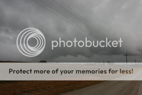
Started the day in Emporia and left for Abilene at 9:00am. Got to the Abilene Super 8 shortly before 11:00am and noticed reports of developing cu to our south. We blasted south and saw very strong convection. The storms took a bit to get their acts together, but once they did it ended up being an enjoyable first chase of 2007.

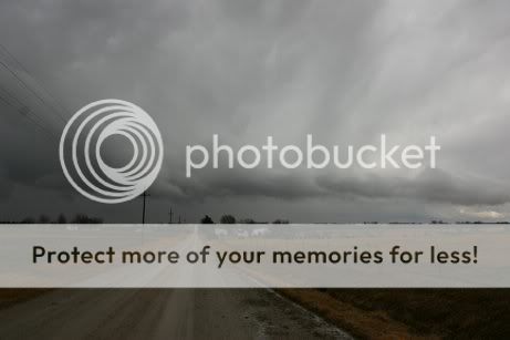
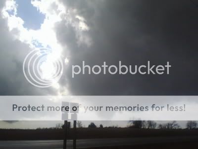
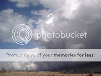
We were on the tornado-warned Marion Co. supercell and witnessed a wildy spinning updraft, beautiful funnel, and somewhat decent structure. We followed the storm to Abilene and stopped for gas and a bite to eat.

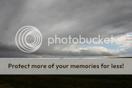
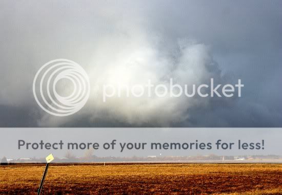
We ended the chase by following a cluster of cells near Salina.

Just arrived back to KC at around 7:15

Will post pictures ASAP.
 
We targeted Salina, KS and quickly intercepted intiation to the SW. Around a half hour later the storm was tornado warned and developed a pretty decent core with some penny size hail. The updraft was well seperated from the area of rain and should some obvious signs of rotation. The rotation weakend pretty quickly and we started heading east to intercept it’s twin a couple miles east. This cell became tornado warned around the time we came into view. It had a nice inflow band feeding into the updraft and an area of lowered ragged clouds. We saw several shear type funnels but nothing to exciting. The previous tornado warned storm to the west had a lowering for a little while but I couldn’t tell you whether it had any rotation. This tornado warned storm soon weakend. Even though it had weakend there was a short period where it had a rapidly moving inflow band going into a nice slightly striated updraft.


A third cell had formed east of the other two and was putting down pea sized hail. The radar had showed it weakening a bit so I started to look at other options. At this point we encountered a brief dry microburst that I’d guess was around 60-70kts. A couple minutes later you could see the very rapid upward expansion of the storm with the anvil spreading back and the cumiliform textures quickly accelerating upwards. The inflow winds increased towards it and the updraft begin to take on a severe corckscrew shape. After about five minutes it started tilting back, until it was overtaken by the outflow. The cell west of it then started to do the same thing with with rapid vertical expansion and a corkscrewed updraft.

Only a couple photos of this event.
 
Last edited by a moderator:
Not too bad a chase day, considering the environment. Observed a couple mini-supercellesque storms in central KS. Both were highly elongated and then seemed to intensify/become more compact while crossing the extremely narrow corridor of 40s Tds surviving along the occluded front/differential heating boundary. The first storm's updraft took its sweet old time developing... then absolutely exploded over northern Marion county about 1220pm. I went in for a close look west of Lost Springs and the storm had decent structure and a small wall cloud. Within 10 minutes the storm structure went to complete crap. A storm farther northwest looked far better and I caught up with it south of Abilene. About 2pm, right before I was about to abandon it for other cells farther southeast, the updraft strengthened north of Solomon.. and put on quite a show at cloud base with dynamic rising motion and moderate rotation. Similar story with that one... it didn't look good for very long.
 
Last edited by a moderator:
Much the same. The closest I saw to tornado'ing was near Johnston KS. It had decent structure leading up to that point, then it was extremely tilted and elongated, and becoming free of precip for the most part. At this point another plume rocketed up at the southern end of the storm. This was soon followed by a v shaped funnel that lasted for a while. I was pretty much infront of it as this happened. It was nice to at least think something cool was about to happen.

It then weakened for a bit. I stuck with it up to Solomon where I encountered a decent mini hail storm. While watching it approach I noted the east to west rfd cut coming around the front of the storm. I thought maybe, then thought eh maybe not, all these little turds had probably been doing that. Wanting to beat the snow home and wanting to check out the stuff s of Manhatten on the way, I decide to blow it off and jump on I70. Just as soon as I get east bound I look back and see a little nub. Then I look back and it is gone. Then I look back and it has all sorts of lowerings going around. I was like @#$#@$ yay I'm eastbound leaving it. I was just under the stupid thing. I get off at Abilene and think of going north and watching it way to the west now. Then I think, maybe I should blow it off and keep going east to check on the others. Then, between hills and trees, it looks as though it's in progress of putting one down....then it didn't. I say screw it then go east again. Then I get a call saying it is corkscrewing really good now. So I stop at the next exit and race all the way back to Solomon, then north, then west, to catch it not doing so well. I thought for sure when I looked back those few times that I was going to miss a great tornado. That would have been pretty hard to take.

Anyway, I try to beat the snow and lose. Cars are going off the road as I near Lincoln. It was thunder sleeting, and making a quick mess of sections of 77. Then it'd be fine, then another area would be a mess. I get into Lincoln and monster flakes are coming down, with thunder. So, beings my car SUCKS in the snow(Mustang that needs new tires), I end up getting a room here in Lincoln, oh so close to home.
 
Marion & Dickinson Counties

Rich and Ryan Thies joined me for this chase which took us to my initial target zone (Marion Co. KS). We moved through the warm front boundary south of Emporia after passing through some very dense fog...viz was well under 1/8 of a mile and it was low enough to obscure the Flint Hills. We reached the magical zone between the warm front and dryline near the town of Cassoday. As we headed west towards Newton, the partly cloudy skies revealed what looked to be initial development near and northeast of Newton to our west. We moved up into Marion Co. and watched the relatively flat bases approach. The storms seemed to undergo some cycling as they attempted to establish sustained updrafts. Finally one updraft managed to get organized to start showing some slight rotation, and a developing RFD. Pictures #1 & 2 shows the storm structure of the updraft as it moved past Marion Reservoir. This was shortly after the tornado warning was issued by the NWS Wichita at 11:51am.

marionupdraftc.jpg


marionresupdraftc.jpg


hopeupdraftc.jpg


navarrefunnelc.jpg


We followed it northward past Pilsen and Ramona and then into Dickinson Co. A tornado warning was reissued at 12:30pm for the small supercell as it moved into Dickinson Co. near the town of Hope. The storm had some lightning with it, and heard some reports of quarter sized hail. It moved northwest and away from us, while a new updraft organized very quickly near Hope. This updraft showed some very nice structure and even had a mid-level rotation that was marked by some laminar features. Picture#3 shows this interesting updraft structure. We then proceeded northward to stay up with the updraft. Near the town Navarre (Dickinson Co.) the updraft finally started to organize sufficiently to create a small but definite funnel south of KS-43. The funnel cloud never did touch down but it lasted for about 2 mins. before dissipating. Picture#4 shows this weak cold air funnel shortly after Sean McMullen expertly spotted this on the very south end of the updraft. It never could organize any further so the chase essentially ended at that point. I saw Jon Davies and Shawna Helt in Abilene KS and they too had seen the action that moved from Marion Co. into Dickinson Co. It was good to see them after the long boring winter and we all agreed this chaser meeting was a sure sign of spring !! Special thanks to Sean McMullen, Jeff Piotrowski, and Terry Schenk for the radar updates for today's chase.
 
Last edited by a moderator:
Observed the tornado near the town of Holden, MO this afternoon. Due to a malfunction of my windshield wipers, I was unable to take any photos until I was out of the precip area. Once in the clearing, I did snap one shot of the latter stages of the life cycle with the only phone I had available...my camera phone as I had left straight from the office.

Short chase account and 1 photo can be found here:

http://dd.lebarinc.com/chaseaccounts2007.htm
 
Beautiful day, nice little pulsating cells with a few funnels in the Marion to Salina area. We then hauled it west-southwest to hit a few heavy snow bands with 45-55 mph winds south of Russell, KS. I think the best part of the day was definitely a very intense snow band with exceptional wind gusts near Hoisington, KS.

Simon Brewer
www.stormgasm.com
 
Kansas cold core chase

Jon Davies and I were in the Abilene-Solomon-Hope KS area on Saturday along with many other chasers. We saw a couple funnels and some decent elongated cells like everyone else. Seemed like a fairly narrow window of opportunity that didn't quite pan out. Jon mentioned that the surface dry slot surged east awful fast, into Missouri by 5 pm, which probably didn't help. We followed a couple rotating cells into the cold air north of Abilene and watched them become elevated and fuzzy.

Nice to see Brian Stertz, who I hadn't seen in awhile. Also fun to see Roger Hill and Jon Merage only a week after the Denver convention. SDS is over!

Shawna :)
 
My target yesterday was Marion/Dickinson counties in Kansas, but I was unable to make it to the target area because of other obligations. I was able to leave at about 3:30, and decided to just head south out of KC to see if there was anything left of the dying line of storms that had moved up through the Emporia area earlier. I decided to check out an embedded cell that kept trying to pulse on the south side of all the precip, which was located near Gardiner, between Olathe and Ottawa. Days like yesterday are interesting in that even small storms exhibit structural characteristics of supercells. This storm wasn't even severe, but as I came through the precip, there was a gust front to the west, adjacent to some very well-structured inflow. No rotation that I could see, but still nicely structured. Very low LCLs yesterday. Clouds were barely hanging off the ground. I could see what became the Holden storm on radar and thought about trying to intercept it, but at the time this one looked as good as any.

I didn't take time to edit these ... just a few jpegs.

web943.jpg
web946.jpg
web944.jpg
CRW_0953.jpg
 
Last edited by a moderator:
Well i wish i had felt better instead of sick , but i still chased anyways i ended up southeast of Wichita KS, from Fredonia KS to Chanute, nice little cells for Feb ill take what i can anyways i let the line go over me, and a few minutes later a tornado warning was issued for Chase CO KS, radar indicated. This warning lasted only a few minutes, however before the storms overtook me i saw this interesting feature, looked like a funnel to me, i was watching the clouds do some incredible motions near this, video timelapse shows it real well this persisted for a good 10 minutes before moving off, i wish i had felt better but hey least i got to see something anyways. I agree with Mike H. driving home sucked! period while i made it back ever so slowly slipping and sliding in the taurus, i made it but the whiteout conditions , and plows having diffaculty just tells me how much i hate winter!

2007.jpg


0224071134.jpg


0224071218.jpg
 
I left Olathe at 11:30 and flew down I-35 to try and intercept a cell that was developing in Greenwood county. The other storms I had no chance to catch, so I headed to west of Lebo KS and met up with Mike Parker. We waited for the cell to catch up with us near Lebo, because road options were nill south of there. It exhibited some weak rotation at times, but looked rather elongated. The storm actually had some decent structure and dime-sized hail (which covered the ground) hit us south of Lebo, before the storm went to crap. Not too bad of a chase, considering visibility was low, and I left KC rather late. I used Alltel's connection through my phone for the first time, and it worked flawlessly (I could actually answer the phone while staying connected).
 
Last edited by a moderator:
Scott Olson and I chased near Hope and Abilene and sat through what appeared to have been a brief dry microburst just after seeing some unfortunate chasers from Illinois having a brief discussion with law enforcement(probably not exchanging storm photos). Then Scott and I drove to Topeka to assess the situation. We had a quick lunch and decided to call it a day since everything pretty much had turned into a crapfest. I took 70 west to 81 north and shot up into Nebraska pretty much unscathed Mike H. I figured I'd get blasted by a monster blizzard, but I must have lucked out compared to what you ran into.
 
Back
Top