09/01/2016 - Tropical Storm Hermine

Joined
Jan 14, 2011
Messages
3,132
Location
St. Louis
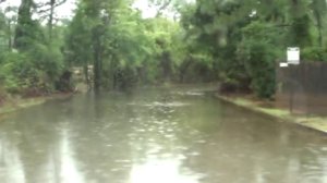
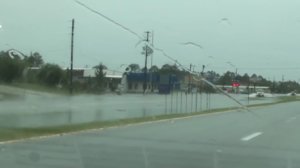
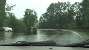
Starting a master thread for this storm. Models seem to agree on a mostly inland track after landfall instead of a re-emergence over water, which will introduce some potential for low-topped supercell tornadoes. The NAM and GFS both show a dry slot working in on the southeastern quadrant of the storm.

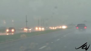
Of interest is that this is the first storm (that I can remember) of TS or greater intensity that we'll have a 4KM WRF forecast. It's interesting that this model is showing some cellular convection in the outer bands in South Carolina on Friday. If I were able, I would make this a two-day inland TC tornado chase, starting in Georgia and moving into NC/VA on Saturday. I doubt the storm's center will be of much chaseworthy interest after landfall.
 
Dan,

I'm on this one here in South Florida...

Myself and two other Sky Warn drivers are currently in Fort Myers FLA

We will be riding north bound up I - 75 in the morning looking in between the feeder bands visually and radar...

Tornados usually drop out of the feeder bands on the east northeast side of the storm bands...

Already getting hit pretty good here with strong feeder bands and 30 - 40 MPH wind gusts...


Sent from my iPhone using Stormtrack mobile app
 
As of 10:00 AM EST

We are now in Tampa FLA on I - 75


Sent from my iPhone using Stormtrack mobile app
 
Easterly Storm Feeder bands now heading towards land off the Gulf of Mexico... Cat 1 storm by tonight...


Sent from my iPhone using Stormtrack mobile app
 
Waterspout - Tampa - north of Skyway Bridge


Sent from my iPhone using Stormtrack mobile app
 
Feeder bands now impacting Tampa - St Petersburg / Clearwater Beach area...


Sent from my iPhone using Stormtrack mobile app
 
Destination currently for us - The Perry and Live Oak Florida area by 3:00 PM EST


Sent from my iPhone using Stormtrack mobile app
 
Arriving into the city of Alachua...

The storm eye center of circulation now coming into Doppler Radar loop range...


Sent from my iPhone using Stormtrack mobile app
 
e12e5dbd1fabbbeca171edda87138814.jpg

Live Oak Florida - 3:45 PM EST

Off I - 10 and 75


Sent from my iPhone using Stormtrack mobile app
 
a64816e6e1a5377acd6a33013a17e3d8.jpg

Feeder Band rolling in south of I - 10


Sent from my iPhone using Stormtrack mobile app
 
62881b8e505fd3daea11e216284f76c9.jpg

Rolling in....


Sent from my iPhone using Stormtrack mobile app
 
26028139aa1622cb0048be2743dbe7da.jpg

Hard rain and Severe Lightning...


Sent from my iPhone using Stormtrack mobile app
 
1ccb2e7c0c291761095d8f33c88a7a01.jpg

Storm tracking almost due North...

Rain bands heavy coming into Perry FL...


Sent from my iPhone using Stormtrack mobile app
 
Flooding...
 

Attachments

  • 2fa38ef6130401eb723707134f8db2c1.jpg
    2fa38ef6130401eb723707134f8db2c1.jpg
    167.8 KB · Views: 3
  • 77949430e6b306eaed11f3b75a5851f0.jpg
    77949430e6b306eaed11f3b75a5851f0.jpg
    167.8 KB · Views: 3
  • 4f7b0c0d82d2970bcc8a8efd16a78e6c.jpg
    4f7b0c0d82d2970bcc8a8efd16a78e6c.jpg
    113.5 KB · Views: 3
  • a1a76a5929b8f09c6b48bcb84253b385.jpg
    a1a76a5929b8f09c6b48bcb84253b385.jpg
    187 KB · Views: 3
  • b46a72c8b9345df2735772722180b88d.jpg
    b46a72c8b9345df2735772722180b88d.jpg
    85 KB · Views: 3
Last edited by a moderator:
032935ace76f534f88c6de69f5984674.jpg

3ba33dd5bc67826d44049471fa8fa5f1.jpg

010069019171238a0c8a9ac0b7fdf967.jpg

Heavy flooding heading towards Perry Beach...


Sent from my iPhone using Stormtrack mobile app
 
HWY / County Road 30 / 98

West Perry...


Sent from my iPhone using Stormtrack mobile app
 
Heading towards Wakulla Florida off HWY 98 / CR 267

Heavy solid rain now... High water - Storm Surge -

a1a57323514fe48b1c10cc262ec7a43b.jpg

Center of eye circulation tracking dead ahead at our location... 155 miles SSW

Sent from my iPhone using Stormtrack mobile app
 
Last edited by a moderator:
Heading into Walluka off 98 onto CR 267...

de4883e3a9dbf27e01fb0b070ab3d1f0.jpg

6ba4f91fed284439610f6e617143bbe3.jpg

ff240f0df95696c1757ba7e244632f40.jpg

d686af72eb0b7dfb1cf204b483a02324.jpg

Water level coming up... Storm Surge Increasing...

Sent from my iPhone using Stormtrack mobile app
 
Back
Top