08/18/2005 REPORTS: WI

Tim Gonyo

EF2
Joined
May 28, 2005
Messages
131
Location
Saukville, WI
Left home at 3:15 PM, intercepted tornadic storm around 6:00 PM near Lake Wisconsin. Produced a tornado for a duration of about 2 minutes. Some pics below of the wall cloud, tornado, and damage:
Large8-18-05-1.jpg


Large8-18-05-2.jpg


Large8-18-05-3.jpg


Large8-18-05-4.jpg


Large8-18-05-5.jpg


Large8-18-05-6.jpg


Tornado is confirmed on the ground in picture number three.
 
A tornadic supercell just about intercepted me today (rather than vice versa :) ) just north of Stoughton, WI. The tornado passed literally less than a block from our house-just across the road, houses are leveled. Our yard is full of debris with a few trees/limbs down, but we got off easy compared to areas just across Skaalen Road.

I saw no condensation funnel, but I did see rotating clouds with debris lofting into the air. This supercell's base reminded me of Karen Rhoden's May 12, 2004 pic: http://www.stormskies.com/May12th0421.jpg

Pics to follow (when I have power back). I'm running my lappy on battery power but have no power to the Pinnacle MovieBox USB which is necessary to transfer video to the computer.

Edit: 2:00 PM CDT Friday August 19: Power has been restored to my neighborhood. Spent all morning helping some neighbors saw up and cart away downed trees. My father had quite an adventure last night when he left the house for water and ice, was ok'd by the firefighters on duty at the time, but then was denied access by the Dane County Sheriff's department on his way back.

The individual killed was Mr. Harold Orlofske, who lived just about 2 blocks from me. :shock: I know his son from high school.

Edit #2: Preliminary vidcaps are up: I did not get a very good view of the tornado itself but the storm structure was incredible. "Am I in Kansas anymore??? I didn't think so...I thought I was in Wisconsin, but that can't be right with this storm overhead...check the map."

Approx. 6:15 PM. Sirens sounding.
08_18_05_1.jpg


08_18_05_2.jpg


Hmmmm...sirens off. Around 6:20.
08_18_05_3.jpg


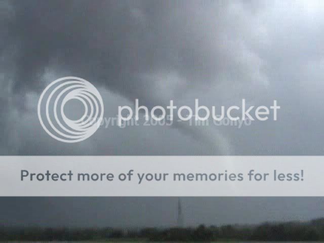
Airborne debris-approx. 6:40 PM.
081805A.jpg


081805B.jpg


Storm/meso structure after passage-Approx. 7:10 PM.
081805C.jpg


081805D.jpg


081805F.jpg


081805G.jpg


081805H.jpg


08_18_05_11.jpg


08_18_05_12.jpg


Damage on my side of the neighborhood was limited mostly to trees. Not so for the other side. :(
081805damage1.jpg


081805damage2.jpg


081805damage3.jpg


08_18_05_16.jpg


08_18_05_17.jpg


Finally, I would like to thank everyone on this board who expressed concern for my well-being. :D
 
I have never seen such outrageous skies. Chasing in Jefferson county saw 4
rainbows and other brilliant optical effects, striking mammatiform, a
couple of funnels trying to organize. Apparently the wife and I were about
5 miles from the Jefferson tornado. Heavily rain-wrapped where we were at
the time of that tornado so didn't see it but observed debris from it high aloft.

Truly tremendous shear, clouds flying every which way.

Got good images of the mammata, pics of towers & spaceships not so great.
Pics posted to Oconomo-Wx web site Oconomowoc Storm Chasing.
 
Prelim Report:

Chasing with Mark Sefried; followed at least two tornadoes of various forms and sizes as well as RFD vorticies from Stoughton to Whitewater areas. Saw homes disintegrate and copious lofted debris near Stoughton. For a time, the shape, colour, and violence of the tornado reminded me of a smaller version of Hesston KS from 3/16/90.

117_1799_sm.jpg


118_1801_sm.jpg


118_1811_sm.jpg


Will ammend with further detail and pics in the future. We were quite close and had to deal with trees, rolling hills and windy roads, however, Darin Kaiser has 20 minutes of good video from a single location as the tornado approached.

Scott
 
Scott,

You should consider sending that second photo of the tornado into the NWS office in Sullivan, or all three of them for that matter. Excellent pics! I volunteer there and am sure they would appreciate it as it is a nice photo (don't worry they will give you full credit on there ;) )

Either email it to the webmaster or myself and I will relay it to them.

EDIT: sorry this is not an actual report, if the mods want to remove it go ahead and I will send the question via PM or email.

Thanks,

Alex
 
Unfortunately living in S. WI did not play to my advantage Thursday. I left early and got on the storm that ravaged Viola shortly after it did so. I witnessed brief tornadogenesis somewhere near Richland Center, as well as nickel size hail. Keeping up with the storm on those roads was a near impossibility. I also had to deal with a 6 mile detour because of a bridge out near Loganville. I was finally able to get back east (totally unaware of any storms to the south, I had no cell or data signal at this point) and made a beeline south on HWY 12 out of Baraboo attempting to get south of the north storm. At this point I had no idea how close I actually was to a tornado which had just developed west of Highway 12. As I was driving south on 12 the radio station I was listening to cut in with noaa coverage and a warning was issued for my exact location - 6mi N. of Sauk City. It was merely 30 seconds to a minute after this that 20-30mph westerlies with moderate to strong precip because strong easterlies (40-50mph) with notable debris floating above the highway from east to west. I knew at this point I was likely under a strong meso and probably very near a rain-wrapped tornado. CURIOUSLY I continued to drive south, and as I did, hell broke loose. Literally, as fast as I could blink the 50mph easterlies violently accelerated into 90-110mph easterlies changing to ENEerlies. (and I'm usually a little conservative on my wind estimates). A copious amount of debris began rocketing past my car and I knew I was on the edge of the tornado. Seconds later when the stronger winds subsided, I drove about 50-75 yards up the road and nearly all the trees on the east side of the road were flattened and there were cars with many windows smashed out. There also happened to be a teddy bear simply lying in the middle of the road. Local sheriff was there so I continued on south to Hwy 60 in Sauk City where I drove west and caught glimpses of the beautiful white tornado through the hills and trees. I don't have video of the later views of the tornado (Kinney Adams was to my south and has very good video of the tor), however, I was filming during much of a intense moments nearly driving into the center of this tornado.

http://www.tornadofx.com/lodi.wmv (~12mb)

Another interesting note. There was not a lot of lightning with the storms except for immediately under the meso structure. I saw maybe 2 or 3 CG strikes while driving in the precip but once I was within 2 miles of where the tornado crossed the road, I had literally a dozen or more CG strikes within a mile of myself in the matter of 30 seconds to a minute. This was also the case near Fort Atkison where apparently a tornado crossed Hwy 106 only a few minutes ahead of me while I was again playing catch up. The lightning seemed to be of the staccato variety, very quick intense flashes with usually only one visible quick return stroke.
 
Back
Top