Joey Ketcham
For the first time in my chase career, I was placed in a situation that I hope to never encounter again.
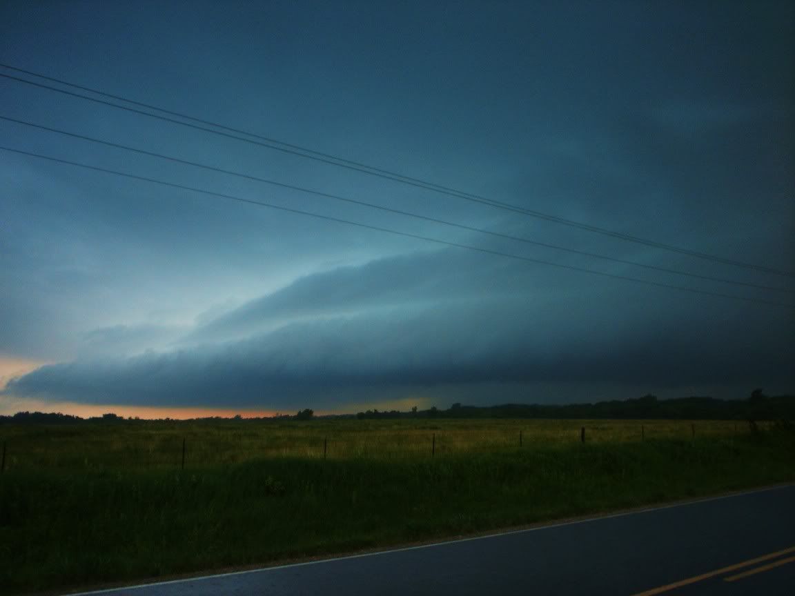
All I can say is WOW! What an expected chase day this evening. Where to start…. Early evening storms began to develop in and around the Woodson and Wilson county area during the 5 and 6:00 hour. They soon became tornadic prompting a tornado warning to be issued.
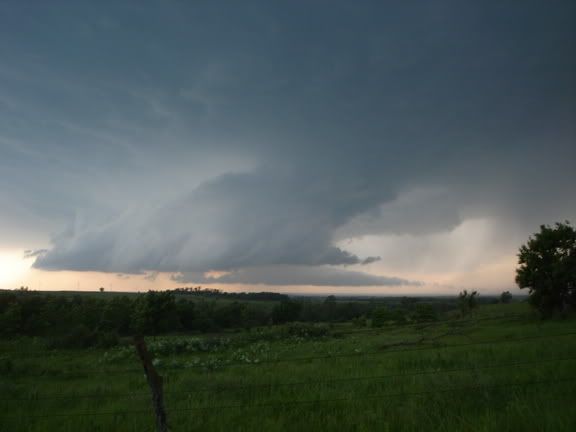
The storms were moving in a south, to southeast direction placing the counties of Cherokee, Labette, and southern Crawford in it’s path. After watching the storms as they progressed, I made a last minute decision to head out west on Highway 400 and intercept the storms as they rolled through.
I began my adventure heading west with the ability to see the strong supercell to the north. The storm was headed towards the McCune area, so I decided to head a bit further west to the intersection of Wallace Rd. and Highway 400. This would place me at an intersection where I had a paved south road in case I needed to bail.
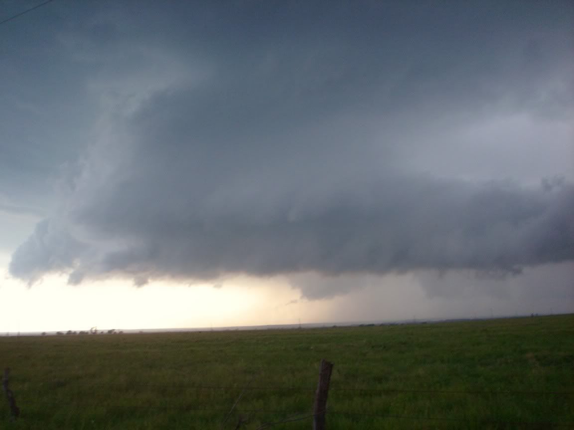
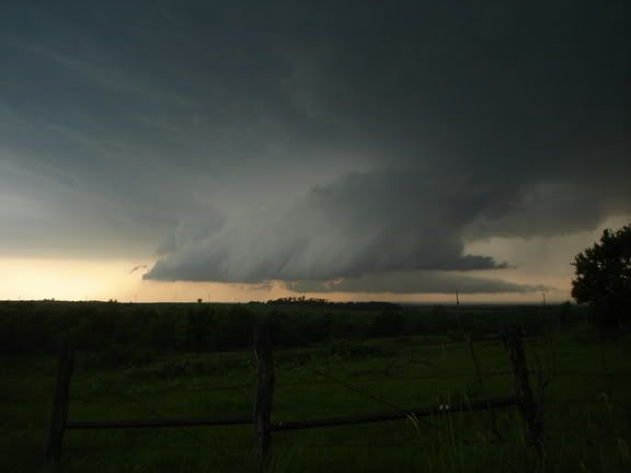
Across the street from the volunteer fire dept. at Wallace Rd and Highway 400 was a vacant lot I decided to pull off onto, here I was able to observe both a shelf cloud and beaver’s hail to the north and northwest. The beaver tail was actually more north of McCune Kansas.
Reports of funnel clouds and tornados soon began to pour in, I heard reports of a tornado near Thayer Kansas, and then a report of a tornado north of Parsons Kansas, which would place the tornado to my NW. I decided to hang out there at the intersection longer, shortly afterwards a Labette county Sheriff’s Deputy arrived to join in on the storm spotting.
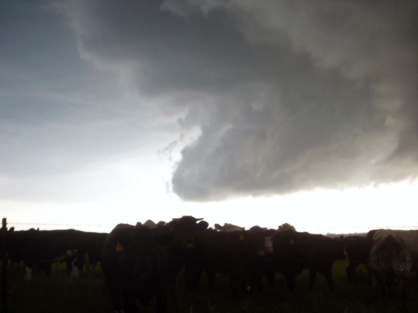
Soon the firefighters across the street began rushing inside and the deputy discovered a developing funnel cloud right over us. I turned around and the deputy lead the way and I soon followed as we headed south on Wallace Road as the funnel began descending to the ground. The winds were very violent, at least 80 MPH and branches were literally flying horizontal and just breaking in half. It was hard to keep my expedition on the road.
The Deputy headed to the first house we came upon and took shelter there, I continued south and ended up at a farm house that was occupied by an elderly man. The man’s house faced south, he was sitting in his drive way in a lawn chair completely unaware of a tornado just to our north, which was heading south – southeast. If I hadn’t stopped, chances are he would have been caught out there.
I pulled in, jumped out and advised him we needed to get to shelter now. At this time as we entered his garage the winds picked up to an Est. 80MPH or so. We headed to his basement and all I could see out the window was dust, debris and such being kicked around. The tornado passed barely to our north, thankfully.
After the tornado had passed, I headed back to highway 400 and headed back east towards home knowing I wouldn’t be able to catch up with the storm now. We did run into heavy rains, some small hail, and gusty winds. The tornado ended up staying on the ground making it’s way into southwest Missouri.
I got a couple pictures, and a radar grab. Nothing spectacular. It was quite the day!


NOTE: In a previous thread I stated I gave up chasing, I have. I, however, am going to continue storm spotting for the county though.. in case anyone gets confused.
All I can say is WOW! What an expected chase day this evening. Where to start…. Early evening storms began to develop in and around the Woodson and Wilson county area during the 5 and 6:00 hour. They soon became tornadic prompting a tornado warning to be issued.
The storms were moving in a south, to southeast direction placing the counties of Cherokee, Labette, and southern Crawford in it’s path. After watching the storms as they progressed, I made a last minute decision to head out west on Highway 400 and intercept the storms as they rolled through.
I began my adventure heading west with the ability to see the strong supercell to the north. The storm was headed towards the McCune area, so I decided to head a bit further west to the intersection of Wallace Rd. and Highway 400. This would place me at an intersection where I had a paved south road in case I needed to bail.
Across the street from the volunteer fire dept. at Wallace Rd and Highway 400 was a vacant lot I decided to pull off onto, here I was able to observe both a shelf cloud and beaver’s hail to the north and northwest. The beaver tail was actually more north of McCune Kansas.
Reports of funnel clouds and tornados soon began to pour in, I heard reports of a tornado near Thayer Kansas, and then a report of a tornado north of Parsons Kansas, which would place the tornado to my NW. I decided to hang out there at the intersection longer, shortly afterwards a Labette county Sheriff’s Deputy arrived to join in on the storm spotting.
Soon the firefighters across the street began rushing inside and the deputy discovered a developing funnel cloud right over us. I turned around and the deputy lead the way and I soon followed as we headed south on Wallace Road as the funnel began descending to the ground. The winds were very violent, at least 80 MPH and branches were literally flying horizontal and just breaking in half. It was hard to keep my expedition on the road.
The Deputy headed to the first house we came upon and took shelter there, I continued south and ended up at a farm house that was occupied by an elderly man. The man’s house faced south, he was sitting in his drive way in a lawn chair completely unaware of a tornado just to our north, which was heading south – southeast. If I hadn’t stopped, chances are he would have been caught out there.
I pulled in, jumped out and advised him we needed to get to shelter now. At this time as we entered his garage the winds picked up to an Est. 80MPH or so. We headed to his basement and all I could see out the window was dust, debris and such being kicked around. The tornado passed barely to our north, thankfully.
After the tornado had passed, I headed back to highway 400 and headed back east towards home knowing I wouldn’t be able to catch up with the storm now. We did run into heavy rains, some small hail, and gusty winds. The tornado ended up staying on the ground making it’s way into southwest Missouri.
I got a couple pictures, and a radar grab. Nothing spectacular. It was quite the day!
NOTE: In a previous thread I stated I gave up chasing, I have. I, however, am going to continue storm spotting for the county though.. in case anyone gets confused.


") . Slid and hydroplaned a lot, and saw hail of many shapes and sizes. Windshield wipers shredded, windshield cracked, numerous dents. Not bad for a milk day.
. Slid and hydroplaned a lot, and saw hail of many shapes and sizes. Windshield wipers shredded, windshield cracked, numerous dents. Not bad for a milk day.