Hey
So what makes them so interested specifically in the eastern Gulf I wonder?
Typical strike probability as provided by NHC:
http://www.aoml.noaa.gov/hrd/tcfaq/G12.html
Honestly, what makes Georgia and NC so much more likely than Florida at this forecast time, I haven't a clue.
SST anomalies would be a guess as to their reasoning,
http://www.cpc.noaa.gov/products/hurricane/12wksst.html
But that shows that while there is a slight warm anomaly off Louisiana, anomalies of such size don't usually persist very long.
Last year had quite healthy sea-surface temperatures (2nd warmest on record in the basin I believe, behind 05) and below average shear, yet produced only an average year. Relating it to El Nino is a common thing to do, and that's fine, but it just goes to show that dynamically the setup can be there and nothing happen. And while a La Nina is forecast/appears to be emering, and a stronger LN becoming more likely,
http://www.cpc.ncep.noaa.gov/products/analysis_monitoring/enso_disc_mar2006/ is all I have to say.
And still the question remains, why those regions???
Is there some weak statistical indicators by region?
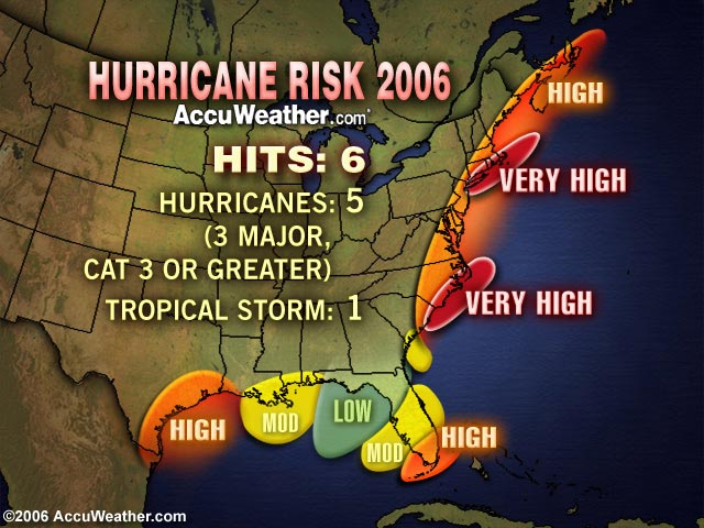
Or you can play Accuweather, pick regions that'll generate concern/large attention, and forget about it before the season dies away. And, yes, it was hilarious to see Alberto getting hurricane warnings right here in the Florida Big Bend where they forecasted the lowest chances. (It never reached hurricane strength, though).
I have to stick with what Jim Leonard discussed a few threads back about the setup of trough/ridge patterns. In an NHC talk here last week, I believe the only dynamical (as opposed to statistical methods like ENSO) negative were in velocity potential anomaly and upper-level temperatures/stability. From my what weak attention I paid most of last tropical season, the SAL wasn't that big of a player (slightly more typical numbers of storms formed out towards the Cape Verdes than the surprisingly huge lack of storms out there in 05). While outbreaks occurred as in any year, I don't remember anything too overbearing. But like I said, didn't pay a TON of attention.
We'll see what happens. It looks like it'll be an active year with recent trends and the lack of El Nino, but no one can bet the farm on this.
Shane