beaudodson
EF5
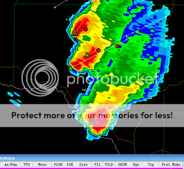
I was reading a thread on this forum (or elsewhere) and someone posted an image from the NWS that showed a radar where the meso signatures (circles) were lined up in a row through several counties. It was one of the options that the radar allowed so that you could track mesos. This would allow the user to see if a thunderstorm has been producing a meso through several counties (or for several hours).
Does someone know where to find an example image of this? The image I looked at showed a thunderstorm that had been producing meso signatures for about an hour or two. On the image you could see about 12 circles where the meso signatures tracked...they were all lined up from the southwest towards the northeast (the track of the storm). Hopefully the above makes sense.
Thanks

")