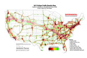
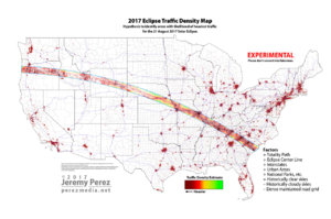
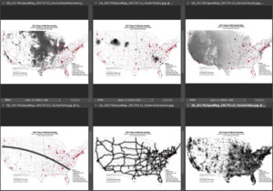
Jeremy, those maps are fantastic! I'm wondering if you can take into account the major cities connected to the path via major highways (like Chicago, Memphis and New Orleans residents traveling to the path via I-55).
The 'move at the last minute' prospect is somewhat worrisome, as I'm not sure how feasible it will be if traffic is on the higher end of the scale. I-70 in Missouri has a history of backups during high-travel events (holiday traffic for example) and I could imagine it being completely out of play for a westward move. Also, there are bottlenecks like few Missouri River crossings between MO/IA and NE.
I would almost think a feasible last-minute change westward would be using state highways like Highway 50 in MO and Highway 56 in Kansas (south of I-70) to get west, then using something like Highway 15 or Highway 81 to go north. Basically bypassing the traffic nightmares likely to be taking place along I-70 and the big metro areas like KC, St. Louis and Omaha. There are lots of road options to go west then north in central KS and NE.
A possible route avoiding these trouble spots would take 9 and a half hours from Jefferson City to Grand Island, which would mean leaving by midnight before to arrive early enough to get into position:
https://www.google.com/maps/dir/Jef...0x8799a8d420d52631:0x6ebbee987dfe6be4!1m0!3e0
I'm now thinking about booking a hotel in Osage City, KS, then making the decision to either go east back home or north to NE depending on which one looks to be out of the clouds.
Again, I'm also concerned about fuel, food and lodging shortages in rural NE, so I may have to plan for that somehow (rooftop or trunk gas cans).
It will be interesting to try and gauge the influx of people ahead of time. I think hotel bookings might be a good indicator to watch as we get closer in time.