Dan Robinson
EF5
I thought this might be an interesting thread. I'm sure it's happened to all of us at least once, if not, it will. You see/report a tornado, and it never ends up in Storm Data for one reason or another. I've always been curious of a tornado would ever be added to the database years later if enough evidence was presented - does anyone know?
Here are a couple of mine. I'll include all relevant data for each one.
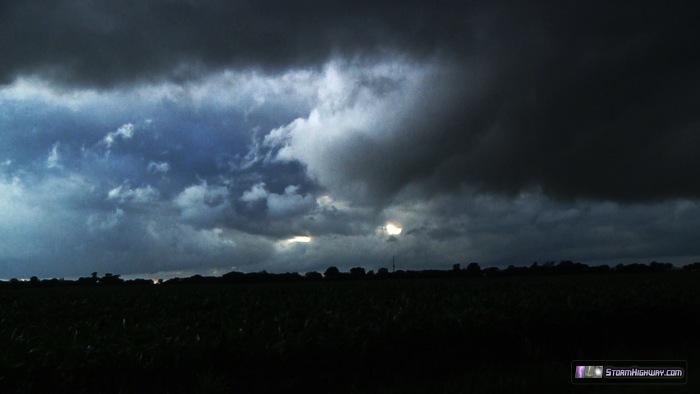
July 1, 2013, St. Francisville/Sand Barrens, Illinois (Lawrence County)

Image at 22:25z
Video clip: Video Link
Radar (baseref and velocity) with more video grabs: http://stormhighway.com/july12013/july12013event1.jpg
Tornado start time: Zulu 22:24:11 (5:24:11 PM CDT)
Tornado end time: Zulu 22:26:00 (5:26:00 PM CDT)
Tornado duration: 1 minute 49 seconds
Viewing location Lat/Lon: 38.5904483000000 -87.740931700000
Estimated rating: EF-0, no structures impacted
Notes: Supercell/hook oriented with inflow to the north. Tornado nearly stationary approximately .5 to .75 miles south-southwest of the intersection of Sand Barrens Lane (150N) and East Harmony Road (900E).
June 7, 2014, Highland, Illinois (Madison County)
Video clip: Video Link
Viewing location: Bluemound Road from Rose Road to Ellis Road, 2 to 4 miles southwest of Highland, Illinois.
Estimated rating: EF-0, no structures impacted
Notes: Low-topped supercell with funnel 1/3 of the way to the ground, intermittent condensation vortices and dirt whirls spinning up on the ground. I missed capturing the ground vortices on video due to prioritizing calling the tornado in to the NWS. This raises the question - for these weaker tornadoes, is it better to capture it on video for "proof" to ensure it has a better chance of being recorded in Storm Data? As with the St. Francisville tornado, I know video evidence won't necessarily guarantee its recording.
Here are a couple of mine. I'll include all relevant data for each one.
July 1, 2013, St. Francisville/Sand Barrens, Illinois (Lawrence County)
Image at 22:25z
Video clip: Video Link
Radar (baseref and velocity) with more video grabs: http://stormhighway.com/july12013/july12013event1.jpg
Tornado start time: Zulu 22:24:11 (5:24:11 PM CDT)
Tornado end time: Zulu 22:26:00 (5:26:00 PM CDT)
Tornado duration: 1 minute 49 seconds
Viewing location Lat/Lon: 38.5904483000000 -87.740931700000
Estimated rating: EF-0, no structures impacted
Notes: Supercell/hook oriented with inflow to the north. Tornado nearly stationary approximately .5 to .75 miles south-southwest of the intersection of Sand Barrens Lane (150N) and East Harmony Road (900E).
June 7, 2014, Highland, Illinois (Madison County)
Video clip: Video Link
Viewing location: Bluemound Road from Rose Road to Ellis Road, 2 to 4 miles southwest of Highland, Illinois.
Estimated rating: EF-0, no structures impacted
Notes: Low-topped supercell with funnel 1/3 of the way to the ground, intermittent condensation vortices and dirt whirls spinning up on the ground. I missed capturing the ground vortices on video due to prioritizing calling the tornado in to the NWS. This raises the question - for these weaker tornadoes, is it better to capture it on video for "proof" to ensure it has a better chance of being recorded in Storm Data? As with the St. Francisville tornado, I know video evidence won't necessarily guarantee its recording.
Last edited:
