Short Mid-range Discussion

Joined
Nov 23, 2019
Messages
39
Location
Baltimore
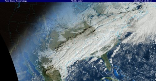
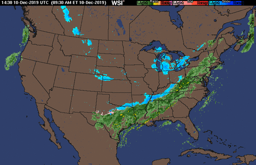
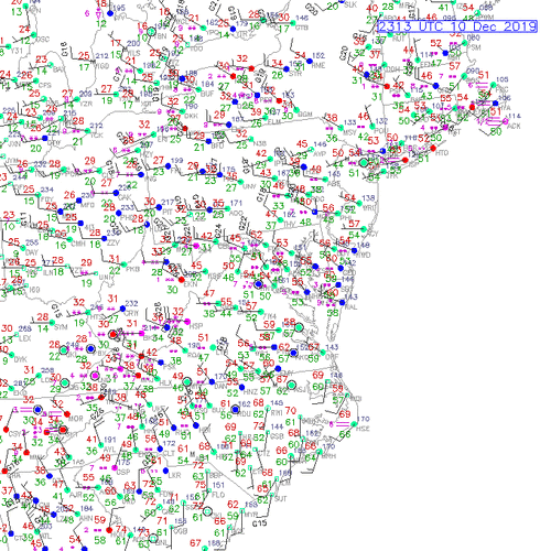
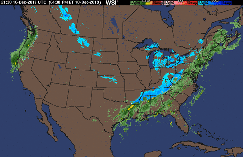
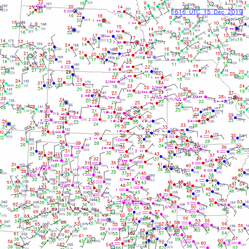
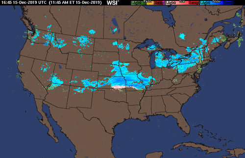
The old day five wave is now upon us, ushering in cold air. Subtropical moisture feed is interacting with northern and southern stream vorticity. Ice pellets developed in Memphis as precip ended. Snow is falling above 2000ft in NW Tennessee. Looks like southern stream energy will produce an overriding event with a 10-50 mile wide snow band from extreme nother Alabama to New York City.

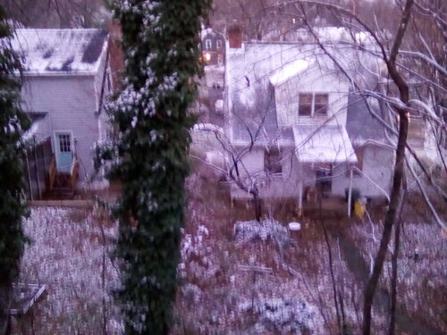
This will be an atmospheric snow. 1-3 inches may fall but will melt on contact with the surface. In northern regions like Baltimore to New York City, expect 1- 1 1/2 inches on car tops, a few patches on the ground in shaded areas at sunrise Wednesday.

This is the first volley. Fun times.
 

Attachments

  • IMGv_0.jpg
    IMGv_0.jpg
    301.4 KB · Views: 0
I should add that the last post was 70% model, 15% climatology, and 15% experience. The great x-factor is reality. That's why we chase storms. That's why we look out the window. Can this event, under or over perform? You bet ya.
 
Unnecessary chatter. I think that showed up in my evals a time or two, that being said, we indeed had 1-2 inches of snow on car tops.. I apologise for image quality. I have a better camera.

The surface accumulation was greater especially south into Tennessee. It over proformed in those areas with 1-3.

Tommorow we will introduce black ice, or freezing rain, from Western NC to Maryland. NW Baltimore suburbs are in question. WAA will erode these conditions. Timing will dictate more or less.

A band of snow and mixed precip with the next wave, the old 10 day wave. Euro further south. GFS still has a "cutter" into Ohio. 84-96 hrs. Models still not in agreement..
 

Attachments

  • IMG_20191211_072638_3.jpg
    IMG_20191211_072638_3.jpg
    288.6 KB · Views: 0
Great snowstorm for eastern/central Kansas , central Missouri, Illinois, Indiana and Ohio. A 75-100 mile band of 3-6 inches with locally higher amounts. This is the old ten day wave.

Northern Virginia, extreem NE West Virginia and Maryland will be under a developing CAD. This will narrow the band to 30-50 miles. I know this will be a nightmare forcast for the local meteorologist in this area including the 1-95 corridor. They most likely have been pulling thier hair out. There will be a lot of nowcasting. More to come.

As an aside, I think I speak for everyone that our thoughts and prayers are with those who experienced the severe weather and tornadic distruction with yesterday's frontal passage in Florida. This volatile pattern will persist.
 

Attachments

  • SN_000-084_0000.gif
    SN_000-084_0000.gif
    166.5 KB · Views: 0
Nice moderate snow band. 16Z surface plots show surface vortex slightly North in southern Oklahoma. Freezing rain in central Kansas. WAA underway. Freezing rain in Oklahoma further south than prog. Love the 6 hr bust....
 

Attachments

  • 2019121516_metars_ict.gif
    2019121516_metars_ict.gif
    50.3 KB · Views: 0
Disclamer. Precipitation at the surface and aloft. Precip below 1500 ft not depicted, ie Zl-. This can be significant.
 

Attachments

  • 1645z.gif
    1645z.gif
    29.8 KB · Views: 0
Back
Top