Hi all,
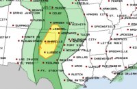
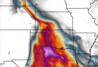
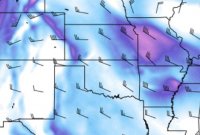
I have a question regarding this Saturday's southern risk area. The SPC have delineated a 'slight' around western OK and TX panhandle, nosing into Kansas. I am aware of the approaching trough to the west and the progressing dryline and the CAPE values do look high in this region. However, I'm struggling to understand why this risk area is not continued any further north, more into Kansas and northeast Colorado. Looking at the latest 12Z NAM for Sun 16-05-22 00z, the bulk shear and CAPE (albeit a thinner tongue) look present in this area too. Is it perhaps something to do with the high 700mb temps which may be accountable for the much higher CIN values?
Any insight much appreciated.
Thanks,
Cammie


