Question on Storm motion (Sat 5/21 Leoti KS & Sun 5/22 Perryton/Spearman TX)

Joined
Feb 4, 2012
Messages
70
Location
Massachusetts
I found myself chasing for the 3rd year in a row, (Im a MA/RI resident so it takes serious planning) but I definitely hit the jackpot this year. I was able to correctly position myself underneath the Leoti KS Supercell (amazing structure) and witness multiple tornados near Spearman/ Perryton in the TX panhandle the following day. I'd like to think the DVDs and books I spent the last year watching/studying helped tremendously, but I can't help but feel I got very lucky as well (especially Sunday where there were multiple tornado warned cells and I could have busted bigtime).

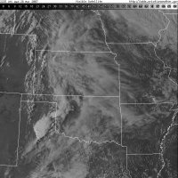
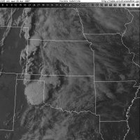
Anyway, as I still digest my chase experience, i am making different observations and comparing the Saturday chase vs. Sunday chase. Both days storm(s) fired along the dryline, with extremely slow storm motion which is welcome by this amateur :) On the Leoti KS supercell from Saturday, I recall the Supercell's motion was tracking to the northeast until it eventually became stationary as it got later in the evening. Closer to dark after it put down a few short lived tornadoes, the motion actually seemed to drift to the South south east. It was the only cell in the area so I gather it wasn't being interfered with at all. This cell seemed to have surface winds feeding it from the south all day, but they eventually just stopped for a good 20-30 mins, not sure how/why the surface winds were cut off like that or if that played a role in eventual motion to the southeast. We were stationary for a good hour or two on that cell, so I can comfortably say the surfaced winds seemed to stop for an extended period prior to the cell drifting southeast (slightly).

Looking back on the following day (Sunday in the TX panhandle), cells fired along the dryline and moved northeast from inception until almost exactlty the same part of the day as Saturday. We saw a 2nd tornado around 7:45pm while positioned on 281 east of Spearman but the cell/tornado which was located to our North seemed to being heading to the southeast. The following few hours until dark the cell seemed to track to the southeast with inflow screaming in from the north.

Thank you for making it this far, and I understand this is probably painful for some of you to read due to my novice/amateur knowledge I'm displaying, but my question is this...Why did the storm's motion eventually begin tracking to the southeast, and was it a complete coincidence that around the same time in the day each cell began drifting to the southeast? Was this expected by other chasers/meteorologists, or did it catch anyone by surprise? I viewed some Youtube footage from T. Laubach who seemed to have same view as myself, and I noticed 2 white tour vans and a 3rd vehicle who looked like they could reach out and touch the mult-vortex tornado, so maybe they were also expecting the cell to keep moving Northeast as well. See minute mark 1:25 mark obviously this is NOT MY VIDEO:

Anyway, I would appreciate anyone's comments on how their chase unfolded these two days, and if the Tornado south of Perryton and the Southeast motion caught any chasers by surprise. Thoughts on why both days eventually ended with motion heading southeast would also be appreciated.

Thanks
 
A southeast turn on any supercell is rarely unexpected. Contrary to popular belief, the right turn has nothing to do with Coriolis force, but rather depends on the tendency for a right-split cell to continue to split and grow toward the direction of maximum inflow.. Strong supercells tend to pulse in cycles, and often this occurs when the updraft is large enough to cause left and right splits. Typically right splits dominate, so over the course of many right splits, this becomes a slow right, often southeastward, turn.

In addition, there is the tendency for inflow to become the dominant predictor of storm motion. As the cell feeds from the inflow, is it common for the base of the cell to move in a different direction than the rest of the updraft and upper level winds would indicate. This is sort of like back-building, see Jarrell, TX EF5, but more like inflow-side-building. This often coincides with a sudden uptick in the low-level jet winds, which may occur approximately the same time of the day each event. This type of storm motion is even more likely in events where upper level steering currents are weak, which was the case in those storms as well.

Moral of story: Both cases aren't that odd, looking at the larger pool of tornadic supercells that occur.
 
That makes a lot of sense. I appreciate the response. I was watching our position on radar and the sky, and it definitely confirms yours answer. I positioned ourselves in the inflow notch on both days and it was evident storm pulsed and had shitload of energy, especially Sunday.

frankly I'd rather not be within a half a mile from a southeastly moving tornado/cell, and it's something I'm still addressing with my chase partner. This was the first year where he wasn't completely listening to my navigating/directions which, as time goes on, makes me less and less comfortable chasing with him again.

Anyway - thank you Royce
 
A few things to comment about this:
-I would argue that the most interesting storms on the 22nd in the Texas panhandle actually did not form on the dryline, but rather along some general confluence some 200 km east of the dryline. A review of reflectivity (this site helps: http://www2.mmm.ucar.edu/imagearchive/) shows a fine line structure in the far western panhandle during the afternoon, which is consistent with local surface obs on the location of the wind shift and moisture gradient, and hence the actual dryline. Storms to the south, in west-central Texas, may have formed along a local bulge in the dryline, but there was even a fine line west of KLBB aside from the area where storms actually formed. Anyway, sort of besides, the point, but it's good to remember that a boundary is not a necessary condition for convection initiation. If the lower atmosphere is unstable enough, very small scale motions such as eddies within the boundary layer or topographically induced circulations can be sufficient to trigger storms in the absence of a larger-scale boundary, such as a dryline.

-What you are describing with the deviant storm motion is basically textbook supercell behavior caused by internal storm dynamics, chiefly, the interaction between the udpraft and deep vertical wind shear. There are a large number of references that explain this behavior in great detail, although it gets very technical. Here are some references:
Klemp 1987 review
Rotunno and Klemp 1984
Bunkers on highly deviant supercell motion
Much of the research on which current research is based was published by a small group of people in the 1980s including Joseph Klemp, Morris Weisman, Richard Rotunno, and a few others. Howie Bluestein and Paul Markowski also have written textbooks that cover the topic of supercell storm dynamics. Bluestein's book, Severe Convective Storms and Tornadoes: Observations and Dynamics, was published quite recently, and so has more updated information and observations. The Markowski textbook on Mesoscale Meteorology covers additional materials besides supercells, but also has a good discussion on this topic.

-Observed storm motion in the Texas panhandle on the 22nd resembles fairly closely the predicted right-mover motion based on observed soundings from Amarillo and Dodge City. The 18Z Amarillo sounding, for example, predicted a right-moving storm motion vector of ENE at 12 kts, but that sounding also had SSW surface winds, whereas nearby obs in the late afternoon near Spearman/Canadian were out of the SSE, so that would tend to decrease the magnitude of the storm motion vector, and possibly bend it to the right as well. Also keep in mind the Bunkers (2000) method is used to predict right mover storm motion, and it's not a perfect method. Observations also contain error that may not be negligible, and heterogeneities in the wind field could result in vertical wind profiles in the vicinity of the individual storms that differ slightly from those sampled by radiosondes taken a few hundred kilometers away. Therefore I don't think it's beyond the realm of uncertainty that these storms moved the way they did.
 
Jeff always breaking out the textbooks to make sure we get our weekly quota of scientific reading. Very nice.

As for your storm chasing perils, Greg, I would suggest that 1/2 a mile is much too close if you are in the inflow of a slow or meandering supercell. I'm not an extreme chaser, so I try and always keep at least 1 mile between myself and the rotation. This is made easy because Nebraska roads are always 1 Mile apart in the grid. If the storm were moving quickly, say 40mph+, then one could reasonably assume forward momentum would keep the inflow notch relatively safe even at shorter distances, but at slow speeds you can never assume that you won't get back-built or right-turned into.

Case in Point June 4th, 2008: I was more than a mile from the rotation, with no visible tors on the ground, only to have the slow moving cell right-split blow up over my head and drop an EF0 a few hundred feet away with me in the path. I was lucky enough to push into the bear cage to escape as the tor went EF2 and hit the town I had just driven through, Ulysses, NE. That storm went from 1 tor on the ground to 3 in a matter of seconds, all relatively far apart from each other.

Moral of the story: The slower the cell, the more careful you need to be with regards to your positioning, as a split or merger could drastically impact storm location and motion.
 
Jeff - So storms fired ahead of the dryline? Now that you mention it, i do remember checking several mobile sites and seeing the dryline on the TX/NM/CO border on Sat and it finally crept slightly into KS/OK/TX panhandle. I do remember seeing the bulge further south closer to Pampa TX on Sunday and we originally targeted Pampa but then I changed my mind because I didn't like being that close to towns and the road network was less familiar. I don't remember if a tornado occurred on that warned cell, but this was where the first Tornado warned cells in TX were that day. I have a shitload to learn, and will bust my ass between this season and next so I don't make as many mistakes. Not to mention, have a sit down with my partner and explain to him knowing where the highest tor-con is, doesn't give him final say on where we target or when we leave a storm.

FWIW - my chase partner with even less knowledge than I (if you can believe it) was responsible for putting us closer than I felt comfortable with on May 22nd TX Panhandle. Unfortunately, my videos from that chase have to be replayed without any sound, because I'm yelling at him for us to relocate. He was caught off guard and didn't expect the tornado to drop right to our North, which if he had listened to me I told him the new meso was forming and about to plant a tornado. There were a lot of chasers in our location, and I know this was exactly what gave him the confidence to stay. To me, that's not a good reason to be in the position you are in, just because others are there...Anyway...

Ryoce - we chased the Beaver Crossing NE Tornado in 2014 (our 2nd chase) and the base on that storm was so damn low, and tornado rain wrapped we couldn't get a clear view of the storm but we were safely positioned several miles away to the south. On that storm, my partner didn't have the confidence to make any of his own decisions so he went with my lead and trusted my navigation skills. He finally admitted last night, we were probably a little too close in the TX panhandle this year, and he should have listened to me when I said "LETS GO!" -
 
Greg, I was also on the Beaver Crossing, NE Tornado. We got a nice spot in the inflow about 10 minutes before anyone else did, and we just sat there not knowing how close to get, it was just so huge and low. I took pictures but nothing turned out worth a darn. Then the TIV flew past us heading straight into the path and we realized it was go time right before the RFD became dominant and hit us with 100mph winds. We were escaping east at 60mph and it still blew our truck-bed cover up into the air from behind, and despite being more than a mile away from the center of circulation. Just goes to show how unpredictable large and violent tornadoes can be.
 
Jeff - So storms fired ahead of the dryline? Now that you mention it, i do remember checking several mobile sites and seeing the dryline on the TX/NM/CO border on Sat and it finally crept slightly into KS/OK/TX panhandle. I do remember seeing the bulge further south closer to Pampa TX on Sunday and we originally targeted Pampa but then I changed my mind because I didn't like being that close to towns and the road network was less familiar. I don't remember if a tornado occurred on that warned cell, but this was where the first Tornado warned cells in TX were that day. I have a shitload to learn, and will bust my ass between this season and next so I don't make as many mistakes. Not to mention, have a sit down with my partner and explain to him knowing where the highest tor-con is, doesn't give him final say on where we target or when we leave a storm.

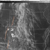
I believe storms indeed developed well to the east of the true dryline throughout the TX panhandle on the 22nd, yes. I pulled some old visible satellite imagery from that day and analyzed where I think the main dryline is. Note the fracture and westward displacement across the Texas panhandle:

satellite_vis_ict_201605222130.jpg

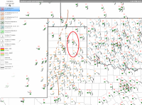
Clearly most of the storms at this point are well east of where the dryline appears to be. Surface observations also support this analysis:

201605222045.png

I've outlined the area where storms fire in red. Clearly there is some separation from where I've analyzed the dryline. I'm open to debate as to where exactly the dryline was, but that is probably getting too far off topic. Anyway, as I was saying before, in a situation where there's very little CIN remaining, lift from boundary layer turbulence or terrain can be enough to trigger storms. Given the strong easterly surface wind component in the red oval, which coincides with the eastern edge of the Caprock in that area of the state, I think it's entirely possible forced ascent from terrain played a significant role in getting storms to fire in the eastern panhandle this day.
 
Though a little off topic from the original post, this is just to add a little on to what @Jeff Duda mentioned about storms firing off the dryline in the Panhandle. This is actually not the first case of this, so it is always something to keep in mind when chasing the Panhandle. Caprock really does play a huge role in the weather out here.

The other case that has always stuck with me is March 28, 2007. The dryline of 50+ dews set up west of a line from Dumas down to Hereford, while the 60+ dews settled off the Caprock about 100 miles east. Storms fired on the dryline north of the Panhandle, but in the Panhandle all of the storms fired off the secondary dryline along the caprock.

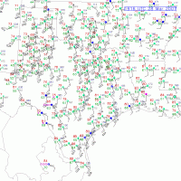
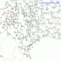
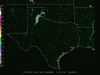
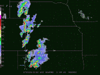
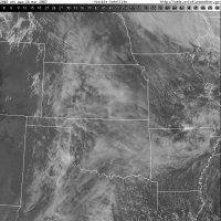
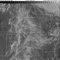
Surface, radar, & satellite data pulled from here: http://www2.mmm.ucar.edu/imagearchive/

Surface obs:
eaf34f3e1102c0a0a0fbf2a79fb0b9d6.gif
5a3fd08f9f999ae48027523d1a2de16c.gif

Radar:
39aba9b22a7f9aa7c1a7c4a97efbb9b0.gif

2f13ce11db70f1202030b39ebb476fef.gif

Satellite:
cb8afd4677d15b12a7c5c1db85893218.jpg
8eaed0cbc3723acd8f25daa39469205d.jpg
8ff9c251488728af6d2c21672ddc52a5.jpg
8a86feba84aa59142d65f983fe2f0aa4.jpg
 
The storm on the end near Big Spring had almost due south movement maybe even a little bit to the SW at some points during its lifecycle. I was expecting SE movement, not due south. Definitely an interesting day with the storms firing off the caprock - That's the true "caprock magic" which doesn't happen as much as people would like you to think. Sometimes tornadoes just happen near the caprock, but have nothing to do with the caprock.
 
The storm on the end near Big Spring had almost due south movement maybe even a little bit to the SW at some points during its lifecycle. I was expecting SE movement, not due south. Definitely an interesting day with the storms firing off the caprock - That's the true "caprock magic" which doesn't happen as much as people would like you to think. Sometimes tornadoes just happen near the caprock, but have nothing to do with the caprock.

That storm definitely had some SW movement to it late in the life cycle (after dark), just before it got overtaken by a new cell from the west. I know, because I was tracking behind it, and headed south - with the hail core just off to my east. Then I started taking hail, looked at radar, and everything had shifted back to the west/sw. I had to retreat back to the North and the chase was over.
 
Back
Top