• While Stormtrack has discontinued its hosting of SpotterNetwork support on the forums, keep in mind that support for SpotterNetwork issues is available by emailing [email protected].

Post storm structure pictures to analyze and ask about

calvinkaskey

Guest
Joined
Feb 17, 2014
Messages
384
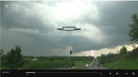
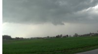
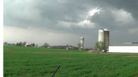
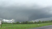
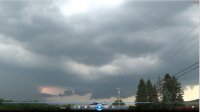
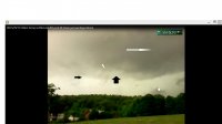
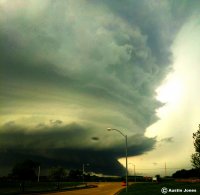
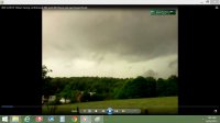
6-12-15 near albany ny9.jpg 4-20-15yorkpaarea.jpg 4-20-15yorkpaarea2.jpg 4-30-14 Emporia, Va meso w funnel cloud.jpg 6-12-15 near albany ny10.jpg 5-29-13mountny.jpg I thought this would be fun for people to learn and to help others learn about storm structure.

First pic shows RFD in foreground with Wallcloud in background.
Second pic shows Wallcloud with clear slot.
Third pic clear slot with tail cloud.
4. Wallcloud with tailcloud.
5. Wallcloud, tailcloud and clear slot.
6.Wallcloud, funnel, scud, tail cloud, accessory cloud
 
Last edited:
Much more helpful is statically framed video. So we can see motions of cloud. Preferably, a timelapse using a static frame on a tripod. With stated compression amount. Top one looks like a scud lowering. Could be way early start of something, more likely it's because it's cold there. Middle one looks like a nice farm silo. Nothing interesting cloud-wise. Bottom one could be a wall cloud, building wall cloud, or again, it might just be cold up there.
 
Much more helpful is statically framed video. So we can see motions of cloud. Preferably, a timelapse using a static frame on a tripod. With stated compression amount. Top one looks like a scud lowering. Could be way early start of something, more likely it's because it's cold there. Middle one looks like a nice farm silo. Nothing interesting cloud-wise. Bottom one could be a wall cloud, building wall cloud, or again, it might just be cold up there.
I'll give you rough calculations for the last picture. 40 mph storm relative for the long white arrow, 20 mph for the short white arrow, 55 for the big black arrow. The scud lowering is a tornado warned cell and the suv ahead of me are storm chasers from Quebec. Bottom pic had a tornado warning 5 minutes prior and the storm to the north produced a confirmed ef-1 with major tree damage. The farmhouse pics were taken during a tornado watch and the wall cloud pictured shows arrow head pointing into the direction of airflow.
 
Much more helpful is statically framed video. So we can see motions of cloud. Preferably, a timelapse using a static frame on a tripod. With stated compression amount. Top one looks like a scud lowering. Could be way early start of something, more likely it's because it's cold there. Middle one looks like a nice farm silo. Nothing interesting cloud-wise. Bottom one could be a wall cloud, building wall cloud, or again, it might just be cold up there.


That's what I was thinking too. Most of them didn't show anything remarkable cloud-wise.
 
I'm thinking there isn't a point in posting pictures of tornadoes. Like I said all of them either are under SPC watches and or NWS warnings. 1st and 4th are under a tornado warning and the 3rd also with a funnel supposedly verified at the time.
 
Yeah, that is nice Austin, unfortunately I don't live in the midwest. Were you trying to chase for tornadoes or for the best pictures for yourself?
 
Back
Top