On the Continuum of Walls and Shelves

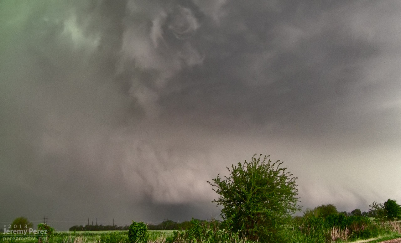
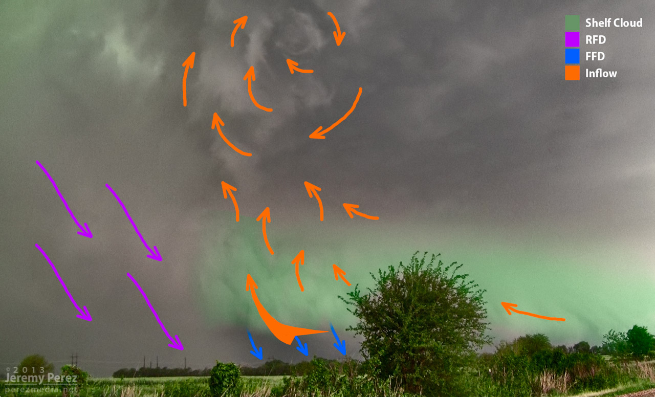
I like your interpretation a lot, Jeremy! I initially tried to draw some arrows over my animations, but nothing felt quite right. Leave it to someone who (I'm guessing) wasn't even there to do a better job. :) You're diagram definitely seems plausible.

Also, I meant to mention earlier that we must have been very close to each other on May 19, 2013 during the weak little Newkirk storm. Our pics look almost identical. Did you by any chance see that random, bizarre Emu farm north of town??
 
Ha, I'll have to have to look at my video footage and see if I drove past that. That was my first time up close with an HP—pretty unsettling. Shortly after that photo, new circulation started to develop just ahead of the occlusion. This is a frame grab of that awesome dynamic. Did you catch it doing that? Or were you fleeing east like I was seconds later? That storm had a tornado report on it about 6 miles northeast a few minutes later. My positioning was poorly timed and mostly terrible that day.


Last edited by a moderator:
Yea we didn't see anything interesting on that Oxford storm. Being a tad more northeast (south of Udall), we didn't have a good escape route east (Walnut river blocking the grid). So we bailed south fairly early and just dodged the edge of the RFD. That was definitely an intimidating storm :)

The emu farm was later on at the tail end of that line.
 
As Skip said, a shelf can transition to a wall cloud fairly quickly. The key is paying close attention to cloud motion and any areas of inflow that can get established. A shelf cloud on a supercell indicates a surge of outflow or RFD, and almost always will be clearly visible pushing outward along its entire length away from the storm. If you're close to it, you'll feel the cold winds coming out of the storm as it passes.

To get tornadoes, you need air flowing into the storm from the *surface*. Outflow kills this by making the inflow ride up and over the cold air. However, inflow to a surface-based updraft can and often does get re-established following a surge of RFD or outflow. This is most likely to happen on the forward flank side of the RFD gust front or on the eastward/northward side of an outflow surge-related shelf. Again, surface inflow is usually pretty easy to spot by cloud motion alone, but also by feeling which way the wind is moving at your location. An outflow/RFD surge can also trigger new updrafts along and ahead of it, so you'll also want to pay attention to those areas.
 
Back
Top