No sign of winter!

January show no sign of winter here.

Grand Rapids, Michigan
50 days in a row with a trace of precipitation a new record
15 days that tied a record of zero possible sunshine

December
We had the 8th snowiest December on record 28.9 inches
We had only 9 percent of possible sunshine
0 Clear Days, 4 Partly Cloudy Days and 27 Cloudy Days
Highest Temperature was only 40 degrees for Deceber

January
has seen only 0.5 inches of snow which is
unheard of, and 13 days with no snow on the ground
and 2 days of a trace of snow on the ground,

Jan 12 we had 93 percent of possible sunshine had to
go back to Nov 19, when we had 96 percent possible
sunshine

Got up to 53 degrees on Jan 12, had to go back to
Nov 15 for a warmer temperature.

Monthly Temperature is 11.9 degrees above normal.

Season Snowfall, we way above normal, now 0.7 inches
below normal, Season Snowfall is at 46.7 inches/

Mike
 
Yes, we are experiencing a heatwave here in Albany this morning. We have just jumped up to 6 degrees. Wind chills remain -5 to -15. The igloo is ok for now I think.

This winter is very reminiscent of last winter. I think we are in for a repeat of Summer 2005.
 
I forgot to mention that we don't even have any frost in the ground. You can go outside and dig holes with your fingers. I can't remember the last time in January we didn't have frost in the ground and it has been atleast 10 days since the frost came out. We still have some green grass and if the ground gets a little warmer we might even see some flowers start to pop up.
 
My spring flowers are starting to come up as of today... another day of 40 degrees and sun here.

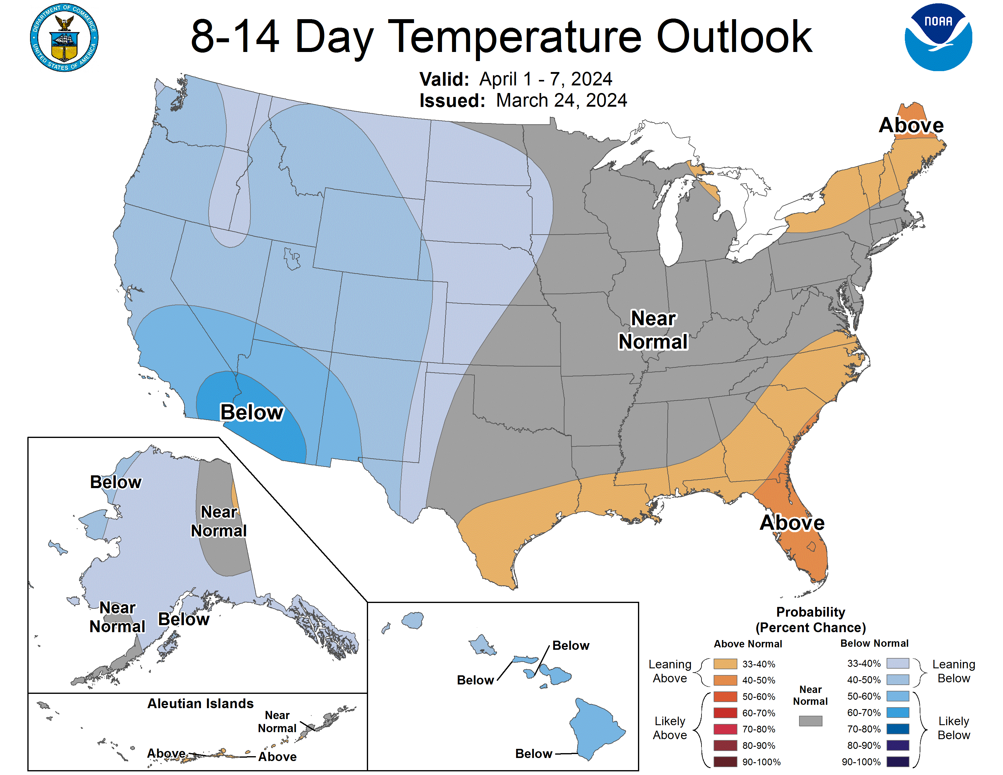
Wisconsin is bullseyed:

814temp.new.gif
 
Hey Joel:


THURSDAY NIGHT AND FRIDAY...MODELS ARE IN REMARKABLE AGREEMENT THAT
THE MAIN WESTERN TROF WILL SWING EAST AND COME OUT NEGATIVELY TILTED
IN THE PLAINS. WHAT IS EVEN MORE AMAZING...IT THAT THERE IS GOOD
AGREEMENT...INCLUDING THE CANADIAN...GFS...UKMET...ECMWF...THAT THE
UPPER LOW AND SURFACE LOW WOULD MOVE NORTHEAST ALONG A SIMILAR TRACK
JUST SOUTHEAST OF THE AREA. THIS IS A FAVORABLE TRACK FOR
SIGNIFICANT WINTER PCPN...AND HAVE BUMPED UP POPS TO 40 PERCENT TO
COVER THIS. WILL WAIT ANOTHER DAY OR SO BEFORE DEFINING THIS
POTENTIAL WINTER STORM IN PRODUCTS...BUT NEEDLESS TO SAY...THIS MAY
BE THE MOST SIGNIFICANT WINTER STORM IN REGARDS OF PCPN THUS FAR
THIS SEASON.

From DVN. 8)
 
Well, winter passed us by AGAIN, as I feared it would. Just saw this on the NWS LBB site:

DOWNSLOPE FLOW ON BRISK NORTHERLY WINDS WILL CONTINUE TO INDUCE RAPID DRYING ACROSS THE SOUTH PLAINS FOR THE REMAINDER OF THE EVENING. DEWPOINTS IN THE LOWER 20S ARE ALREADY ADVECTING SOUTH THROUGH THE NORTHWEST TEXAS PANHANDLE. PRECIPITATION TRENDS HAVE CONTINUED DOWNWARD OVER THE PAST COUPLE OF HOURS AS THE DRY AIR ADVECTS IN.

IT LOOKS LIKE THE STREAK OF NON-MEASUREABLE PRECIPITATION WILL CONTINUE! WE NOW STAND AT 80 STRAIGHT DAYS WITHOUT MEASUREABLE PRECIPITATION AT KLBB. GIVEN THE ZONAL PATTERN FOR THE REMAINDER OF THE WEEK...THE RECORD OF 85 CONSECUTIVE DAYS IS IN JEOPARDY.
 
I was happy to see at least a little bit of snow today here in Omaha. The cold and wind, on the other hand...

I'd be a little more annoyed if it weren't for all the snow we received in early December. And I'm moving to Denver in February... just in time for blizzard season. I'll get my fill of snow yet.

That said, this Friday/Saturday system looks interesting.
 
Almost getting scary,most snow we had in Edmonton Alberta is just a
skiff of snow at any given time.This time of the year we should be
hitting-35.If this dry trend continues we could be in the same boat as
Oklahoma and Texas come spring and summer.
 
Well perhaps I spoke too soon. Last 2 runs of the GFS giving Omaha 6 to 10" of snow Friday into Saturday. Finally things are showing signs of changing. Maybe Albany will inherit our 60 degree weather for a while.
 
Back
Top