Michael Thompson
EF3
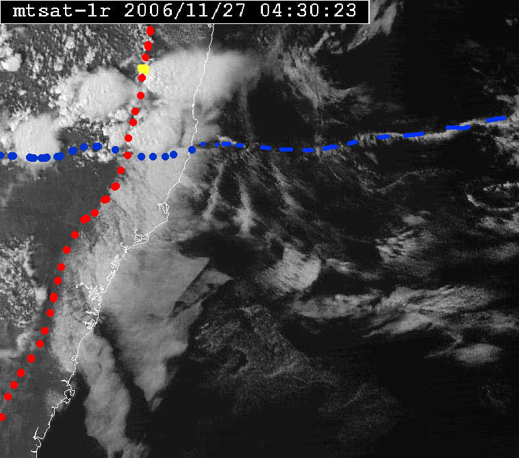
[FONT=Verdana, Arial] Monday the 27th I chased in the Guyra / Glen Innes area of New South Wales. Convection was supressed with the first scrap of Cu not appearing until around lunchtime, the first turkeys not until at least 1pm, but then over a single hour period it exploded.
I headed east from Guyra towards Ebor ( close to coast, but at 4000ft alt ) ) as DP's were a concern, this paid off as a cell near the tablelands escarpment tapped coastal moisture.
I had chaser convergance with Jimmy Deguara, this is about the 5th time this has ocurred with no communication or planning to do so. You are confident that you are on the best storm of the day when you run in Jimmy. ( In Australia it is rare to see another chaser )
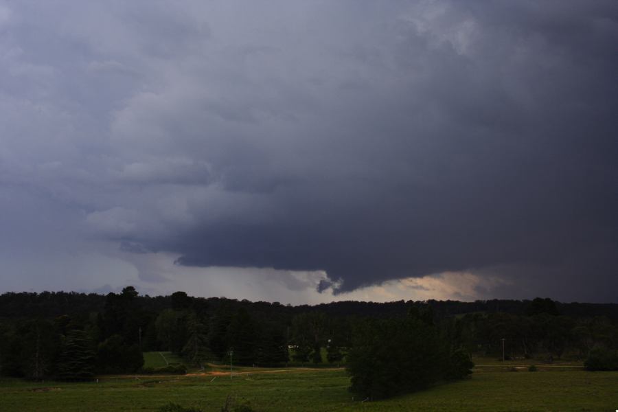
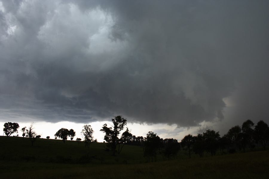
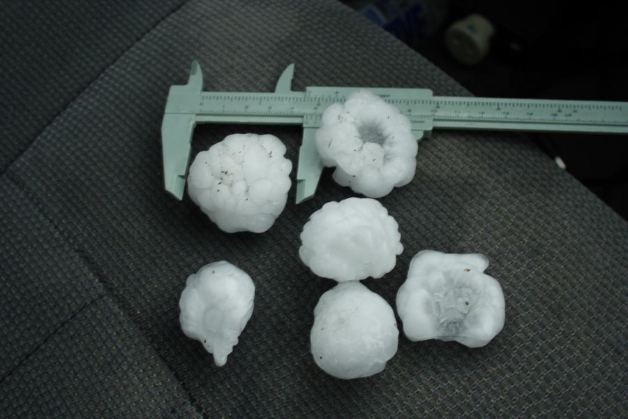
The storm developed a small but severe hail core, Jimmy measured stones to 5cm ( 2ins ) -(that is his car on the other side of the road in the video). We suspected that this storm was a right moving supercell.
We tracked the storm north for the next hour or two along the New England Escarpment, using the most easterly road options we could find, which was a dirt goat track with grass growing down the middle in parts. The country was hilly, alternateting between isolated farms ( of the duelling banjo variety ) and forest.
Unfortunately the road hooked NW near Glen Innes, losing us the storm. In Glen Innes I was treated to several hours of lightning as the three dominate cells [/FONT][FONT=Verdana, Arial]( suspected SC's ) [/FONT][FONT=Verdana, Arial]and other later developing junk merged into a larger convective complex.
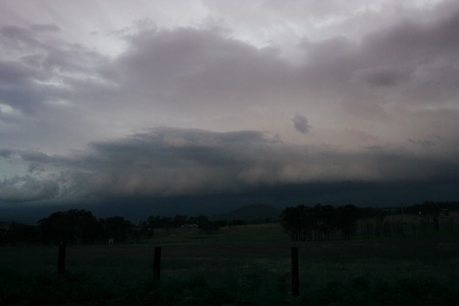
Video contains scences of hail and lightning. I think its worth a look. The ominous base is NOT one of the supercells, but the junk filling the remaining gaps of clear sky later.
http://ozthunder.com/video/glen_pv.wmv[/FONT]
I headed east from Guyra towards Ebor ( close to coast, but at 4000ft alt ) ) as DP's were a concern, this paid off as a cell near the tablelands escarpment tapped coastal moisture.
I had chaser convergance with Jimmy Deguara, this is about the 5th time this has ocurred with no communication or planning to do so. You are confident that you are on the best storm of the day when you run in Jimmy. ( In Australia it is rare to see another chaser )
The storm developed a small but severe hail core, Jimmy measured stones to 5cm ( 2ins ) -(that is his car on the other side of the road in the video). We suspected that this storm was a right moving supercell.
We tracked the storm north for the next hour or two along the New England Escarpment, using the most easterly road options we could find, which was a dirt goat track with grass growing down the middle in parts. The country was hilly, alternateting between isolated farms ( of the duelling banjo variety ) and forest.
Unfortunately the road hooked NW near Glen Innes, losing us the storm. In Glen Innes I was treated to several hours of lightning as the three dominate cells [/FONT][FONT=Verdana, Arial]( suspected SC's ) [/FONT][FONT=Verdana, Arial]and other later developing junk merged into a larger convective complex.
Video contains scences of hail and lightning. I think its worth a look. The ominous base is NOT one of the supercells, but the junk filling the remaining gaps of clear sky later.
http://ozthunder.com/video/glen_pv.wmv[/FONT]
") In fact it moved sharply near 90 degrees of the steering wind flow - moving NNW in direction.
In fact it moved sharply near 90 degrees of the steering wind flow - moving NNW in direction.