John Farley
Supporter
Kind of surprised there hasn't been more discussion of recent weather here (aside from the 12/23 reports), given the nationwide and multifaceted impacts of this past week's storm system. This article from CNN gives the big picture:
http://www.cnn.com/2015/12/28/us/severe-weather-us/index.html
However, there are a number of smaller pictures:
1. Tremendous snowfall in the Rockies from the initial wave of the storm, which cut off and more or less stalled in the Rockies for several days. For example, the Wolf Creek Ski Area in Colorado received 77 inches of snow in a week, and nearby Wolf Creek Pass (U.S. route 160) was closed for two days - a real rarity, given that this area routinely gets a lot of snow and has one of the best snow removal operations anywhere.
2. Multiple tornado and severe weather outbreaks from both the initial energy east of the main storm on the 23rd in MS, TN, and elsewhere (this part well documented by chasers in the 12/23 thread) and then another outbreak in TX on the 26th with EF-4 damage in Garland, TX and 11 fatalities tied to 3 tornadoes. I have seen spectacular video of the Garland tornado illuminated by power flashes and lightning online and on TV, but not much discussion of it on ST. When the deaths from these tornadoes are added to the SPC database, which they have not yet been, 2/3 of this year's tornado fatalities will have occurred in December, a pretty rare situation.
3. A record-setting blizzard in the plains of NM and the southwestern part of the TX Panhandle, as well as in the central and southern mountains of NM. Mountain snow totals included 41 inches at Ski Apache near Ruidoso, NM and 30 inches at Sandia Peak above Albuquerque, and on the plains, as much as 30 inches of snow fell at San Ignacio along I-40 (which was closed from Albuquerque to the OK/TX state line at times). Drifts in parts of eastern NM reached 7-8 feet, and the all-time one-day snow record was broken at Roswell, which received in excess of a foot.
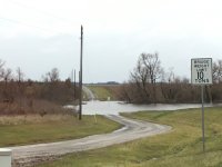
4. Record December rainfall in parts of OK, MO, and IL, resulting in widespread flooding and at least 14 deaths, and in all likelihood more, per the St. Louis Post-Dispatch. The vast majority of these deaths involved people driving into flooded areas on roads, and with 9 of the deaths occurring in two incidents in which people apparently unfamiliar with the areas they were in were swept away. This system brought St. Louis, officially, a storm total of 9.15" of rain, with spotter reports of 12.25 inches in Union, MO and 11 inches in Lyon, MO and Bunker Hill, IL. In St. Louis, the all time annual rainfall record has been broken by nearly 3 inches (it now stands at 61.21 inches), and it is also record rainfall for December. Additionally, current flood crest forecasts predict that in some places downstream from St. Louis, the 1993 all-time record flood crests will be exceeded, and on the Meramec River, the record crests of 1982 will be exceeded in a couple places.
In some way, this weather system impacted pretty much the entire lower 48 states, with major impacts in quite a few of them. Definitely a storm system for the record books!
http://www.cnn.com/2015/12/28/us/severe-weather-us/index.html
However, there are a number of smaller pictures:
1. Tremendous snowfall in the Rockies from the initial wave of the storm, which cut off and more or less stalled in the Rockies for several days. For example, the Wolf Creek Ski Area in Colorado received 77 inches of snow in a week, and nearby Wolf Creek Pass (U.S. route 160) was closed for two days - a real rarity, given that this area routinely gets a lot of snow and has one of the best snow removal operations anywhere.
2. Multiple tornado and severe weather outbreaks from both the initial energy east of the main storm on the 23rd in MS, TN, and elsewhere (this part well documented by chasers in the 12/23 thread) and then another outbreak in TX on the 26th with EF-4 damage in Garland, TX and 11 fatalities tied to 3 tornadoes. I have seen spectacular video of the Garland tornado illuminated by power flashes and lightning online and on TV, but not much discussion of it on ST. When the deaths from these tornadoes are added to the SPC database, which they have not yet been, 2/3 of this year's tornado fatalities will have occurred in December, a pretty rare situation.
3. A record-setting blizzard in the plains of NM and the southwestern part of the TX Panhandle, as well as in the central and southern mountains of NM. Mountain snow totals included 41 inches at Ski Apache near Ruidoso, NM and 30 inches at Sandia Peak above Albuquerque, and on the plains, as much as 30 inches of snow fell at San Ignacio along I-40 (which was closed from Albuquerque to the OK/TX state line at times). Drifts in parts of eastern NM reached 7-8 feet, and the all-time one-day snow record was broken at Roswell, which received in excess of a foot.
4. Record December rainfall in parts of OK, MO, and IL, resulting in widespread flooding and at least 14 deaths, and in all likelihood more, per the St. Louis Post-Dispatch. The vast majority of these deaths involved people driving into flooded areas on roads, and with 9 of the deaths occurring in two incidents in which people apparently unfamiliar with the areas they were in were swept away. This system brought St. Louis, officially, a storm total of 9.15" of rain, with spotter reports of 12.25 inches in Union, MO and 11 inches in Lyon, MO and Bunker Hill, IL. In St. Louis, the all time annual rainfall record has been broken by nearly 3 inches (it now stands at 61.21 inches), and it is also record rainfall for December. Additionally, current flood crest forecasts predict that in some places downstream from St. Louis, the 1993 all-time record flood crests will be exceeded, and on the Meramec River, the record crests of 1982 will be exceeded in a couple places.
In some way, this weather system impacted pretty much the entire lower 48 states, with major impacts in quite a few of them. Definitely a storm system for the record books!