David Brookshier
EF2
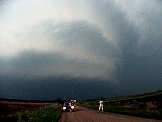
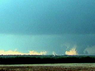
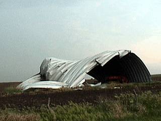
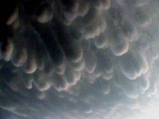
Did anyone see the May 29 2004 Supercell in Geary, I have shots of this storm and in all of my nine years of chasing this one had the most powerful inflow I have ever seen it was ripping dirt right out of the ground from 10 miles out and had hail to 5", Thier were reports of a dbz of 72,000ft is this true? If you look at the radar on this thing it was although an HP cell it had a classic structure with the hook echo aparent the entire time. At one point it even had two hook echos as one disolved another formed. The striations in the meso were incredible and this cell reportedly dropped 11 tornados and it even managed to destroy my expensive 28X200mm lens! (never leave your tripod unattended even for a second)
I have pictures of this beast on our site what a memorable day!
I have pictures of this beast on our site what a memorable day!