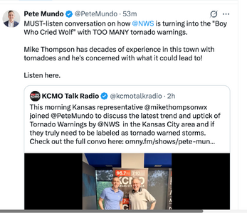
It is worse than that. Today's NWS tornado warning's are far less accurate than from 2005-2010.
The management of NWS/NOAA keep making bad decisions after bad decisions. We desperately need a National Disaster Review Board (a NTSB for disasters) to help them and the wider government to help them out.
1:18pm Monday: Right now there is a tornado warning issued by STL NWS that will almost certainly not verify. See image. There's no significant rotation in those storms. The level of training in radar interpretation and severe weather nowcasting in the NWS is highly inconsistent. They are too worried about IDSS rather than the needs of the general public.
CYA attitude? Are some so afraid of missing a tornado that does damage or worse that the social environment/pressures result in this behavior?
It's not confined to tornado warnings. Ever see the "carpet bomb" SVRs that extend for 100s of miles along the length of a squall line? I recall one squall line that had solid SVR warnings from ORF to SAV (so not just a single WFO doing this). It was one of those low-topped, cool season events. The thing is gradient winds were already strong ahead of the squall line gusting to 35-45 mph, and you looked at actual obs when the squall line passed (there are a *lot* of METAR sites these days for ground truth), and none were showing any increase in winds, gusty or otherwise.
Is this really good forecast/warning science being applied? And I don't want to hear, "better safe than sorry." That is an outdated ideology overall when it comes to wx now. The forecast science has advanced immensely in the last 30 years alone, but IMHO we are not taking full advantage of this progress. instead relying on outdated tropes and mindsets. And you can say excessive/over-warning promotes apathy and confirmation bias, which ends up costing lives as well (look at the Joplin tornado).
And I know what some may be thinking, the forecast science concerning tornadoes still is not good enough, so that's why FAR for tornado warnings are high. I agree completely. However there is a perplexing problem, and Mike Smith has pointed out many instances over the last several years alone in the central and eastern U.S. There have been clear and obvious signatures on radar and actual ground reports for tornadoes, and yet no warning or the warning is delayed/late and lives were lost. These were not borderline cases either, radar signatures were screaming at you, at least to the point that one should err on the side of caution to issue a tornado warning. We all look at the same data, so it makes you wonder what is going on here. It has happened far too many times to be just something like equipment or dissemination issues.
One more thing that has become an issue in recent years that is a big factor --
heaven forbid you criticize or call-out something or someone! One is often met immediately w/ vitriol, hate, and worse, or at the very least, "there is no fault here." How is this good overall? Mistakes happen, ppl screw up (accidentally and deliberately), it's part of society, so deal w/ it respectfully! Don't insult our intelligence by being an a-**** or disingenuous! Science progresses by trial and error. Sure there are numerous social/political/economic factors that mess w/ the science, but in the end, learning from mistakes and trying to improve is a solid, noble sentiment that never (or shouldn't) goes/go out of style!