Follow along with the video below to see how to install our site as a web app on your home screen.
Note: This feature may not be available in some browsers.
A friendly and periodic reminder of the rules we use for fostering high SNR and quality conversation and interaction at Stormtrack: Forum rules
P.S. - Nothing specific happened to prompt this message! No one is in trouble, there are no flame wars in effect, nor any inappropriate conversation ongoing. This is being posted sitewide as a casual refresher.
A new feature has been added to the Xenforo software - Shoutbox. A quick chat platform
Anybody chasing this storm? I’m not myself, but have friends and family waiting it out in and around Englewood. I notice the storm surge currently predicted in that area is 8-12 feet with winds to be approaching 150 mph.
With the size of this thing, I can easily imagine power being out in some areas more than a week.
Following up on myself here, but it looks to me like all the spaghetti models are wrong. I notice a turn to the right. Cape Coral and Fort Myers are looking more likely to me for the eyewall to hit than anywhere else…
I thought about doing a my first ever chase on this guy but wasnt sure on lodgings/ travel/ etc. with no plan. I just spent a week and alot of $ in hot Florida earlier this month for two scrubbed liftoffs on Artemis I ...so thought better about traveling back down for Ian.
Much like @Bobby Little , I seriously thought about doing my first ever hurricane chase but scrapped it for similar reasons of uncertainty as to logistics and overall plan / approach. Hurricanes were actually my first weather fascination when I was a kid, and finally chasing one (other than experiencing “brush-by’s” and indirect impacts here where I live on the east coast) is on my bucket list for sure. This year, for the first time, I finally had the work flexibility to disappear on short notice for 5 days or whatever.
But I procrastinated too long. On Monday I called 14 hotels, hoping to fly to FL on Tuesday to get in position for what was then projected to be an 8pm Wednesday landfall. All of the hotels were either sold out for at least one of the nights needed, or were in evacuation zones and subject to closing or already closing.
I should have booked hotels sooner, like late last week… The track was uncertain at the time (as it was right up until the morning of), but I could have booked in multiple areas and then cancel what I didn’t need. But even the timing was uncertain, with models showing a landfall anytime from Tuesday to Friday depending on location of landfall. The combination of variables resulted in too many potential scenarios to plan travel that soon. Also, my calendar was not completely free of other commitments for the entire week, for example I had some stuff I had to do on Monday.
I definitely procrastinated in making travel plans. I have heard that procrastination results from your mind realizing that your plan is not viable, and/or that the objective is not realistic, worthwhile or workable. In this case, I had too many worries about my plan, or lack thereof. I was going to be conservative and just hunker down in a hotel for my first chase; would that be doable? Would I see enough to make it worthwhile, or would I be in the wrong place and/or find a weakening hurricane? Would I be in the right hotel or have a room on the right side of the building? Would they make all the guests gather in a hallway, or, worse, evacuate us to a shelter? Would I be able to drive around in an evacuated area without being road-blocked or maybe even arrested? Would I get a flat tire? Or damage a rental car? Would I be able to find a parking garage that wasn’t closed off? If I landed near the target area, would I be able to get food and water, or would the stores be wiped out? If I flew into an airport further away to stock up on food/water, would I be able to refill the tank when I arrived in the target area? I think all of these logistical concerns and uncertainties - and having to tackle them without a chase partner - kept me from committing early enough. As did my suffering from a case of gout that had me limping around and lacking mobility and energy for such an adventure. If I had been able to get a reservation on Monday when I finally called hotels, I may have made the trip, but I probably would have failed to book a room as far south as landfall turned out to be.
So, I blew what may have been my only opportunity for many years to come. I regret it in hindsight, no less than I would regret missing a great tornado because I chose not to chase or picked the wrong target. You have to just go for it sometimes. Hurricane chasing remains on my bucket list. However, I admit to still being very perplexed about the logistics involved. On the bright side, even just the limited process I went through of trying to make plans (albeit too late), studying the maps, and talking to different hotels about their evacuation plans, provided at least some small amount of learning experience to build on for the next chance I have to do this for real - although that could be years away.
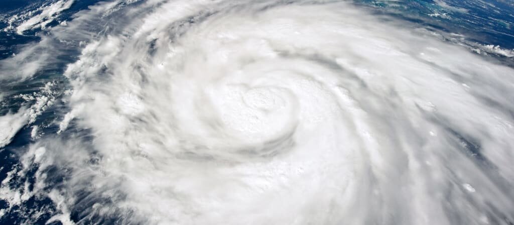
Storm Summary: Hurricane Ian was a devastating high-end category 4 hurricane that slammed into southwestern Florida on September 28, 2022. The storm began as a tropical wave moving off Africa and into the eastern Atlantic and past the Cape Verde Islands before September 19. This system did not start developing until it was near the Windward Islands and in the eastern Caribbean sea, forming into a tropical depression on September 23, and tropical storm "Ian", a day later. The storm was originally hindered by the high-altitude (clockwise) outflow from Hurricane Fiona, which was north of Bermuda and making landfall in Atlantic Canada. This produced northerly shear on Ian, slowing its intensification, but abated on September 25. By September 27, Ian was a powerful hurricane, rapidly intensifying, and turning towards the north, passing over Cuba during the evening of September 27 with 125 MPH winds. Western Cuba had little effect on the structure of hurricane Ian, and the storm continued north and eventually northeast. With such track trends more east than north, the hurricane avoided atmospheric conditions (dry air and vertical wind-shear) that would disrupt it, and remained in an area of upper air divergence and high-pressure / anti-cyclonic outflow at high altitude (above FL 340). The storm had an eyewall replacement cycle early on the 28th, and began rapidly intensifying, reaching a staggering 155 MPH (and central pressure of 936 mb) offshore of SW Florida. Catastrophic (high-end category 4) hurricane Ian made its first landfall during the late morning / early afternoon of September 28 near Cayo Costa, Florida with winds at least 150 MPH, then a second landfall near Punta Gorda, Florida in the afternoon with at least 145 MPH winds. This was nearly the same track hurricane Charley, another category 4 storm, took in August 2004, but Ian was far larger than Charley. The right eyewall caused devastating storm surge and / or wind damage in Fort Myers, Sanibel Island, and across the path from Lee and Charlotte Counties. The storm moved inland during the evening of September 28, leaving SW Florida with catastrophic damage in its wake. During the night, Ian weakened to category 3, past Orlando, and moved off Florida, re-emerging into the Atlantic as a strong tropical storm on September 29 near Daytona Beach. Ian was not done, as it was now over the Gulf Stream current. The storm strengthened back to an 85 MPH subtropical hurricane (interacting with strong wind-shear and a frontal zone) late on September 30, making landfall near Georgetown, South Carolina. This final landfall caused extensive flooding in coastal South Carolina. By October 1, Ian had moved inland as a non-tropical remnant low, and dissipated near North Carolina and Virginia.
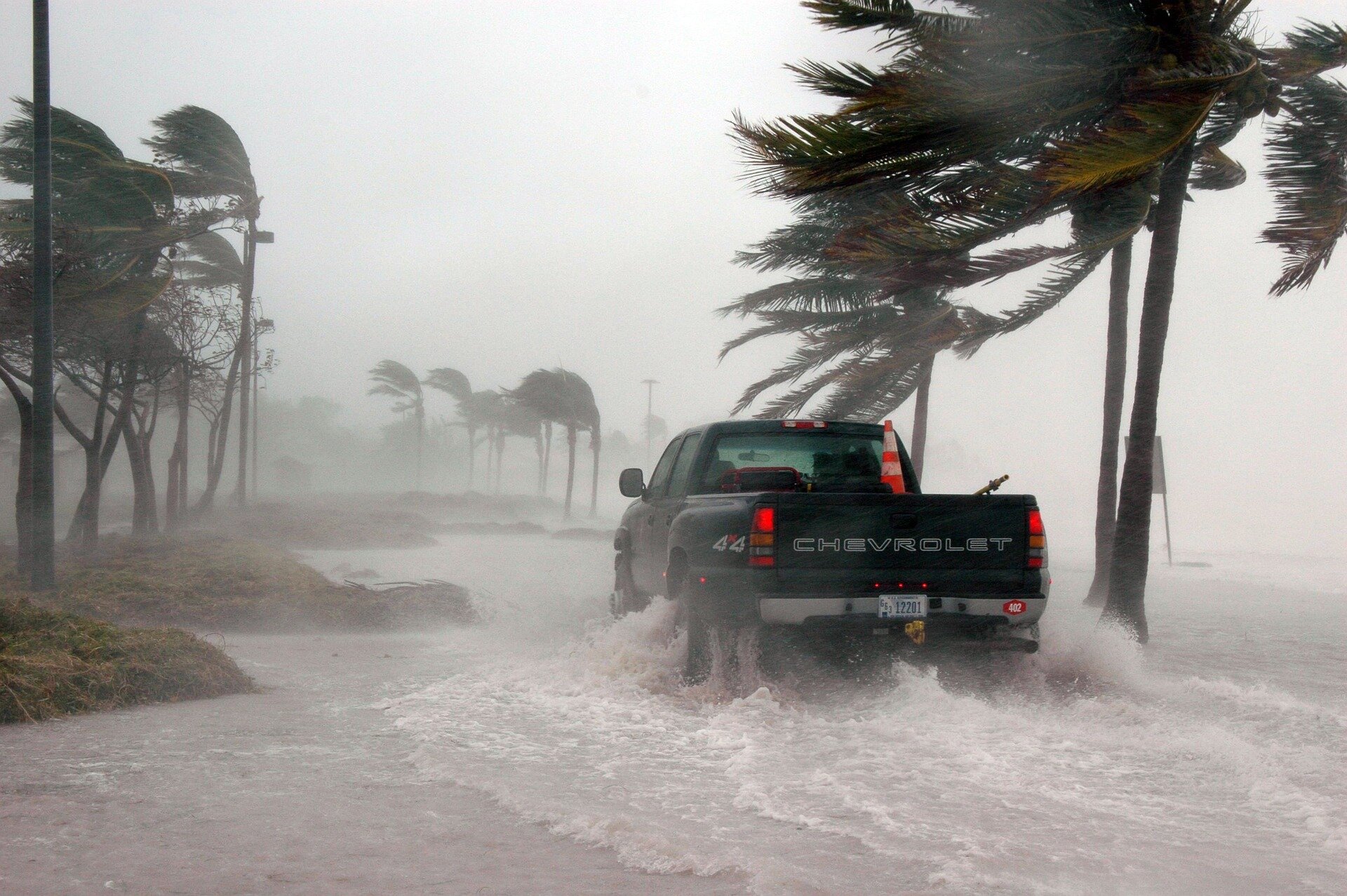
Storm Chasing Details: Sept 28, ALL-DAY – Interception and direct penetration of an extremely dangerous and catastrophic category 4 (nearly a 5!) hurricane (named “Ian”) in Charlotte / Lee County, Florida from near Englewood, and points east and southeast through Port Charlotte and Punta Gorda, and eventually south to east of Fort Meyers. This was mainly along and near Highway 41 and I-75. The chase penetrated the northern eyewall of the storm, which had winds around 155 MPH at landfall, and entry into and across the calm eye in Punta Gorda by afternoon. Conditions encountered were extremely violent winds, gusting to at least 130 to 140 MPH, horizontal, violent rain, and frequent lightning (in the eyewall). The eye of the storm was cloudy, with occasional breaks in the low cloud deck, with bright sky peeking through overhead. Winds in the eye were dead calm, with a pressure of 950 mb measured. Pressure at the first landfall was around 943 mb, the second landfall being near Punta Gorda and Pine Island. Damage observed was extensive, with many trees, powerlines, and signs blown down. Roofs were torn off many homes and buildings, along with structural damage, some complete. The initial landfall point (Lee County, including Sanibel Island and Fort Meyers Beach) was avoided for safety, anticipating a storm surge of “historic” magnitude. The objective was intercepting the eye of the hurricane, not the deadly right eyewall farther south. Damage in these areas (Lee County) was nearly complete, with buildings disintegrated, bridges and roads washed away, piles of destroyed boats, and new inlets / breaches carved into Sanibel and Captiva Islands. Death toll as of this writing is unknown, and damage may be in the hundreds of billions of dollars. In Charlotte Harbor, with a violent easterly wind, nearly all the water was removed from the bay in a rare “negative surge” prior to arrival of the eye. Boats were left dry on the bay sea-floor, with docks and marinas without any water in them. Storm surge rapidly rose after passage of the eye, and south of the eyewall, later in the day, storm surge flooding was observed at least 20 miles inland near the Caloosahatchee River, with water up to the roof on many homes. Flooding from rain was also observed, with many areas under several feet of fresh water. Documentation was digital stills, audio, and HD video. A 2022 Jeep Renegade was used to chase the hurricane. Total mileage logged was 398 miles. A tornado watch, storm surge warning, and hurricane warning were in effect most of the day.
Above: The image above is a composite graphic using maps from the National Hurricane Center and NOAA as well as a map of the SW Florida coast in the upper-left inset image. The NHC map shows the winds swaths of tropical storm and hurricane forced winds, in orange and red, respectively with a storm track overlay as a hashed path. The chase (driving) paths appear in blue, from Deerfield Beach, to and from the target-area. In the inset, the chase location was mainly in Charlotte County, Florida, with the path of the storm core (inner eyewall and eye) depicted by the yellow swath. The total driving distance logged was 398 miles.
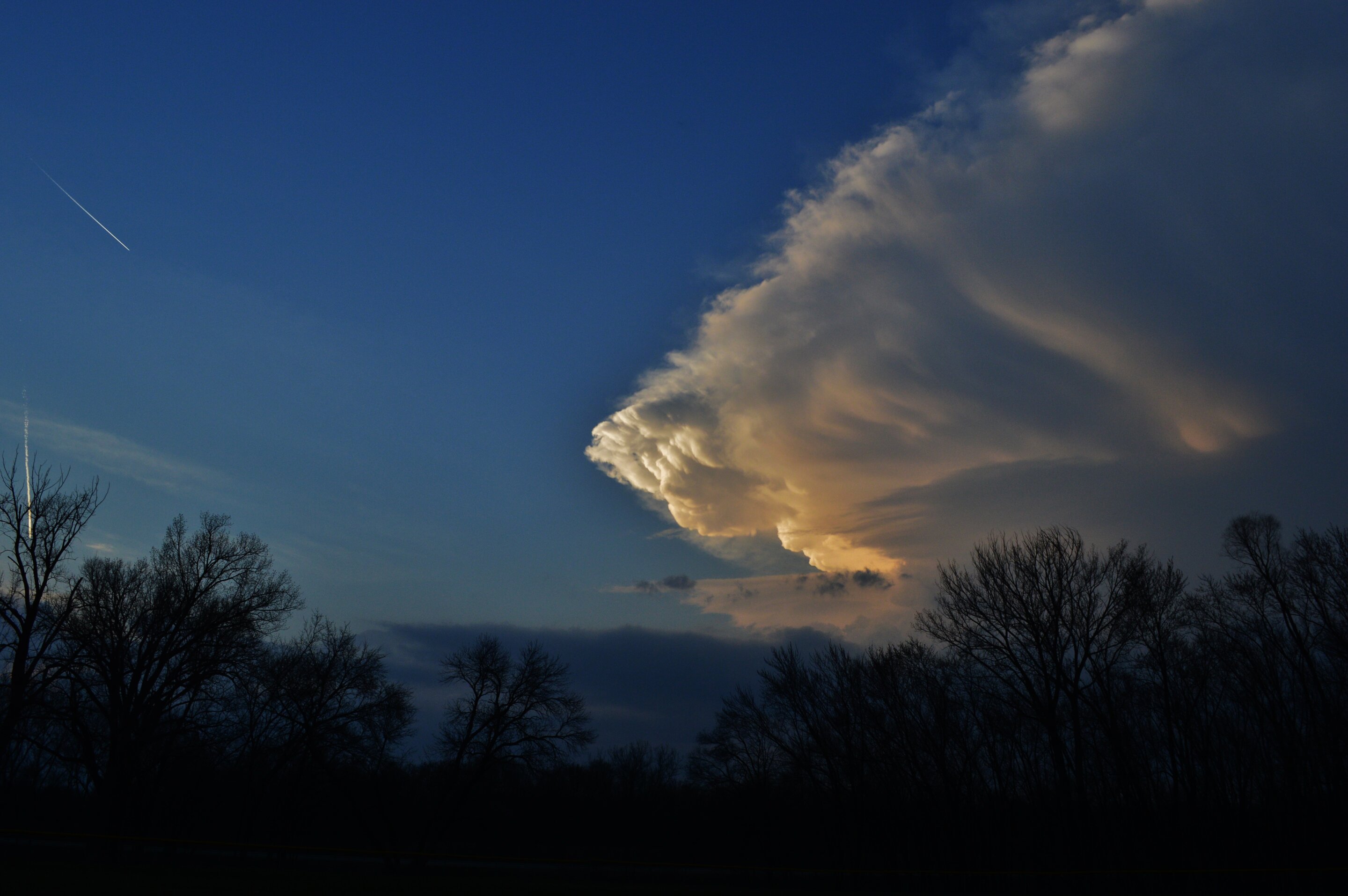
Above: This is a wide view of the inner eyewall of Hurricane Ian, looking south and southwest towards Charlotte Harbor (just north of the bridge to Port Charlotte), during the afternoon of September 28, 2022. The winds here are gusting over 130 MPH at times, and the picture does no justice to the pure violence of this hurricane. Also note that the rain is actually stopping, despite the maximum winds occurring. This is because I am on the inner edge of the hurricane eyewall, and just about to enter the calm eye. This area is often where the most destructive winds occur, usually in a narrow "ring" between the eyewall and calm eye. In the view looking south, with the fast-moving low clouds racing left to right, the edge of the hurricane eye (bright area) can be seen approaching from the SSW, apparently making its second US landfall near Punta Gorda, Florida, after devastating the Fort Meyers area farther south. The building and crane to the far right is the new Sun Seeker hotel under construction, which was heavily damaged, including a crane toppling. The murky area to the left is the winds whipping mud and sand off the BOTTOM of Charlotte Harbor, which was nearly emptied by the offshore flow of winds (negative surge)!
Above: This is a radar image (base reflectivity) from Miami from roughly 4 PM EDT as the eye of hurricane Ian was moving slowly northeast across Punta Gorda and Charlotte County on September 28, 2022. The blue cross-hairs are my position inside the calm eye of the storm, while experiencing light and variable winds, with bright sky occasionally peeking through overhead. Note the impressive eyewall structure, surrounding the rain-free eye of the hurricane.
Above: View looking towards the clearer eye of Ian as it was continuing north and northeast of Punta Gorda. The sky was much brighter, with a stadium effect visible at times, but mostly clouded over.
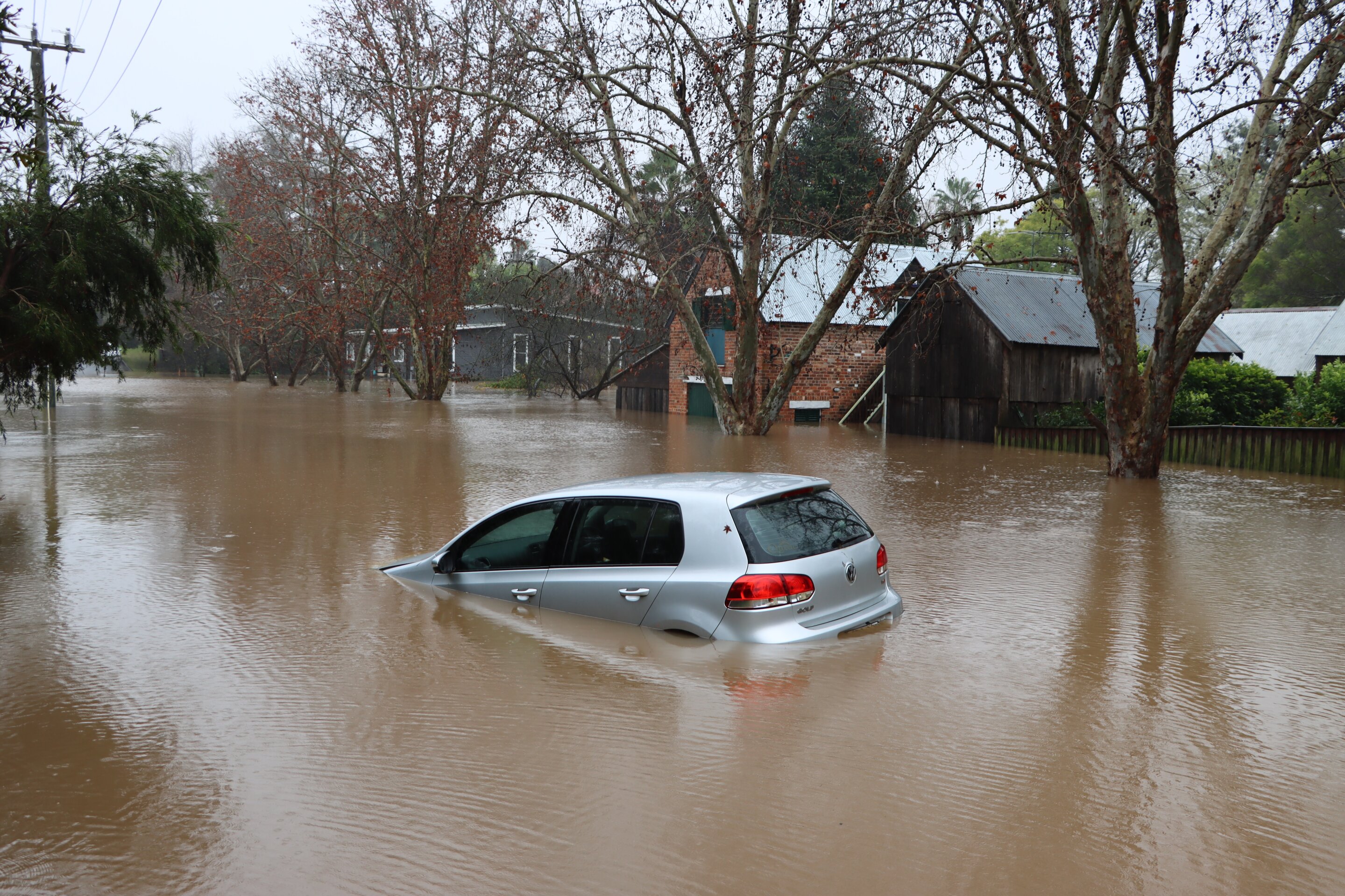
Above: Inland flooding, far from the coastal areas and beaches, affecting homes in eastern Fort Myers and near the Caloosahatchee River.
Much like @Bobby Little , I seriously thought about doing my first ever hurricane chase but scrapped it for similar reasons of uncertainty as to logistics and overall plan / approach....
Hi Chris, thanks, yes, I had read your write-up in the past, and again while thinking about chasing Ian. While there is some great information in there, it is mostly cautionary and confirms many of my logistical concerns, for example the potential encounters with LEO while in an evacuation zone. What I really hope to learn is more about how to deal with and work around these challenges, and how to mitigate the risks. Any additional information you can share about strategies for getting into the eye while staying safe? Assuming a proper landfall forecast, what is the best way to choose a hotel in that area that is age and likely to stay open? How do you stay safe while driving around?
For the first time, high-energy muon particles created in the atmosphere have allowed researchers to explore the structures of storms in a way that traditional visualization techniques, such as satellite imaging, cannot. The detail offered by this new technique could aid researchers modeling...
phys.org
"We successfully imaged the vertical profile of a cyclone, and this revealed density variations essential to understanding how cyclones work," said Tanaka. "The images show cross sections of the cyclone which passed through Kagoshima Prefecture in western Japan. I was surprised to see clearly it had a low-density warm core that contrasted dramatically with the high-pressure cold exterior. There is absolutely no way to capture such data with traditional pressure sensors and photography."
When a heat wave drives the temperature in your apartment over 100 degrees or your power goes out during a brutally cold winter storm, knowing your neighbors can save your life. Research has shown that communities with strong social ties—where people check in with each other and have someone to...
Hurricanes have become prolific at producing damaging winds and storm surge. FIU research shows they have also grown to become prolific at making more rain.
Summer 2022 has been an unprecedented one with five "1-in-1,000-year" floods experienced across the U.S.: St. Louis and Eastern Kentucky, both in July, and Southeast Illinois, Death Valley and Dallas, all in August.
Scientists have harnessed Internet-transmitting fiber-optic cables to overcome a long-standing geophysical challenge: identifying where seismic noise in the ocean originates. Tiny vibrations of Earth called microseisms are ubiquitous, yet researchers have not had a way to pinpoint their sources...
Subtropical gyres are enormous rotating ocean currents that generate sustained circulations in the Earth's subtropical regions just to the north and south of the equator. These gyres are slow-moving whirlpools that circulate within massive basins around the world, gathering up nutrients...
Regarding the top article in @Jeff Wright's post, if the leading image in the article represents a sense of the spatial resolution of the product, then I highly doubt you'll see such technology being used in weather forecasting anytime soon. Weather radars provide better vertical resolution when the storm is close, and satellite products provide better horizontal resolution pretty much all the time and in all locations (away from the satellite's limb).
This site uses cookies to help personalise content, tailor your experience and to keep you logged in if you register.
By continuing to use this site, you are consenting to our use of cookies.