Hurricanes, High-rises, and Hubris

Joined
Oct 30, 2006
Messages
74
Location
Minneapolis, MN
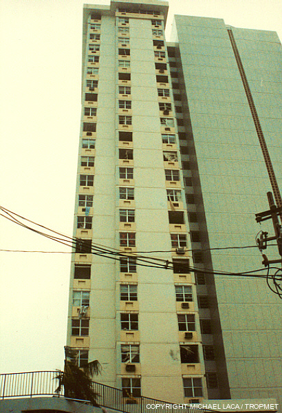
There's been a lot of focus on the potential effects of hurricane winds on high-rises recently. Herbert Saffir was a guest blogger last week on Roger Pielke Sr's Climate Science blog, talking about damage to high-rise buildings in NOLA from Hurricane Katrina. When Max Mayfield left the NHC last month, he gave an interview in the LA Times describing what they referred to as an "apocalyptic vision" and in which he also was critical of lenient building codes in coastal cities, specifically referring to high-rises. Also continually in the news this past year is the transformation of portions of the MS Gulf Coast into another "Miami Beach" of high-rise high-price condos, if real estate developers get their way.

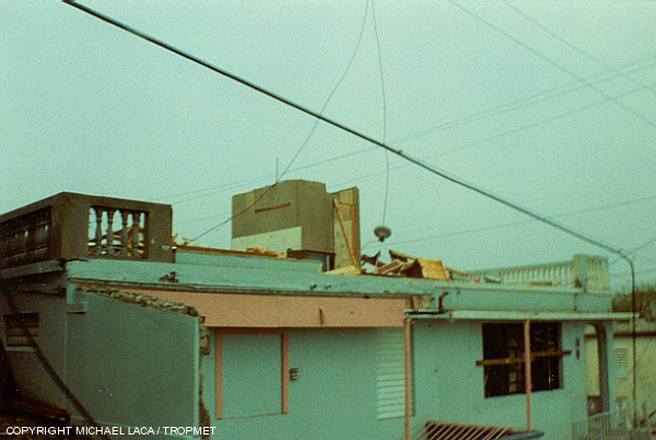
In NOLA, Cat 1 winds / gusts caused inner walls to fail in a hotel room after the windows were broken from flying debris. Seeing this, I researched high-rise damage from Cat 4 Wilma, which made a direct hit on the many high-rise hotels of Cancun's exposed peninsula. The Mexican government downplayed the damage because of the tourist trade, but it took about a year for the resorts to rebuild. Much of the interior damage was caused by window breakage from flying debris, or failure of the framing to keep water from coming in.

Into this current climate, last week I reviewed a video on You Tube of footage taken in a high-rise during 1989's Hurricane Hugo. The video claims to have captured Cat 4 windspeeds.

My first thought on viewing the video was that the top windspeeds appeared to be around 100-110 mph (about equivalent to 90-95 kt) -- a strong Cat 2, based on the size of flying debris that was seen, and the condition of the palms after the high winds had passed (the majority were not denuded). I also observed the winds were mainly being filmed as they funneled between two high-rises (Bernoulli effect).

Then I read the commentary that went along with the video.

My second thought was that someone who lives in a coastal high-rise in an area vulnerable to hurricanes was going to watch this video, read the information provided about the video, and conclude that not only would it not be necessary to evacuate any major hurricane (Cat 3-4-5) bearing down on them, since the high-rise in the video remained intact during "Cat 4" winds, but that it might be a fine and dandy thing to sit and watch it right out their window.

In an objective look at the details, I've reprinted the commentary that went with the video, and highlighted statements that could be compared with known observations, along with those observations, below:

This is my Hurricane Hugo chase video. The footage was taken during Hugo's landfall on the northeast tip of Puerto Rico at Luquillo. In my 25 years of hurricane chasing, this remains, overall, the best footage I have ever been fortunate enough to capture. Though I have been in stronger hurricanes, given that Hugo was a Category Four and the strongest portion of the eyewall passed directly over my location (during daylight hours), I had the rare opportunity to document the full force of an intense hurricane at a direct coastal location. Though significant damage begins about 8 minutes into the video, the peak winds occur between 10 through 21 minutes in, and are sustained near 135mph with gusts to 160-170mph. An anemometer on the island of Culebra (just offshore Eastern Puerto Rico) reported a peak gust of 170mph when the same portion of the eyewall passed over that location a couple of hours prior to reaching Luquillo.​


"Hugo was a Category Four"

The best track and the NHC report on Hugo state the maximum intensitiy to be 110 kt (127 mph) -- a Cat 3 -- not a Cat 4 -- at the time Hugo hit the island of Vieques, and again shortly afterwards when it hit mainland Puerto Rico.


"the strongest portion of the eyewall passed directly over my location [at Luquillo]"

Hugo was travelling northwest, and made landfall just on the very northeast corner of Puerto Rico as it passed.

The lat and lon of the best track shows the center of Hugo moved past to the northeast of Luquillo, so Luquillo was hit with the northwestern eyewall.

This can also be seen in the video, where the northeast-facing beachfront is subject to onshore winds coming from the northeast, which also places it to the west of the center of the storm (cyclonic winds move counter-clockwise in the northern hemisphere, so that in the northwest portion of the eyewall, winds are coming from the northeast).

The strongest winds of the hurricane were likely located in the typically-more-powerful portion of the hurricane to the right of the forward movement, not in the portion of the eyewall that passed over Luquillo. At the time Hugo was moving northwest, so the strongest winds would likely have been to the north and east of the center -- offshore and well to the east of Puerto Rico.


"the peak winds...are sustained near 135mph with gusts to 160-170mph"

As already mentioned Hugo was not a Cat 4 at landfall in Puerto Rico, but a Cat 3. Peak windspeeds were determined to be 127 mph (110 kt), but likely remained offshore. The highest sustained winds measured on land in Puerto Rico were Cat 2.


"a peak gust of 170 mph when...the same portion of the eyewall passed over that location a couple of hours prior to reaching Luquillo"

This gust of 148 kt (170 mph) on the island of Culebra was actually a significant distance away: about 25 miles due east of Luquillo, and to the east of the eye. The portion of the storm that passed over Culebra would have continued on the northwest track, and so by the time it was as far west as Luquillo, would have been far away, around 25 miles to the north of Luquillo. And the NHC report does not state the time the gust occurred. The fact that the highest recorded gust occured to the east of the eye supports the premise that the strongest winds were associated, as usual, with the northeast quad of the storm, and remained offshore of Puerto Rico.

However the northwestern eyewall that passed over Luquillo, did pass over another area of Puerto Rico prior to crossing Luquillo, with documented windspeeds. This was a US Naval Air Station to the southeast of Luquillo. The official readings were labeled "Roosevelt Roads." The maximum sustained windspeed there was 104 mph (90 kt), with a gust to 120 mph (104 kt) -- solid Cat 2 winds. This was the highest sustained windspeed noted over land in Puerto Rico.

Also of note is that the minimum pressure at Roosevelt Roads was 946.1 mbar, and occured at 1250Z. The minimum pressure at Luquillo was 956 mbar, noticeably higher, and that occured ten minutes later at 1300Z.

For those who find these things as facinating as I do, and are interested in taking a closer look, I provide the link to the NHC Hugo report, the recon obs, and the relevant best track points below, which can be plugged into Google Maps -- which also provides a quick and easy way to look at the various locations that were mentioned.

18/0600Z 17.7N 64.8W 940 mbar 110 kt <-- this was a typo, as noted in subsequent post; should read 120 kt
18/1200Z 18.2N 65.5W 945 mbar 110 kt
18/1800Z 19.1N 66.4W 958 mbar 105 kt
19/0000Z 19.7N 66.8W 959 mbar 100 kt

Luquillo is located at 18.375N 65.715W. Landfall on the Puerto Rican mainland was identified in the NHC report as being at Fajardo, at 18/1300Z, with a pressure of 946 mbar.
 
Last edited by a moderator:
the most relevant data, the advisory just before landfall was quoted incorrectly. She states the winds were 110 knts., when the advisory preceding landfall was actually: 32 17.70 -64.80 09/18/06Z 120 knts. 940 HURRICANE-4. ( advisory 32; lat 17.7, long 64.8, 09/18/06 z, max winds 120 knots, cat 4). . She must have gotten the winds off a misprinted table that said 110 knts.).

I never referred to an advisory. The post analysis contains the relevant data, including the best track and intensities at landfall. I provided that link in my original post, and even went to the trouble of typing the specifics of the best track points for that portion of the track (I also recommend reviewing the best track max sustained wind graph which is plotted against the observed data).

From the very first page of the NHC report on Hugo:

When the eye passed over the island of Vieques, Puerto Rico, it is estimated that the maximum one-minute wind speed had decreased to 110 knots...Maximum wind speeds were also estimated at 110 knots one hour later when the eye passed over the eastern tip of Puerto Rico. However, the highest recorded wind speed over land was 90 knots with a gust to 104 knots at Roosevelt Roads.​

although Roosevelt Roads is "on" the coast...the wind speeds recorded there are not representave.

NHC takes great care with accuracy. Wind speeds that are not considered representative are not included in the post analysis.


To give a current-day analogy, for similar windspeeds, Katrina's Public Advisories just prior to landfall were still indicating a Cat 4 hurricane, even though real-time analysis showed weakening. NHC will never downgrade on an advisory just prior to a landfall in this type of situation, to my knowledge. However, in the post-analysis, Kat was downgraded to a Cat 3 for both the LA and the MS landfalls (even though there were only Cat 2 winds recorded in MS). Prior to the relase of the Tropical Cyclone Report there was some speculation among mets that I talked with that the MS landfall would be downgraded to a Cat 2. The TC report also contains the best track information.

The TC reports can be updated after the initial release. For instance, the Katrina report was updated a year later, in 2006: "Updated 10 August 2006 for tropical wave history, storm surge, tornadoes, surface observations, fatalities, and damage cost estimates." And the NHC best track data for 2006 was recently updated both in January and, for four storms, again, in February. Also, reanalyses can be done years later, such as with Andrew.

But once the post-season storm analysis is complete, and the TC report containing the best track data is released, that supercedes the advisory information. And analyses can go in both directions; 2005's Cindy was upgraded to a hurricane based on the post-season analysis.
 
Last edited by a moderator:
Below is the exact wording from the last public advisory on Katrina BEFORE it made landfall along the Mississippi coast...

It wasn't; the MS landfall was officially at 9:45am (i.e, the downgrade could have had something to do with the fact that the hurricane had just made landfall). But regardless of why the downgrade was made, this cannot be considered an advisory that was issued prior to landfall.


The downgrading was based on the recon. reports minutes before that advisory was issued...

The NHC report paints a different picture:

The strongest surface (10 m) wind measured by dropwindsonde on the morning of 29 August was 99 kt from two separate sondes. The maximum surface wind estimate from a dropwindsonde, derived from the mean wind over the lowest 150 m of the sounding using an average adjustment derived from profiles in several storms, was 98 kt.

…all available data from aircraft indicate that Katrina’s winds weakened only slightly between the first and last Gulf coast landfalls. Just prior to final landfall, surface (10 m) winds measured by dropwindsonde were as strong as 99 kt, adjustment to the surface of the mean wind speed in the lowest 150 m of dropwindsonde profiles yielded surface winds of 90-95 kt, and SFMR winds were as strong as 91 kt. [emphasis mine]


...the central pressure was still 927 mb, which is usually representative of a STRONG cat #4 storm.

Actually...and this just came up recently in another conversation -- the wind-pressure relationship is not constant and does change with respect to whether a storm is strengthening or weakening. The best track is too coarse a measure to tell very many interesting things about intensity; however it does show very clearly the different range of values in the wind-pressure data distribution for strengthening vs. weakening storms. So in this case that same 10am advisory had a max of 125 mph, Cat 3 winds, for the pressure of 927 mbar. The closest best track point to this one, three hours earlier, had an mslp of 923 mbar and the same windspeed (110 kt).

Here is an example from the AL basin for the most recent years of data, for the range including the mslp of 927. Note that 130-135 kt is almost a dividing line for this particular range of mslp (90% of weakening TC are 130 kt or less, and 90% of strengthening TC are 135 kt or higher).

Range of vmax for mslp of 920-929, strengthening:

vmax frequency
---- ---------
120 1
125 1
130 1
135 6
140 6
145 6

Range of vmax for mslp of 920-929, weakening:

vmax frequency
---- ---------
105 1
110 3
115 4
120 3
125 7
130 9
135 1
140 1
145 1
 
Last edited by a moderator:
Hubris indeed!

Hi Margie - Thanks for your candor and perspective on my Hugo video and comments. I certainly welcome all personal opinions, and you definitely seem to have some aptitude in the field of tropical meteorology.

That said, I'd like to clarify a few things, from my first-hand perspective, and pose a few questions to your "claims" as well.

My first thought on viewing the video was that the top windspeeds appeared to be around 100-110 mph (about equivalent to 90-95 kt) -- a strong Cat 2, based on the size of flying debris that was seen, and the condition of the palms after the high winds had passed (the majority were not denuded). I also observed the winds were mainly being filmed as they funneled between two high-rises (Bernoulli effect).

My first thought, on reading your comment above, was that if you truly believe the peak winds in my Hugo video to be that of a strong Category Two, then you clearly have a bit still to learn about the characterictics and dynamics of tropical cyclone winds and their impacts.

To your specific comments, I'm not sure what "flying debris" you're using as your reference point(s) to determine the "peak" winds, but the majority of debris, that is actually "visible" in my video, occurs prior to the arrival of the eyewall. During the peak of the storm it is difficult to see much of anything that is going on beyond a couple hundred yards, and the only "visible" debris are windows being ripped out of the neighboring building followed occasionally by people's furniture falling out. At the time of the eye passage, we noted numerous instances of significant structural damage, both in the condo that we were in, as well as in the town of Luquillo. As examples:

hugo_011.jpeg

Numerous leeward facing windows, even in the center of the building on lower levels, were ripped (inclusive of their frames) out of the concrete, after interior walls failed. I certainly don't think this implies to anyone that it would "not be necessary to evacuate any major hurricane (Cat 3-4-5)" or that "it might be fine and dandy to sit and watch...right out their window."

hugo_012.jpeg

The second floor of this home was completely intact prior to our chase team going into the stairwell in the video. So sometime between that point and the arrival of the eye this home was destroyed. The peak winds during the eyewall probably occurred while we were in the stairwell, as evidenced by the incredibly high-pitched wailing attending the one gust that you can hear at 0:17:15, easily the strongest gust I recall during the entire event.

hugo_014.jpeg

As a separate point of reference, although dramatic looking, this flimsy wood-frame constructed home did completely fall apart in winds of 90-95kts. That said, this happened long before the arrival of the eyewall.

As Richard pointed out in his response, our five team members comprised some of, if not, the most experienced hurricane chasers at that time. Prior to Hugo, I already had numerous field interceptions including Hurricanes Elena, Gloria, Kate, Bonnie and Gilbert ...not to mention my colleagues who, by that time, had nearly 30 years of experience, each! Certainly enough familiarity with tropical cyclones of all intensities that we would know the difference between 90-95kts and 120-140kts.

I also agree with Richard that when faced with an event like what we witnessed during Hugo, it is easy for anyone, regardless of their prior experience, to over estimate wind speeds visually. In fact, as it was happening, the three of us who were in Luquillo were all of the opinion that the peak gusts were up in the 160kt range...there's even a point in my video where Jim Leonard and I are talking and saying that the winds are easily gusting to "180" [mph]. After the adrenaline overload subsided, we both re-evaluated our estimates and, after almost 18 years of reviewing the footage, not to mention going through many, MANY other tropical cyclones...I can confidently say that the peak winds we experienced in Luquillo were sustained near 115kts with frequent gusts between 130-140kts and it is entirely plausible that an instantaneous peak gust reached 150kts. This estimation is not inclusive of the amplification in wind speed that did occur between the two condo towers, which you are completely correct in assessing.

I am curious, how many times have you personally been through the core of a major hurricane, and what are your qualifications for the visual estimation of windspeed?

I would also challenge that you truly gave this an "objective" look as you seem content that the sparse surface reports from Roosevelt Roads NAS and San Juan as well as the "best-track" positions of the storm described in the NHC Preliminary Report are sufficient to describe Hugo's strongest winds and exact position, relative to Luquillo...without even the possibility that there could be more to it than what is officially documented.

Again I'm curious, how well do you know Miles Lawrence, the man who wrote that preliminary report? How many years did you spend physically at the National Hurricane Center talking to him, or Bob Case, or Gil Clark, or Bob Sheets, or Neil Frank...or any of the other forecasters or directors through the years? How many times have you actually been on a chase with one of the forecasters from the National Hurricane Center?

The best track and the NHC report on Hugo state the maximum intensitiy to be 110 kt (127 mph) -- a Cat 3 -- not a Cat 4 -- at the time Hugo hit the island of Vieques, and again shortly afterwards when it hit mainland Puerto Rico.

Well then, I guess it is clear, if it is written on paper it must be fact! I would just note that, for ten years, what was written in the NHC's official report for Hurricane Andrew was that the storm was a Category Four with sustained winds of 125kts, at landfall...although many of us held fast that sustained winds were much higher...not surprisingly, that estimate was revised to 145kts. I will also point out that while the NHC reports use knots as their standard for best-track wind speed... the exact conversion of 110kts to 127mph, while correct, is not how it is reflected operationally...where the number is rounded up to 130mph. Thus, even in Miles' report, Hugo's intensity at the time it passed over Vieques and Northeast Puerto Rico is technically only 1mph shy of Category Four strength. So suffice it to say that even by your reasoning, Hugo was at the cutoff between Category Three and Category Four at the time I experienced it.

Hugo was travelling northwest, and made landfall just on the very northeast corner of Puerto Rico as it passed. The lat and lon of the best track shows the center of Hugo moved past to the northeast of Luquillo...

The geometric center of Hugo did indeed cross the extreme northeastern tip of Puerto Rico, just north of Roosevelt Roads from Fajardo through Luquillo. A ragged portion of the northeastern eyewall is briefly visible offshore, on my video, as we exit the eye and enter the southeast portion of the storm. The "best-track" positions in the NHC report are an averaged/smoothed track and do not represent the actual physical location of the circulation center at any given time.

You are partially correct that northwestern eyewall impacted Luquillo, though it was really more the area between the northern and northwestern eyewall that moved over our location.

The strongest winds of the hurricane were likely located in the typically-more-powerful portion of the hurricane to the right of the forward movement, not in the portion of the eyewall that passed over Luquillo. At the time Hugo was moving northwest, so the strongest winds would likely have been...offshore and well to the east of Puerto Rico.

As Richard also previously pointed out, a tropical cyclone's surface windfield distribution can be highly variant to the "typical" right-front quadrant conventionality, as observed in numerous instances. At any given time, the wind maximum can even be transient, with the development of intense convection in any quadrant. Though detailed radar analysis of Hugo crossing Puerto Rico has been elusive, some satellite imagery (like on the cover of this Natural Disaster Survey Report) near the time the storm moved over Luquillo showed the most intense convection from the northern through southwestern eyewall, as evidenced by the brighter, more bulbous, convective tops. Since the north and northeastern extremity of this "hot spot" in the eyewall is what would have passed over Culebra, with the northwestern portion passing over Vieques and later over my location...this is what I'm referring to when I mention that the "strongest portion of the eyewall passed over my location".

As already mentioned Hugo was not a Cat 4 at landfall in Puerto Rico, but a Cat 3. Peak windspeeds were determined to be 127 mph (110 kt), but likely remained offshore.

Again, your reasoning, while solid from a conventional analysis of the limited data provided through the NHC report, is not consistent with what our chase team experienced. Additionally, your assumption that the strongest surface winds remained offshore is neither substantiated by the NHC report, let alone "likely" based on the presence of the most intense convective activity over the northwestern portion of the eyewall...since that convection would likely be bringing the higher winds aloft, down to the surface.

<<Continued>>
 
Hubris indeed! (Continued)

<<Continued>>

This gust of 148 kt (170 mph) on the island of Culebra was actually a significant distance away: about 25 miles due east of Luquillo, and to the east of the eye. The portion of the storm that passed over Culebra would have continued on the northwest track, and so by the time it was as far west as Luquillo, would have been far away, around 25 miles to the north of Luquillo. And the NHC report does not state the time the gust occurred. The fact that the highest recorded gust occured to the east of the eye supports the premise that the strongest winds were associated, as usual, with the northeast quad of the storm, and remained offshore of Puerto Rico.

A couple of things that you are failing to mention/acknowledge... first, the 148kt gust from the yacht "Night Cap" was reported just prior to the anemometer failing, so it is plausible that even higher winds occurred at that location and were not recorded. Miles Lawrence inexplicably left this detail out of the report. Second, your assumption that just because this is the highest "reported" wind, that this represents the location of the highest winds in the storm is flawed... while it is certainly possible... it is just as possible that higher winds existed elsewhere in the eyewall and/or that the wind maxima was uniformly distributed from the northern through western eyewall, or possibly split into two areas of wind maxima, or even transiently rotating within the eyewall. Indeed a 700mb wind-field analysis from 17/20Z through 18/06Z indicated that the peak winds were distributed from the eastern through northern eyewall, coinciding with the location of the most intense eyewall convection at that time. Subsequent to that, the most intense convection apparently migrated to the northern through western eyewall and this supports the premise that the surface wind maxima likely followed and rotated from the eastern through northern portions of eyewall to the northern through western portions of the eyewall, impacting both Culebra and Northeastern Puerto Rico, in turn.

However the northwestern eyewall that passed over Luquillo, did pass over another area of Puerto Rico prior to crossing Luquillo, with documented windspeeds. This was a US Naval Air Station to the southeast of Luquillo. The official readings were labeled "Roosevelt Roads." The maximum sustained windspeed there was 104 mph (90 kt), with a gust to 120 mph (104 kt) -- solid Cat 2 winds. This was the highest sustained windspeed noted over land in Puerto Rico.

It is actually likely that it was the western eyewall that impacted Ceiba and Roosevelt Roads NAS. That said, the direction of the strongest winds in this area (also absent from NHC's report) was likely from the north-northwest or northwest, meaning that 1. these winds were from an over-land direction, as opposed to onshore... and 2. they would have been partially blocked by the moutainous terrain of the El Yunque peak. Again, you are correct that this is the highest "recorded" wind speed from a land station in Puerto Rico, however, if your assumption is that Roosevelt Roads observation happened to record the strongest winds anywhere in Puerto Rico, and that this alone substanstiates your claim that winds were no stronger than Category Two intensity anywhere on the island, I would suggest that you re-examine your methods of analysis.

Also of note is that the minimum pressure at Roosevelt Roads was 946.1 mbar, and occured at 1250Z. The minimum pressure at Luquillo was 956 mbar, noticeably higher, and that occured ten minutes later at 1300Z.

You are absolutely correct...the minimum pressure reported in Luquillo was indeed 956mb... BECAUSE IT WAS OUR CHASE TEAM'S OBSERVATION! You can actually see Jim Leonard's barometer, which is what the observation was made on, in my video. As such, I think I am qualified to say that the reading of 956mb was made significantly after the mid-way point in the lull. We had been walking around filming damage, in the eye, for nearly 30 minutes before returning to the garage where our car was, just before the second-half started. This is when the observation was made. Just because the lowest pressure we observed at that point was 956mb, doesn't mean that the pressure wasn't lower earlier during the eye. As you point out below, even the NHC report indicates that the pressure at landfall in Fajardo (just to the east of Luquillo) was 946mb, which is probably closer to what the minimum pressure at our location actually was. This just goes to highlight that not all documented data can be taken at face value.

For those who find these things as facinating as I do, and are interested in taking a closer look, I provide the link to the NHC Hugo report, the recon obs, and the relevant best track points below, which can be plugged into Google Maps -- which also provides a quick and easy way to look at the various locations that were mentioned.

18/0600Z 17.7N 64.8W 940 mbar 110 kt
18/1200Z 18.2N 65.5W 945 mbar 110 kt
18/1800Z 19.1N 66.4W 958 mbar 105 kt
19/0000Z 19.7N 66.8W 959 mbar 100 kt

Luquillo is located at 18.375N 65.715W. Landfall on the Puerto Rican mainland was identified in the NHC report as being at Fajardo, at 18/1300Z, with a pressure of 946 mbar.

I want to reiterate that although I do not necessarily agree, I completely respect your opinions. Based on your previous posts, I know that you have a great understanding of tropical cyclone dynamics. I just ask that before you make public claims of hubris, that you give the appropriate respect and weight to the opinions and observations of people who had first-hand experience and have spent years dedicated to understanding every nuance of that encounter with Hugo. And, also to allow for the possibility that empirical observations alone do not always paint the complete picture.

As a direct observer, I know Richard Horodner has already provided his perspective, and I would love to see Jim Leonard's views on this topic. I would also encourage anyone, who is interested, to watch my video and share their perspectives and views.
 
Last edited by a moderator:
Michael, I thank you for a really excellent reply to my posts, and will definitely want to continue this facinating discussion. As regards hurricane dynamics or any other TC topic, I know nothing by comparison -- but I'm working very hard to increase the range of my ignorance (equations...are your friends). If I could ever remember to play the lottery I might be looking for a grad school for old people. :)

But it will have to wait until this evening...I'm going to try to get a quick post out on the rapid intensification of Favio, and then address some interesting problems at work.
 
Last edited by a moderator:
Margie is correct to reference the best track analysis rather than the operational analysis. RSMC Miami and the other RSMCs/TCWCs spend significant time re analysing all the systems after they have occurred. Quite a few had changes from RSMC Tokyo last year for example. They have far more time than they do when also forecasting the track and writing all the advisories etc and also gives more time to gather data.

Yes Katrina was a high cat 3 at first landfall (110kts, 204km/h), they had several reconnaissance aeroplanes in it at that time so had a pretty good dataset compared to other TCs. It looked to be a cat 3 to me at the time based on the HDOBs and so on. Operationally it was held as a cat 4 until 1500 GMT on the 29th August by which time it was making landfall for the second time (Excluding landfalls before the 28th August). The BT in the tropical cyclone report has it down to a cat 3 by 1110GMT on the 29th August.

The Bernoulli effect will happen of course between buildings allowing the wind to be funnelled and so increased. Friction is also much greater over land than it is over the ocean. You don't have to go up very high for the winds to increase by a category or two so being at the top of a tall building in a TC isn't a great idea obviously.
 
A quick post to note that it looks like I sure did mistype the 110 as a 120 for the 06Z; my apologies. I was including prior track points for the lat lon to show the NW movement and that was definitely not intentional (I'm a real stickler for accuracy...but not the greatest typist with the number keypad). The 06Z intensity, six hours earlier, in any case doesn't really have anything to do with the Puerto Rico landfall, as the eyewall winds would have been miles away at that time (pounding St. Croix). Remember the context of the video...the strongest winds were some time after it became light outside. There was a lot of filming during daylight from various locations prior to the onset of the highest winds. When is sunrise that time of year in Puerto Rico? --around 10Z. And even if some of the video was shot from as early as 10Z (6am -- and it appears there was some footage around that timeframe) the strongest winds came some time after. Therefore the winds from the eyewall were right around the time of landfall, or just prior, probably 12Z to 13Z, as you'd expect. Remember that vmax was determined to be 110 even earlier than the Puerto Rico mainland landfall -- at the Vieques Island landfall at 12Z.

Note: I did a quick review of the minobs before my original post. I could find no data to support the highest winds in the western eyewall at any time near the landfall, or to support any winds of Cat 4 or Cat 3 intensity over eastern Puerto Rico or nearby. But I didn't take a look at the dropsondes, so someone with more time, have at it. :)
 
Last edited by a moderator:
You've got a point on the BT, I'd not checked the HURDAT file but it looks like you are correct. That time gives a sustained wind of 120kts with a centre pressure of 940hPa.

53685 09/10/1989 M=16 08 SNBR=1139 HUGO XING=1 SSS=4
53690 09/10 *1320200 25 1010*1330218 25 1010*
53695 09/11*1320237 030 1009*1300255 030 1007*1280273 30 1005*1250292 35 1003*
53700 09/12*1250310 040 1002*1250329 045 1000*1250348 045 998*1260367 50 0996*
53705 09/13*1260382 055 994*1270400 055 992*1280418 060 990*1280435 65 0987*
53710 09/14*1290449 070 984*1300463 080 980*1320478 085 975*1360491 90 0970*
53715 09/15*1380505 100 962*1400519 110 957*1420533 125 940*1460546 140 0918*
53720 09/16*1480561 135 923*1510573 130 927*1540584 120 940*1580594 120 0941*
53725 09/17*1610604 120 941*1640615 120 943*1660625 125 949*1690635 125 0945*
53730 09/18*1720641 130 934*1770648 120 940*1820655 110 945*1910664 105 0958*
53735 09/19*1970668 100 959*2070673 090 962*2160680 090 964*2260686 90 0966*
53740 09/20*2350693 090 957*2440701 090 957*2520710 095 958*2630722 95 0953*
53745 09/21*2720734 100 950*2800749 100 950*2900761 110 948*3020775 120 0944*
53750 09/22*3170788 120 935*3350803 085 952*3590817 055 975*3850818 40 0987*
53755 09/23E4220802 035 988E4600745 040 990E4900690 040 992E5100650 40 0993*
53760 09/24E5200620 040 994E5250605 040 993E5300595 040 991E5350585 40 0989*
53765 09/25E5400570 040 983E5600520 040 979E5800460 040 974
53770 HR SC4

One other point on MK's last posts. She used an "analogy" to try and make her point about Hugo: stating that the NHC will not lower the category immediately prior to landfall. The forecaster , positioned the eye 45 miles wSw of Biloxi. This is offshore.
He also lowered the max winds to 125 mph. Hence: he thaught the eye was offshore, but still lowered the category.

Even if the post analysis times landfall at 9:45 (whether that is the center of the eye or the northern edge of the eye is another question), the analogy example is supposed to show that the NHC does not lower the category before landfall. The NHC at the time of the advisory writing, was going under the assumed data that the eye was still offshore. They lowered the category on that advisory. The analogy indicates the opposite of the hypothesis.

The 0000, 0600, 1200, and 1800 positions in the BT are not the same as the positions in the advisories. The advisories are issued at 0300, 0900, 1500, and 2100 and these positions are three hourly forecasts based on the positions at the times above used in the BTs all over the globe. The intensity of the later times is also usually decided from the former times.
 
Michael, I'm finally geting an opportunity to provide more information that I have researched on Hugo.

Regards the IR image you mention, since it is a copy of a front page of a document that was itself a copy of an IR satellite image, it would be hard to analyze the strength of the convection, even if the scale were also visible in the image. Also, that was taken ten hours prior to the time the Hugo's eyewall affected Luquillo, where you were located in Puerto Rico...and many changes occurred during that time, which makes any conclusions about the relative strengths of the various quadrants ten hours later impossible to tie to this particular satellite image. I do however have two IR satellite images that I’ll link to in this post that are color images and do provide more of a comparison of the strength of the storm between the 17th and the 18th.

I reviewed the more recent Commission on Engineering and Technical Systems (CETS) 1994 report, which uses some material from the earlier NOAA report, but which also provides an extensive engineering analysis, as well as additional meteorological information. The report noted the sparse observations but did not find this impeded their damage analysis.

What I'd like to do is to present a broader picture of what was happening with Hugo on the afternoon of the 17th, and the 18th, to provide a context for understanding maximum sustained windspeeds (all given in 1-min. averages) in relation to the timing of your video.

First, let’s review the maximum sustained winds from the best track times:

18/0000Z 17.2N 64.1W 934 mbar 130 kt
18/0600Z 17.7N 64.8W 940 mbar 120 kt
18/1200Z 18.2N 65.5W 945 mbar 110 kt
18/1800Z 19.1N 66.4W 958 mbar 105 kt
19/0000Z 19.7N 66.8W 959 mbar 100 kt
19/0600Z 20.7N 67.3W 962 mbar 90 kt

Do you see the trend? Pressure increasing at every track point, and vmax falling with every track point? Take a look at the mslp-vs-time and vmax-vs-time graphs from the Hugo best track. Hugo weakened for 48 straight hours, from 18/00Z to 20/00Z then strengthened from 20/00Z to 22/00Z, prior to landfall in South Carolina.

Now there are two NOAA images in the photo archive that are key in capturing the differences between Hugo when more powerful, just prior to landfall in St Croix, at 00Z on the 18th, and after weakening, during landfall in Puerto Rico, at 1330Z on the 18th.

wea00450.jpg


wea00451.jpg


Note the dramatic differences between the two images, taken only 13 1/2 hours apart. In the first image, the eye is clearly discernable, but in the second image, it has filled and cannot even be seen. However San Juan radar fixes showed it to be about five miles offshore, due east of the northeastern tip of Puerto Rico at that time (and just at that same time, mid-morning, you were filming the eyewall coming ashore). Also the structure of the CDO is no longer uniform and the cloud tops have warmed since the earlier image.

Now, look at the path of the center of the storm as tracked by the San Juan radar fixes:

p200046c9g30001.jpg


That movement is called trochoidal movement, and it is another big tip-off to what was going on inside Hugo. You probably know where I’m going with this now: the recon first reported a double concentric eyewall at midday on the 16th.

Hugo underwent an eyewall replacement cycle (ERC) starting at about 18Z on the 16th, and finishing at around 00Z on the 20th, after which time, the ERC having completed, intensity increased up until landfall. It is well-known that during the restructuring of an ERC, intensity usually falls, sometimes quite rapidly. Where have we seen this most recently? Just days ago, with Favio, where satellite intensity estimates from JTWC dropped from 125 kt at 00Z to 90 kt at 19Z on the 21st – in less than a day. Both of these TC weakened from a Cat 4 to a Cat 2 during the ERC.

Hugo's ERC was particularly messy, taking a long time to complete, and depending on the position of the partially-open inner eyewall in relation to the outer eyewall, at times only the outer wind maximum was noticeable (in the context of 1989, prior to a more complete understanding of ERCs, the size of the eye appeared to “grow” and “shrink”).

The trochoidal movement mapped on satellite or radar imagery occurs when what is left of the disintegrating inner eyewall rotates around inside the outer wind maximum that is becoming the new eyewall, while the storm is moving forward. This easy-to-spot trochoidal movement can be seen in reviewing images of Wilma on the NRL web site, using the animate feature, during a time period prior to landfall at Cozumel, when the ERC was completing. It can also be seen on a radar loop of Katrina when making landfall on the northern Gulf Coast.

I’ll provide more details about the winds in Hugo, and when they occurred during this period of weakening, in a subsequent post.
 
Last edited by a moderator:
IR Images, Survey Reports and ERC's

Hi Margie - To be fair, we have had a significant amount of e-mail exchange between the time of your last post in this thread and today. And it is only fair that other readers get to review the data that I shared with you outside of this thread. I'll post some of that a little farther down.

Regards the IR image you mention, since it is a copy of a front page of a document that was itself a copy of an IR satellite image, it would be hard to analyze the strength of the convection, even if the scale were also visible in the image. Also, that was taken ten hours prior to the time the Hugo's eyewall affected Luquillo...and many changes occurred during that time, which makes any conclusions...impossible to tie to this particular satellite image.
I do admit that changes in the structural organization of Hugo could have taken place between the time of the IR image on the cover of the report, and when Hugo moved over northeastern Puerto Rico. That said, this image is not 10 hours prior to the time Hugo's eyewall impacted Luquillo. Our chase team entered Hugo's eye at approximately 0900 AST, and the northwestern eyewall had impacted us for approximately an hour and a half prior to that...so assuming that the eyewall began at 0730 AST and the IR image from the Survey Report is at 0208 AST, this is about 6 hours prior to the worst weather impacting Luquillo. While this may mean it is difficult (though not impossible) to tie formal conclusions about any potential structural changes to this one image, your comment that "...many changes occurred during that time" [presumably the time between the survey image and the second IR image you have posted] is just as difficult to formalize, since you are apparently basing your assumption on two premises... 1. that there is a significant difference in the presentation of Hugo between your first image and your second...to that, of course there is a significant difference... in the first image Hugo is over water southeast of St. Croix and in near it's peak intensity in the Caribbean...in the second image, the center has just moved offshore northeastern Puerto Rico and the storm is weakening. 2. that it is difficult to analyze the IR image from the survey report cover, because it is a copy of a copy...that may be, but this image is certainly more detailed than the colorized IR image you posted below. I certainly have no trouble locating the most intense convective tops over the northern through western eyewall in the survey report image. Either way, I submit the following comparison, between the second IR image you posted and the one from the survey report...

hugo_ir_comparison.jpg


...as best I can tell there is very little, if any, structural difference between the two...other than the fact that the 1030 AST image is after the core of the storm has already interacted with the mountainous terrain of Eastern Puerto Rico and has begun to fill. With this, I stand by my prior conclusion that the strongest eyewall convection from at least 0200 AST through landfall, was located over the northern through western quadrants and impacted Northeast Puerto Rico from Fajardo to Rio Grande, including my location in Luquillo.

While I think that the CETS report may indeed have some definitive conclusions, the overarching goal and findings of the original Dept. of Commerce/NOAA Natural Disaster Survey Report is probably more relevant to this particular debate. Here is some additional information from that report:

The 13-person survey team was comprised of representatives from NOAA, NWS, NOAA-ERL and NESDIS. The goal of the report was documentating "an objective appraisal of Hugo's impacts" as well as presenting findings and recommendations. The report was published in May, 1990 (note that this is fully six months after the NHC published their preliminary report and best-track data for Hugo in November, 1989...so the NHC data was well known to this commission). The survey team's findings and conclusions are of significant interest to this debate, since they deal specifically with the Hugo case-study and, in my opinion takes a much more "evaluative" approach. In some cases the findings and conclusions from this report stand in stark contrast to other "official" documents on Hugo. Here are some excerpts:

Pg 1 - Chapter I - Hurricane Hugo: The Event and its Impact - "At one point east of Guadeloupe, a NOAA research aircraft measured winds of 160 MPH and a central pressure of 27.1 inches (918mb) which rated Hugo as a Category 5 -- the highest -- storm on the Saffir-Simpson Scale. When Hugo struck the Virgin Islands, Puerto Rico and the Carolinas, it was classified as a Category 4."

"...A couple hours after midnight Monday, September 18, the hurricane's eye crossed the southwestern coastline of St. Croix near Frederiksted severely damaging this Dutch-style town. Maintaining 140 MPH maximum winds, the hurricane destroyed or damaged more than 90 percent of the buildings on St. Croix...Based on the Fujita Tornado Intensity Scale (see Appendix C), damage surveys indicated that there was widespread upper (F1) and (F2) straight-line wind damage. Thus, wind speeds as high as 161 MPH were estimated. Some localized damage appeared to be (F3) but might have been caused by topographic channel effects or microbursts."

"After sunrise Monday, September 18, the hurricane increased its forward speed as it crossed over the Puerto Rican islands of Vieques and Culebra and skirted the northeast tip of Puerto Rico near Fajardo. As the eye passed over Vieques, maximum winds were estimated at 132 MPH. At Culebra just north of Vieques, an unofficial gust of 170 MPH was reported by the yacht, Night Cap."

Pg 4 - Chapter I - Hurricane Hugo: The Event and its Impact -"On Puerto Rico proper, peak gusts at Roosevelt Roads Naval Air Station, 10 miles south of Fajardo, were recorded at 120 MPH. Sustained winds hit 98 MPH. The hardest hit areas were Fajardo and Luquillo Beach on the northeast coast where damage paralleled that of St. Croix."


Do you see the trend? Pressure increasing at every track point, and vmax falling with every track point? Hugo weakened for 48 straight hours, from 18/00Z to 20/00Z
I'm not sure what the point is here? There has never been a debate about wether Hugo was on a weakening trend...clearly the storm weakend between the time that it crossed St. Croix and when it moved over Vieques and later NE Puerto Rico. What is in question is the intensity of the storm at, and just prior to, landfall in Puerto Rico and what the maximum sustained surface winds and gusts in Luquillo (and subsequently on my video) are. My conclusion (and the conclusion of the DOC/NOAA survey team) was that even though the storm was weakening, it was still a category four when it moved over both Vieques and Puerto Rico...with maximum sustained (1-min) surface winds likely weakening from 120kts (140mph) over St.Croix to 115kts (135mph) over Vieques/Puerto Rico. This is consistent with the survey team's finding: "As the eye passed over Vieques, maximum winds were estimated at 132 MPH". Note that in all instances in the report, they are using the exact conversion of knots to mph, rather than rounding up to the nearest 5mph, which is what is done operationally. Of more importance is what the damage survey yielded, that within the area from Fajardo to Luquillo Beach, "damage paralleled that of St. Croix", where extensive upper F1-F2 damage was observed, with some localized areas of F3 damage, which may be attributed to microbursts. Regardless, this indicates that as far as the DOC/NOAA disaster survey team was concerned, peak winds (gusts) up to 140kts (160mph) occurred in the area between Fajardo and Luquillo...and this is completely consistent with what I have been saying all along... in Luquillo, our chase team experienced maximum sustained (1-min) surface winds of 115kts (135mph), with gusts to 130-140kts (150-160mph).

That movement is called trochoidal movement, and it is another big tip-off to what was going on inside Hugo. You probably know where I’m going with this now: the recon first reported a double concentric eyewall at midday on the 16th.
Again, I'm uncertain of the relevance to this specific debate. Cyclodial looping of the circulation/wind center's path is not specific to instances of an ERC, a pronounced trochoidal deformation of both the circulation center and/or pressure center can occur for a variety of reasons, even when the geometric center of the storm does not appear to be affected and continues moving on a relatively steady state.

Hugo underwent an eyewall replacement cycle (ERC) starting at about 18Z on the 16th, and finishing at around 00Z on the 20th
Unless you have access to some detailed radar analysis for Hugo (that I'm unaware of), I have no idea how you are inferring that a prolonged 3-day ERC event took place. I have no doubt that an ERC or multiple ERCs occurred with Hugo during that time...possibly even at, or near, the time of Hugo's landfall over Vieques and NE Puerto Rico...indeed the survey report IR image clearly shows a broad central area. That said, even if this occurred, and it was an outer wind maxima that moved over NE Puerto Rico, it doesn't automatically mean that Hugo was below category four intensity at that time....or that the winds in Luquillo were anything less than what I have previously described.
 
Last edited by a moderator:
"When Hugo struck the Virgin Islands, Puerto Rico and the Carolinas, it was classified as a Category 4."

Michael, that's just simply incorrect as regards the Puerto Rico landfall. It contradicts the best track information, which was available at the time that report was written. Besides it is just one of the inaccuracies in that document (for instance, on their map of the islands, they labeled Vieques as Culebra and vice versa). The 1994 document is much more complete, and for the first time thoroughly evaluated all the wind information and tracked wind reports down to the source.

I'll try to get a chance to provide the more detailed wind information today.
 
Last edited by a moderator:
Hi Margie - To your points below....
"When Hugo struck the Virgin Islands, Puerto Rico and the Carolinas, it was classified as a Category 4."

Michael, that's just simply incorrect. It contradicts the best track information, which was available at the time that report was written.
When I previously quoted the DOC-NOAA report, I qualified that their conclusions stood in stark contrast to other "official" documents, including the NHC preliminary report/best track observations. My entire point was not to say that either the DOC-NOAA report or the NHC preliminary report are the "final word" on Hugo, but to illustrate that there is significant variance across many "official" documents on Hugo and that this, and our current debate, continues to show that deliberations on Hugo's intensity over Puerto Rico will continue among professional and amateur meteorologist for quite awhile. To say that it is "simply incorrect" is just a point of view...as there is room for speculation within all of these documents. Personally, I am hoping that the HRD re-analysis effort, that has been underway for the last few years, will ultimately revise Hugo's best-track intensity (up to 115kts) at the time it was over Vieques and Fajardo. Regardless, as for that same question in our current discussion, I will agree to disagree, since it seems unlikely that either of us will be convinced otherwise. :)

Besides it is just one of the inaccuracies in that document (for instance, on their map of the islands, they labeled Vieques as Culebra and vice versa).
Figure 2-1 on page 10 (Decision arc methodolody) is a generic map that has been used in numerous publications from the mid-70's on and is in no way specific to Hugo. That said, you are correct that the labels for "Vieques" and "Culbera" are transposed on this one graphic...however, this is a flaw from the original image, not an inaccuracy from the authors or in the meteorological data, findings or conclusions in the document. So it makes no sense to try and imply that this invalidates the work done in this report.

Furthermore, if you do want to look at more serious inaccuracies or disparities that do impact final conclusions...let's look at the 1994 document that you are referencing:

[On page #54 - Referencing the advancement of Hugo's rainshield over Puerto Rico, the author, Joseph Golden (et al), notes: "The rainshield moved eastward at about 20 mph from midnight September 17 to 0200 AST September 18 over northern Puerto Rico, but after the first hour the forward movement was retarded in the southern parts."]
Obviously this is should be "...moved westward"... as Hugo's rainshield was propogating westward with time as the storm approached Puerto Rico. Additionally, a similiar reference in the previous paragraph does have the direction correct...so this is clearly an oversight.

[On page #38 - Referencing Surface Wind-Speed Observations, the author notes: "An unofficial estimate of winds gusting to 150 knots (173 mph) in the harbor at Culebra was made by a mariner who rode out the storm on his sailboat and videotaped his anemometer."]
As noted in both the NHC preliminary report and the DOC-NOAA survey, the correct value, from the yacht Night Cap, was actually 148kts (170mph). So it is unclear if this is simply a typographic error, whether the authors felt it was acceptable to be ambiguous about this value, or whether there was some additional qualitative data to support changing the value (though no specific references are cited to support that). It is extremely interesting to note that they indicate the observer "videotaped his anemometer"...if anyone reading this has ANY idea if/where a copy of this videotape exists, please let me know.

[On Page 35 - Referencing Mesoscale Changes in Storm and Structure, the author notes: "Hugo's ill-defined eye moved north-northwest after hitting the northeast coast of Puerto Rico (Figure 1-13), and by noon on September 19 was over open water north of San Juan with maximum sustained winds of 109 knots (125 mph) and minimum sea-level central pressure (MSLP) of 957 mb."]
I'm not even sure where to begin with this one...apparently the author got the entire DATE wrong, as it appears he is referring to noon on September 18th, as by the 19th Hugo was well past Puerto Rico. So overlooking that the date is incorrect, and assuming he meant noon on the 18th, the NHC best track intensity for this time is 105kts (120mph)...so if I am to be as stringent as you are with adhering to the "official" NHC best-track intensities for Hugo as the basis for invalidating other reasearch documentation and findings (i.e. the 1990 DOC-NOAA survey), then I'll have to assume all of your citations from the 1994 CETS document are "simply incorrect", without merit, and the entire document should be disgarded on the basis of numerous inaccuracies. Obviously I really don't feel this way about the CETS document, which is an incredibly important and detailed piece of work...but I just want to make sure that the playing field for our debate is truly level.

[On Page 36 - Referencing Unique Observations, the author notes: "A storm chaser was able to position himself in a multistory condominium in Luquillo and produced a remarkable videotape of the approach and passage of Hugo's eye directly over head. The videotape documents damaging wind and rain effects on nearby structures during major rainband and eyewall passages in Hugo, as well as the chaotic state of the adjacent sea surface. He used a digital barometer to measure a lowest pressure (956 mb). San Juan, which remained outside the eye, recorded a minimum pressure of 970.3 mb. The radar sequence in Figure 1-14 supports the pressure data indications that Hugo was filling as it crossed the northeast coast of Puerto Rico. However, it must be emphasized that the western eyewall passed just to the east of metropolitan San Juan, probably affecting Loiza and Pinones (Figure 1-11, Figure 1-12 and Figure 1-13); moreover, this geometry is entirely consistent with the large gradations of damage and surge effects (especially overwash) documented by the team from Catano eastward."]
Want to take a guess as to what "storm chaser" and videotape the author is referencing?!? So, as I already pointed out in a previous post, our chase team's observation of 956mb was made at the very end of the eye passage, when the pressure was already rising rapidly and likely does not represent the lowest pressure that occurred in Luquillo, which was probably closer to 946mb, 15-20 minutes prior to our 1300 UTC observation. The author's conclusion that Hugo had filled by 10mb, based partially on the "face-value" of our observation, really is..."simply incorrect".

The 1994 document is much more complete, and for the first time thoroughly evaluated all the wind information and tracked wind reports down to the source.

I totally agree that the 1994 CETS document is an amazingly detailed look at Hugo...what I would point out though is that this document should not be viewed simply as a replacement of any previous documentation (whether that be the NHC preliminary report in 1989 or the DOC-NOAA survey in 1990), but rather an additional piece of evidence to be used collectively with all other documents to make the most evaluative conclusions.

That said, while the 1990 DOC-NOAA survey takes a more hardline stance that Hugo was a Category Four over Puerto Rico, even in this 1994 document, there is significant ambigiuty...as examples:

[On Page 2 - "Hugo was a category 4 hurricane when it crossed the Caribbean islands. On Guadeloupe, about half of the capital city of Pointe-a-Pitre was destroyed. Severe damage also occurred on the nearby island of Montserrat. The U.S. Virgin Islands of St. Croix and St. Thomas were hard hit, with St. Croix experiencing an unusually prolonged battering of hurricane-force winds. Hugo crossed over St. Croix the evening of September 17 through the early morning of the 18th. Hugo then passed through Vieques Sound, between the islands of Culebra and Vieques, early on September 18 and moved over Puerto Rico around 0830 AST. After subjecting northeastern Puerto Rico to hurricane-force winds and rains and causing extensive damage, particularly in the San Juan area, Hugo was again over open water, heading for the mainland."]

[On Page 3 - "Before Hurricane Andrew in 1992, Hugo was the costliest hurricane endured by the United States. Monetary losses were over $10 billion, with about $3 billion of this damage in the Caribbean. St. Croix and St. Thomas suffered tremendous damage, as did the northeastern corner of Puerto Rico. San Juan, Fajardo, and Luquillo were hard hit, with Luquillo receiving the most severe damage."]

Many of the indications in this report continue to imply that Hugo was stronger over Vieques and Puerto Rico than the current NHC best-track data dictate. I'm looking forward to your more detailed analysis of wind information.
 
Last edited by a moderator:
The 1994 document is an update to the previous one that was issued just by NOAA -- or, probably more correctly, an expansion of the original document. The section on meteorology is written by the same person, but is clearly more detailed.

There is really nothing in that document that indicates a Cat 4 over Puerto Rico.

Yes I noticed that date is a typo -- that should have been the 18th. The information they quote is correct, that refers to recon from between 20Z and 21Z on the 18th. I have additional recon data to that one though that I'll be posting... sometime... soon...
 
The 1994 document is an update to the previous one that was issued just by NOAA -- or, probably more correctly, an expansion of the original document. The section on meteorology is written by the same person, but is clearly more detailed.
It is not simply an "update" or expansion to the previous document. It does use a lot of the same data, but while the majority of the body of data in the CETS report is primarily authored by Joe Golden (et al), this is not the case for the 1990 DOC-NOAA report where some data from Golden is incorporated, but Joe was not even part of the actual team, let alone the author? The primary authors specific to the information about Puerto Rico and the Virgin Islands in the 1990 DOC-NOAA survey were:

R. Augustus Edwards, III - Special Assistant to Dpty.Administrator, NOAA.
Edward M. Gross - Chief, Constituent Affairs Office, NWS.
Jose G. Meitin, Jr. - Meteorologist, Environmental Research Labs, NOAA.
Donald R. Wernly - Chief, Warning & Forecast Branch, NWS

This team was lead by: James W. Brennan - Deputy General Counsel, NOAA

...to try and say that it was the same person who wrote both documents, implies that author changed their mind about the findings and conclusions in the earlier 1990 DOC-NOAA document...which is not true.

There is really nothing in that document that indicates a Cat 4 over Puerto Rico.
[On Page 2 - "Hugo was a category 4 hurricane when it crossed the Caribbean islands. On Guadeloupe, about half of the capital city of Pointe-a-Pitre was destroyed. Severe damage also occurred on the nearby island of Montserrat. The U.S. Virgin Islands of St. Croix and St. Thomas were hard hit, with St. Croix experiencing an unusually prolonged battering of hurricane-force winds. Hugo crossed over St. Croix the evening of September 17 through the early morning of the 18th. Hugo then passed through Vieques Sound, between the islands of Culebra and Vieques, early on September 18 and moved over Puerto Rico around 0830 AST. After subjecting northeastern Puerto Rico to hurricane-force winds and rains and causing extensive damage, particularly in the San Juan area, Hugo was again over open water, heading for the mainland."]

Last time I checked, Puerto Rico is still a Caribbean island.

Yes I noticed that date is a typo -- that should have been the 18th. The information they quote is correct, that refers to recon from between 20Z and 21Z on the 18th.
Again, forgetting the inaccuracy with the date, please explain how the "information" is correct? You're citing that it refers to "recon from between 20Z and 21Z on the 18th" [presumably you mean flight level observations?]

Let's revisit:
[On Page 35 - Referencing Mesoscale Changes in Storm and Structure, the author notes: "Hugo's ill-defined eye moved north-northwest after hitting the northeast coast of Puerto Rico (Figure 1-13), and by noon on September 19 was over open water north of San Juan with maximum sustained winds of 109 knots (125 mph) and minimum sea-level central pressure (MSLP) of 957 mb."]

I'm having a hard time seeing where the reference to "recon from between 20Z and 21Z on the 18th" is made or implied? In fact...the author specifically says "noon" though it is unclear if this is AST or EST. Assuming EST, just to give your theory the benefit of the doubt for the latest possible time, 1200 EST would translate to 1300 AST...or 17Z on the 18th...but you're saying that Golden is refering to recon observations between 20Z and 21Z on the 18th, please explain how he is referencing recon data 3-4 hours in the future?

In my opinion, when a tropical cyclone report references "maximum sustained winds", unless otherwise qualified, it usually refers to the maximum sustained 1-min surface wind speed (i.e. maximum intensity) at that time. There is nothing in the citation above to indicate differently...and as I pointed out before, this is 4kts (5mph) higher than the NHC best-track intensity at the time.

Aside from this issue, what about the other disparities I noted previously? With a prior post you noted that the transposing of a label on a graphic in the 1990 survey document illustrated the inaccuracies of that document. And, with the 1994 report, you've commented on the date/intensity issue above...but what about the discrepancies with the direction of the rainsheild's movement; the unofficial gust at Culebra; or the conclusions drawn based on my chase team's pressure in Luquillo? Again I am not trying in ANYWAY to discredit the 1994 CETS report...just to point out that there are inaccuracies, disparities or omissions in all documents (including NHCs preliminary report and best-track data) and that there is continued credibility in the 1990 DOC-NOAA report as part of the overall body of research, findings and conclusions regarding Hugo.

I have additional recon data to that one though that I'll be posting... sometime... soon...
I'm looking forward to it.
 
Last edited by a moderator:
Back
Top