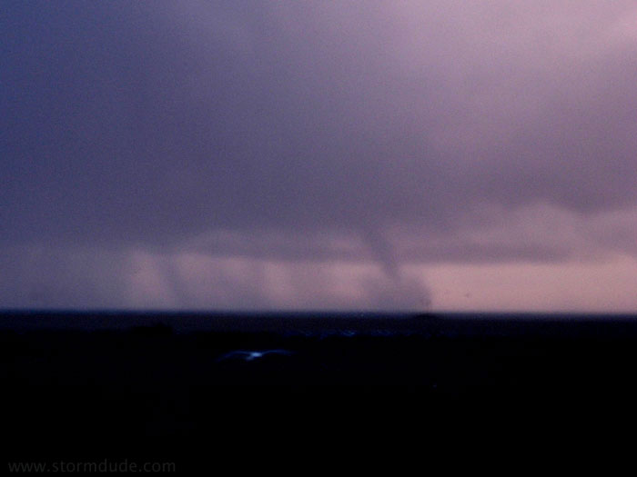
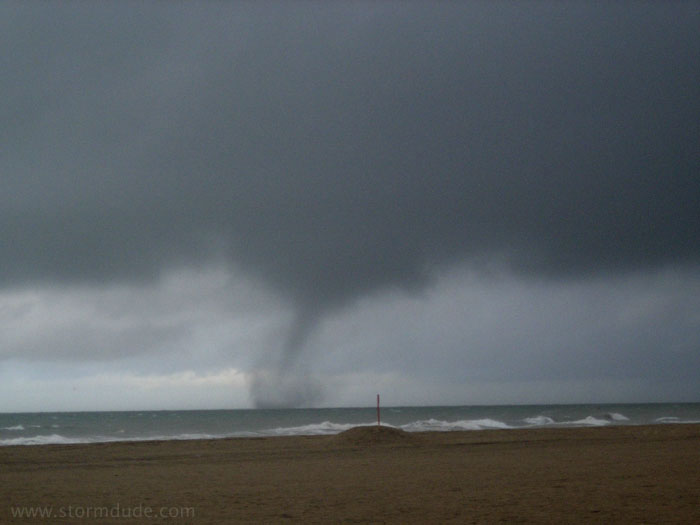
Great lakes Waterspouts

I'd have to say, a great deal with chasing waterspouts/seeing one, has to do with pure luck. Other than minor marine forecasting, such as look at buoy feeds, and what not. Snpw devils/Dust Devils, are completely luck, no forecasting is involved, or can be.
 
"ome can form from an actual supercell that forms overwater it would actually be a tornado,"

Right - that's a tornado. We're talking waterspouts here...


A tornado formed by a supercell over water is still labelled a waterspout.
Thats surely standard convention. :)
 
It's called a "tornadic waterspout" or "tornado over water" - a true waterspout is what we're talking about and does not require a thunderstorm.
 
"ome can form from an actual supercell that forms overwater it would actually be a tornado,"

Right - that's a tornado. We're talking waterspouts here...


A tornado formed by a supercell over water is still labelled a waterspout.
Thats surely standard convention. :)

Sorry, but any vortex extending from cloud base to surface of sufficient intensity to create damage (we can debate the exact quantitative threshold) IS a tornado. Period.

One then can also consider if the tornado is mesocyclonic or non-mesocyclonic.

Also note that the original definition of a "supercell" considers a temporal component so it is theoreticaly possible to have (an albeit brief) mesocyclonic tornado from a non-supercell - under the original definition (I don't know if the definition of a supercell still contains a strict temporal requirement). I would posit that such a storm would be exhibiting some or many visual supercellular characteristics during the period it is mesocyclonic and tornadic.

See how some definitions and catagorizations can clash, and how it can be hard to pigeon-hole the atmosphere into human defined categories - especially if they are psudeo-arbitrary (the temporal aspect of the supercell definition is the human defined part). Now think about the F scale!

On the other hand, the definition that a tornado is a vortex (with vortex lines) extending from cloud base to the ground is based soley on the physics of the process. Worrying about what sort of surface the vortex is over is the human defined part that only muddles things up (taken to the ad-absurdium, what is a tornado over an man-made lake???). Now think about the F Scale again!!
 
This same definitional issue confuses matters along the Orange County coast, where the local concentration of tornadoes is due to "fair-weather waterspouts" coming ashore, such as this vortex off Newport Beach on 1-11-01:
1-11-01g.jpg


But then when a waterspout forms under a storm with deep moist convection and deep-layer shear, but dissipates a hundred yards offshore, it remains a waterspout by standard definitions, such these vortexes off Newport and Huntington Beaches on 2-19-05:
2-19-05a.jpg


2-19-05f.jpg


A few years ago a "tornado" (by standard definition) hit a local dive bar located a hundred feet from the ocean, with the damage being primarily the amount of sand that got in everyones' beer. (But then I suppose the column of air by that time wasn't rotating violently enough to be a tornado....)
 
I saw 3 well-developed waterspouts over Lake Erie in late July of 2004, while at Cedar Point Amusement Park!

The first waterspout developed while I was on the "Meanstreak"; the train was going up the first lift hill, I looked to my left and was amazed to see a well developed rope funnel. As the train approached the top of the hill I could see a tight ball of spray at the water surface a few hundred feet under the tip of the funnel. I lost sight of the spectacle as the train descended into the first "dip", but at the top of the second hill/turn I regained visual and the waterspout had become more developed with the condensation all the way to the surface. I lost and regained view of the waterspout several times until the ride finished, but by the time I got off the coaster the waterspout had dissipated.

The other two developed about 20 minutes later at the same spot, but I was then in line for the "Gemini". A large stovepipe waterspout developed first and minutes later a thin rope developed to its east. The waterspouts lasted about 10 minutes or so and were then under cut by cold outflow from the thunderstorm, which produced them.

Didn't have a camera with me, but wish I did; I'm not going to Ceder Point again without bringing at least a disposable camera.

Simon Brewer
 
We get em in the UK too :wink:

Spout%202.jpg


Mark[/img]

But see, that looks like it was spawned by some sort of convective storm, and without any 'normal' features...see in the background there looks like a lot of precipitation...
 
That's exactly what landspouts ARE - they are ALL convectively-induced......as far as I know.......which isn't very far. :lol:

It's true that you don't need a deep mesocyclone/supercellular characteristics to get landspouts (by their nature that's not what they are, most of the time).........but in the end of the day you'll always need a Cb or congestus above it to stretch that pre-existing vorticity to cloud base.

KR
 
That's what I was saying earlier...but he said, you can get one out of plain fair-weather cumulus, and he may be right, but I thought that most likely they were caused from the high amount of convection in a cloud base....
 
Back
Top