Tim Vasquez
EF5
- Joined
- Dec 4, 2003
- Messages
- 3,411
As some of you may have already done, I did an armchair "survey" of the Bolivar Peninsula eastward with Google Earth. Interestingly it looks like a real no-man's land, which is fortunate. From what I can tell, there are no coastal residences at all between High Island and the outskirts of Sabine Pass (furthest right inset, Sabine Pass being just off the right edge of the map). I wonder if there's a historical reason why that area is so desolate, besides low elevation, which doesn't seem to stop other areas of Texas.
I did find a few weird structures out in the middle of nowhere, which I have highlighted. I can't imagine what the purpose of them are, but I'm guessing they're industrial and were probably not occupied.
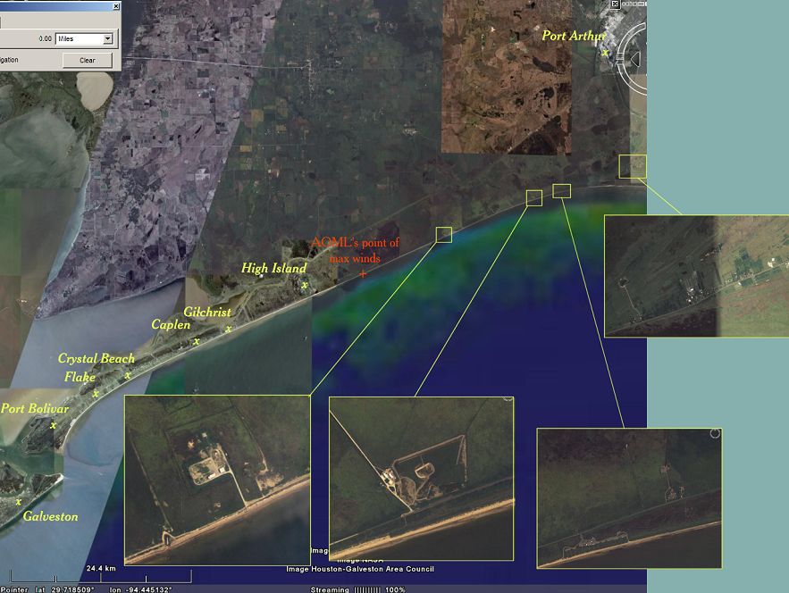
I'm off to scour the news for any information on High Island, which appears to have been in the worst possible area... I've heard a lot about Bolivar and Crystal Beach, but practically nothing about High Island.
Tim
I did find a few weird structures out in the middle of nowhere, which I have highlighted. I can't imagine what the purpose of them are, but I'm guessing they're industrial and were probably not occupied.
I'm off to scour the news for any information on High Island, which appears to have been in the worst possible area... I've heard a lot about Bolivar and Crystal Beach, but practically nothing about High Island.
Tim