Jason Toft
Hello all,
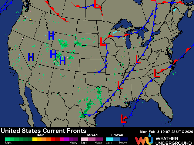
I have a question. Take a look at this picture from Weather Underground:

Note, this will change...
Notice in the middle of the CONUS, the free warm front...
I thought Warm Fronts were attached to cold fronts/cyclonic storm systems. Can anyone help me explain this?
Thanks,
Jason
I have a question. Take a look at this picture from Weather Underground:

Note, this will change...
Notice in the middle of the CONUS, the free warm front...
I thought Warm Fronts were attached to cold fronts/cyclonic storm systems. Can anyone help me explain this?
Thanks,
Jason
