Early death toll reports in Florida

Mike, just to clarify, it’s really two different issues albeit related. We can easily debate NHC’s forecast performance with Ian, but that’s not the same as me saying that accountability, such as via an independent review board, is a bad idea. In fact, I didn’t even realize NWS was no longer doing service assessments, so if that’s the case then that would tend to convince me that your proposal has merit,
 
The hurricane with the highest death toll in Florida history is 4,100+ in the 1928 Great Okeechobee Hurricane of Sept. 26, 1928. The "plus" sign is due to the fact that hundreds, and maybe thousands, are buried in mass graves with no death certificates, etc. See: Commentary: The Lack of Understanding of America's Storm Warning System

For those unfamiliar with the Okeechobee Hurricane, there is somewhat of a similarity between it and Katrina regarding the huge death toll.

In the month leading up to the Okeechobee Hurricane, rainfall was far above normal, causing Lake Okeechobee to be quite a bit higher than normal. Then the hurricane came along, dumped some more rain, and the combination of wind and water caused the lake to greatly overflow and breach some small dikes on the lake [does this sound familiar?]. The result was hundreds of square miles being inundated, most of which was farm land.

Migrant farm workers were working this land, particularly since it was September, and the workers were the main contribution to the death toll. Of course, it was hard to know exactly how many workers were in the area to begin with, much less how many of them might have died with no one noticing. And this is the main reason that the death toll from the hurricane varies considerably from one source to another.
 
The nhc forecast wasn't perfect, I think they should have stuck closer to the EC when it became clear that was the better forecast (and it was probably clear before Ian was even in existence lol) but a ~60 mile error 24 hour in advance is pretty darn good, and I thought the usual wording to not overly focus on exact track was pretty clear to all parties. Monday morning quarterbacking is what it is....

More interesting to me from a political standpoint is the insistence by the media that Ian was borderline cat 5 at landfall. I have not seen any sustained wind ground level measurements anywhere near high cat 4 (a couple gusts of 140+) and most seems to indicate high end cat 3. But even if solid cat 4 is never 'uncovered' (kind of like 11,000 votes...) Ian will remain in history as a cat 4, not because of ground measurements but from radar and flight data. All of the serious damage was from surge--ive seen comparatively little wind damage.
 
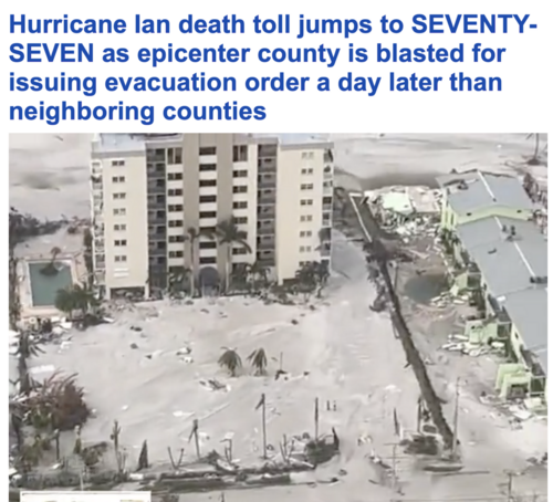
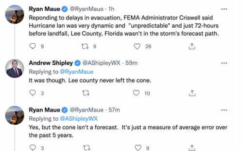
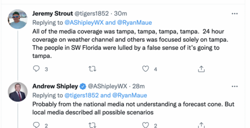
Going back to the original topic about the number of deaths in Florida. We are seeing a number of stories about the delay in evacuations south of Tampa.
Screen Shot 2022-10-02 at 9.20.47 AM.png

Screen Shot 2022-10-02 at 9.16.30 AM.pngScreen Shot 2022-10-02 at 9.17.13 AM.png


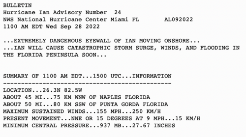
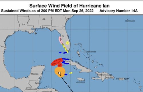
My hypothesis is that NHC's late inclusion of Lee County in a hurricane watch, late alone a hurricane warning, played at least some role in the slow evacuation order. Local officials aren't going to order an evacuation for a tropical storm watch. This situation is exactly why we need a National Disaster Review Board.
Ian, No hurricane watch 48 hr before landfall, Ian, 2p Mon. 9-26-22.png
 
More interesting to me from a political standpoint is the insistence by the media that Ian was borderline cat 5 at landfall.

That's because NHC had it borderline Cat 5 at landfall.

Ian will remain in history as a cat 4

Ehh - maybe :) The final report coming next year will have the say on what it goes down in history as.
 
The last NWS Service Assessment was four years ago for Hurricane Michael. It is here:

If you go to page 11, you will find the names of the people involved in the assessment. Every single one of them is a NOAA employee or associate. How critical are you going to be of your fellow employees and of the organization that signs your checks?

That is why we must have an independent National Disaster Review Board.

Addition: Because a number of people have asked questions, I have updated my blog piece on this topic: Hurricane Ian's Forecast Fiasco
 
Last edited:
Here's another jewel of a quote from someone who should know better, a county commissioner in DeSoto County, Florida. This one was in an Associated Press article in this morning's newspapers:

The county was prepared for strong winds after being hit by Hurricane Charley in 2004, but it was not prepared for so much rainfall, which amounted to a year’s worth of precipitation in two days, DeSoto County Commissioner J.C. Deriso said.

Let's see - the average annual rainfall in DeSoto County is about 52 inches. Does anyone recall any rainfall amounts anywhere CLOSE to such a total in Hurricane Ian?

Crazy - that statement not only exaggerates the amount of rainfall as you noted, but also is ridiculous on another level: How could anyone claim to be unaware of the heavy rainfall threat from Ian?!?

These types of media statements are not only frustrating and laughable to the more meteorologically astute among us, but are damaging to the public’s perception of the weather enterprise.
 
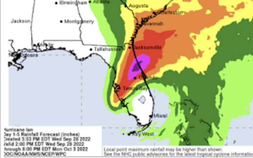
With regard to the rainfall threat, here is NHC's/WPC's rainfall amount forecast from 21 hours before landfall. It does not forecast excessive rainfall in DeSoto Co. The forecast is for 2-4 inches.
 

Attachments

  • Screen Shot 2022-10-04 at 8.48.38 AM.png
    Screen Shot 2022-10-04 at 8.48.38 AM.png
    622.3 KB · Views: 0
Back
Top