Dan Robinson
EF5
Please feel free to post comments or submissions in this thread!
We have finished filling out a preliminary list of every storm chase event I could think of or find from the 1970s to present, and listed them in the Storm Chasing Event Archive.
http://stormtrack.org/weather-library/storm-chasing-event-archive/
Now, we need your help!
First, I know there are still some events missed that should be included. Post those in this thread and we'll add them.
Second, and more importantly, the event listings that don't have hyperlinks (also marked with two asterisks **) are the ones that we need event summaries written, pictures donated, and radar/charts/links collected. Some of the older events have event pages, but still need content collected.
This appears daunting, but what we're hoping for is that for each event, there will be someone who actually chased it and/or has a special fondness or interest in the event enough to do the writeup. I think that this will be a long-term project that may take years to complete, but we figure if we get 20 contributors, we can finish the project much sooner!
The criteria for listing an event here is simply that it needs to one with tornadoes, notable supercells or otherwise famous/noteworthy storm events where multiple chasers embarked on planned storm chases. In other words, something like La Plata, MD or Xenia, OH wouldn't be listed here, because those weren't events covered by any chasers. We'd like to keep the list concise and strictly chaser-centric, yet as complete as possible.
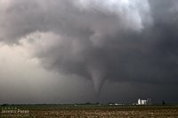
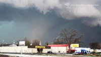
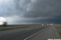
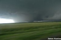
Here are examples of completed event pages. We'd like to accomplish this for all of the events:
May 12, 2004 Attica, Kansas tornado:
https://stormtrack.org/weather-libr...y-12-2004-attica-and-harper-kansas-tornadoes/
April 14, 2012 tornado outbreak:
http://stormtrack.org/weather-libra...ril-14-2012-oklahoma-kansas-tornado-outbreak/
Storm chaser web sites and social media posts come and go, and as a result, many past events are fading from memory. The event archive is meant to be a permanent historical resource for the storm chasing and weather community, one that will be there in the future for old and new chasers alike. But, we need your help to make it a reality.
Again, feel free to post content and submissions right here in this thread, and we'll migrate it over to the appropriate page.
Style guide for pictures:
Submit only photos you have taken yourself (you own the rights)
Photo height: 200 pixels (for uniform height), maximum width 300 pixels (we can do the resizing for you)
Watermark your photos with your name clearly legible
Photos will only be used on the event page.
Weather Charts and Radar images:
Any size, make thumbnail versions a uniform 150 pixels high for each image (again, we can do this for you if you provide the full size image)
Use only public-domain charts and images (from NWS/NOAA sources)
Thanks in advance for everyone's help.
Last edited:

