Marko Korosec
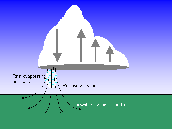
EF4
Hi all,
probably you remember the other topic I opened several days ago about wind damage: http://www.stormtrack.org/forum/index.php?showtopic=11789
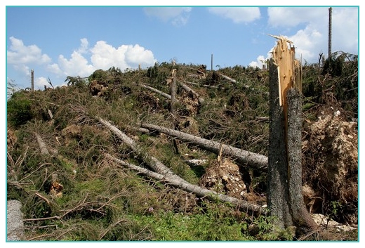
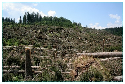
Few days after that we got news that there was another extreme event on that day, but much bigger than the one mentioned. It happened on June 29th, 2006 at around 14:30 UTC (16:30 local time).
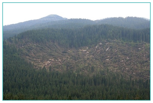
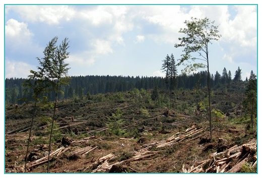
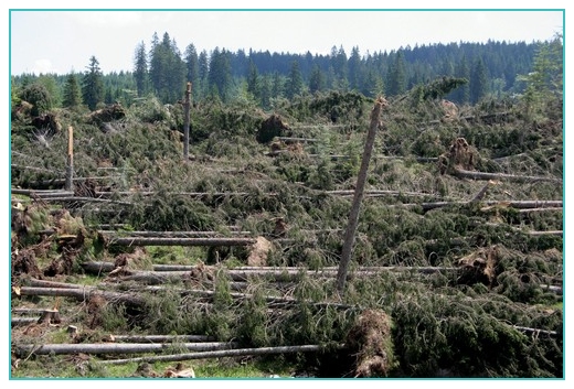
A friend of mine was there few days ago and took these incredible pics of devastation (images are copyrighted to Jaka Ortar, Slovenia):

http://www3.shrani.si/files/tnimg644712880.jpg
http://www3.shrani.si/files/tnimg648712897.jpg
http://www3.shrani.si/files/tnimg619712848.jpg
http://www3.shrani.si/files/tnimg649712901.jpg
http://www3.shrani.si/files/tnimg650712905.jpg
http://www3.shrani.si/files/tnimg651712909.jpg
Radar image at the time of event:
http://www3.shrani.si/o.php?newimgpr714175.gif
June 29th 12z sounding diagram for Udine, Italy about 50km west-southwest of event location:
http://img72.imageshack.us/my.php?image=udine29jun12z8hs.png
Here is a link to European Storm Forecast Experiment (ESTOFEX) forecast for that day: http://estofex.org/cgi-bin/polygon/showfor...ormforecast.xml
What do you think, guys and girls? Thanks for help!
Regards,
Marko
probably you remember the other topic I opened several days ago about wind damage: http://www.stormtrack.org/forum/index.php?showtopic=11789
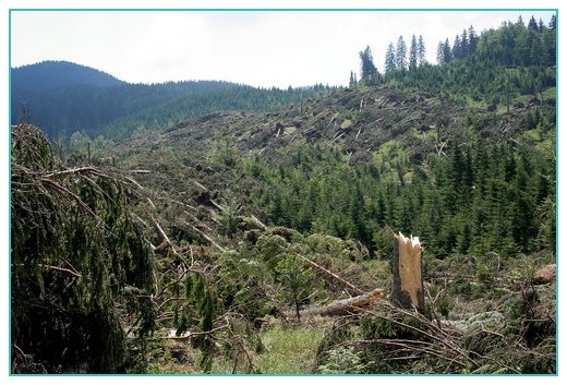
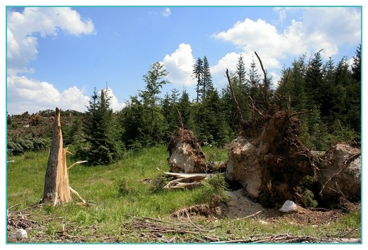
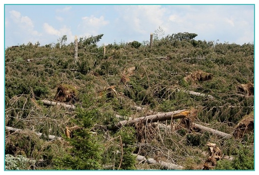
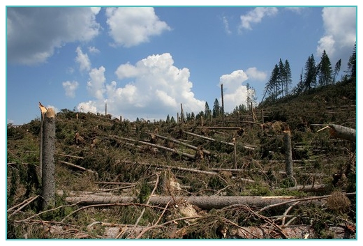
Few days after that we got news that there was another extreme event on that day, but much bigger than the one mentioned. It happened on June 29th, 2006 at around 14:30 UTC (16:30 local time).
A friend of mine was there few days ago and took these incredible pics of devastation (images are copyrighted to Jaka Ortar, Slovenia):
http://www3.shrani.si/files/tnimg644712880.jpg
http://www3.shrani.si/files/tnimg648712897.jpg
http://www3.shrani.si/files/tnimg619712848.jpg
http://www3.shrani.si/files/tnimg649712901.jpg
http://www3.shrani.si/files/tnimg650712905.jpg
http://www3.shrani.si/files/tnimg651712909.jpg
Radar image at the time of event:
http://www3.shrani.si/o.php?newimgpr714175.gif
June 29th 12z sounding diagram for Udine, Italy about 50km west-southwest of event location:
http://img72.imageshack.us/my.php?image=udine29jun12z8hs.png
Here is a link to European Storm Forecast Experiment (ESTOFEX) forecast for that day: http://estofex.org/cgi-bin/polygon/showfor...ormforecast.xml
What do you think, guys and girls? Thanks for help!
Regards,
Marko