July 29/30 2006 Tornado Warned Storm Aitkin County MN
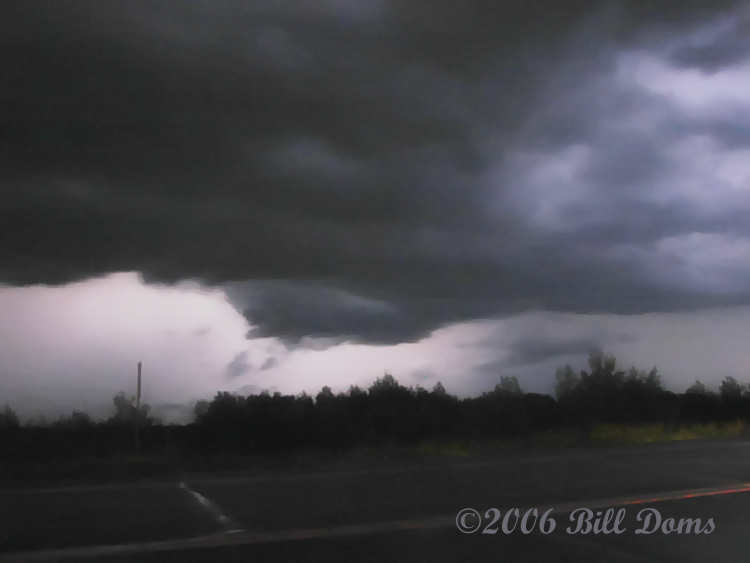
The chase across the state from Breckenridge, MN all the way over to I35 on the eastern edge via highway 210. Night chasing...again..not smart but sometimes you gotta do what you gotta do in 2006. I knew Saturday the 29th was going to hold the potential to be a big day in western MN back on Thursday the 27th. As the morning conditions unfolded on the 29th, it became evident the area where MN/ND/SD meet would be the potential battleground. Note I said potential. Dave Drufke, Michelle Parker and myself left the Cities about 3 pm and headed up I94 to Fergus Falls. The Storm Prediction Center issued a moderate risk of severe weather centered on that same area and issued a tornado watch shortly thereafter. So we headed over to Breckenridge and waited, and waited. Once again strong capping built in suppressing thunderstorm development in the watch area as the 700mb temps rose to 14C and the 850 temps rose to 27C. We headed back to Fergus to stop in and see my mom who had a meal ready for us as we watched data and noted the increasing potential just to our northeast as the sun had set. As we finished dinner and rested a little, storms began to fire in eastern Hubbard and western Cass counties. Back out the door and heading east as we flanked the storm waiting for it to turn southeast and hopefully south. Beautiful light show as we approached Motley, MN. Single updraft trying to corkscrew its way up to 60K tops. Decided to keep moving as Dave did a great job of plotting the track having it crossing highway 210 at Aitkin, MN. Just as we approached Aitkin, the DLH NWS put the torn on it as a wicked hook developed with solid couplet as this beast came barreling southeast at us. Scared the hell out of Michelle as this was her first night tornado warned storm. We set up just east of Aitkin where highway 169 breaks off and heads north as 210 heads east. An extremely low bell-shaped base with a broad wall cloud was periodically lit up by the lightning. Sitting right in the bears cage as the meso and TVS passed just to our west and south, we had a great view but no tornado was seen as the wall got cut off and died.
The new meso developed as we headed east on 210 where it looked for a period of time we were in business as ominous lowering developed right in front of us. I had no idea the rotation was as strong as it was until I went through the still photos and could see it obviously wrap up and was taking scud off the ground near McGregor, MN. This also was cutoff and died as we made the decision to head south and get to the cell near Moose Lake. Lots of small hail and torrential rain to end the night as we arrived home finally about 7:15am. SWIFTWX PRO once again came through giving us perfect data to position ourselves safely and enjoy whatever mother nature was going to throw at us. I'd do it again tonight given the chance....