7/13/06 REPORTS: NE/IA/MO/SD/ND/KS/MN

Joined
Sep 17, 2004
Messages
1,195
Location
Bangladesh
Intercepted the Bow near Omaha. The gust front came in and had some decent 50-60kt winds with it. Continued south through the bow and was not terribly impressed with the winds of the bow. Im pretty sure the it had weakend a little bit. It still had a nice shelf, where you could see it protruding. There were also some aqua/green clouds. Then headed south to Nebraska and went SW, chasing a storm that was just Se of Lincoln. Though the radar presentation was strong (with half a dozen frivilous TV's to boot), the cell generally appeared high based and had little structure. As I headed south, I noticed another storm near Beatrice, the radar showed a good oppurtuntiy for unihibited inflow. So I headed SW to intercept this storm. As I passed Humbolt the storm started exhibiting rotation and had a large 60-65dbz core. The storm also exhibited a WER and inflow notch. As I approached Table Rock, NE the storm was tornado warned for doppler indicated rotation. With a good view, it didn't look very tornadic at the time. I found a good lookout location in Pawnee City and continued to watch the storm as they extended the tornado warning. The storm had a menancing dark blue with a shelf that featured 'bubbles' extending outwards. Still the UDI region looked uneventful and was just a flat base. There was a general lowering trend/rotation striations right before the tornado warning expired and there also was a possible funnel during this time.

When I was watching the bow come into the Omaha area, there was a jet flying right towards the gust front. They went directly at it, looks like they were trying to climb above it. Well, the jet's left side clearly lifted and shuttered. The pilot then through it into a sharp turn away from the bow echo. After watching that interesting episode, I looked down and saw another Jet trying to land with the approaching 50-60kts crosswind. He was about 200 feet before he figured out it was a bad idea and pulled up and away from the approaching menance. Im pretty sure I took some pictures of the first jet flying right into it.
 
Scott, we must have been near each other all day. I too observed the shelf SE of Lincoln, near Auburn NE. For 3 minutes my cell phone worked and I called Darin Brunin, where he told me to head west. So off I went. Saw a nice meso near Tecumseh, before stuff to the SW interfered, and I headed further west. Punched through the core east of Beatrice, before it was torn warned, where I encountered inch to 1.5 hail, sporadically. Dropped south of Beatrice, where an impressive hail shaft came into view, and I found a dirt road near Wymore and headed east. Shot some stills and video, when my wx radio decides to work and alert me of the tornado warning for Gage County. I didn't really notice a whole lot of rotation so I continued east, glancing at my map, hearing the sirens in Barneston, and about hitting a herd of cows in the highway. Got to the intersection of highway 8 and 9 in Pawnee County, where I shot some more photos. Lost a lot of photo ops taking dirt roads south of Pawnee City, and by that time, storm really began to line out. Saw an impressive roll cloud in Marshall county KS, and called it a day. Pretty relaxing and rewarding chase, considering my laptop is in repair, and was without GPS, cell phone most of the day, and mobile radar. Will post some pictures up soon.
 
Add MN to the subject header I guess....

060713004.jpg


Well, that wasn't too bad. Cullen, Dave Drufke and I started out heading up to Fergus to pick something up at my mom's then dove south into Lac Qui Parle and Yellow Medicine counties where we got to see a few severe warned storms today. Lots of wind with quite a bit of crop damage west of Granite Falls, MN unfortunately from a downburst. Tree damage was also very evident on the west side of the groves and wind breaks. Not the greatest chase, but sure was better than a day in the office....speaking of such, it is time for bed for me as have a full day there tomorrow! Bring on the heat!!!

July 13th chase pics HERE
 
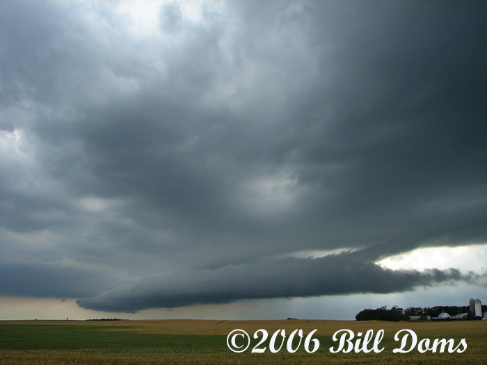
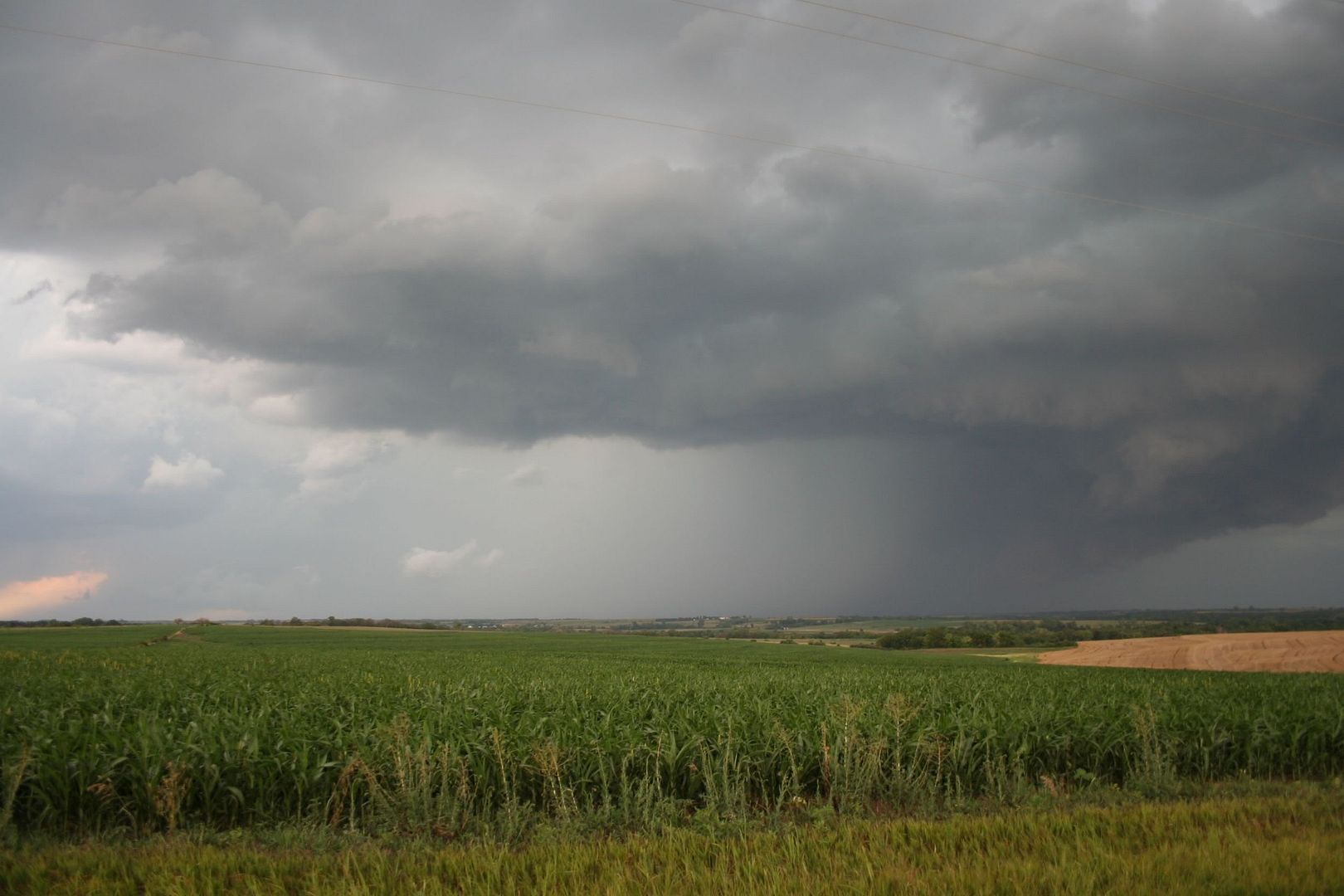
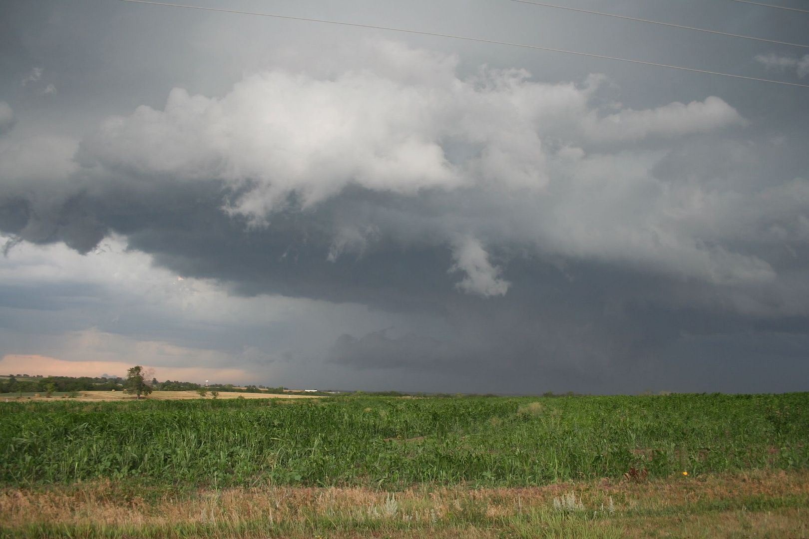
I was on the supercell between Ord and Ericson NE from around initiation. Today was one of those days you just kind of enjoyed because of how some processes work. Stuggling storms can be fascinating to watch, when/if they finally get going I guess.

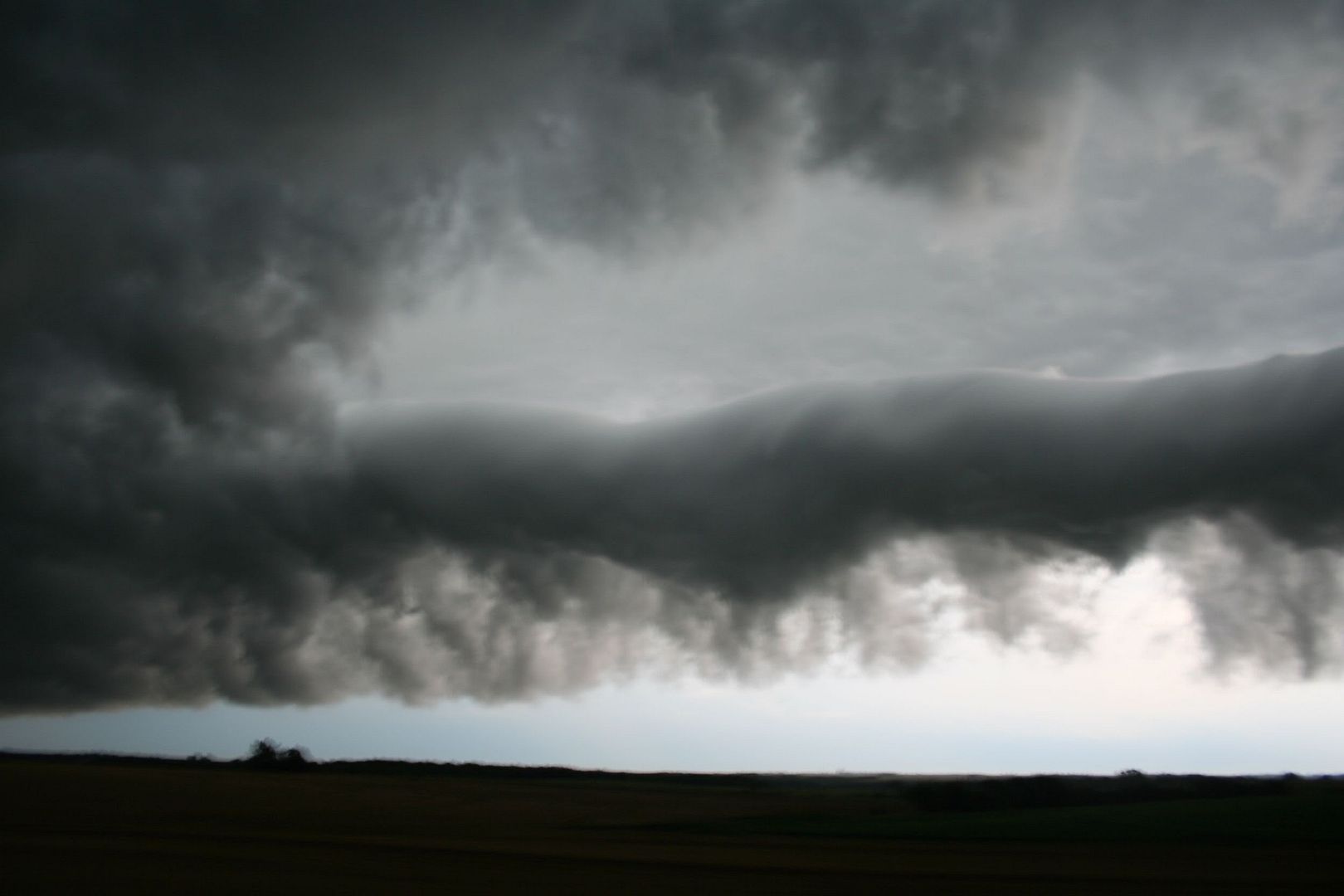
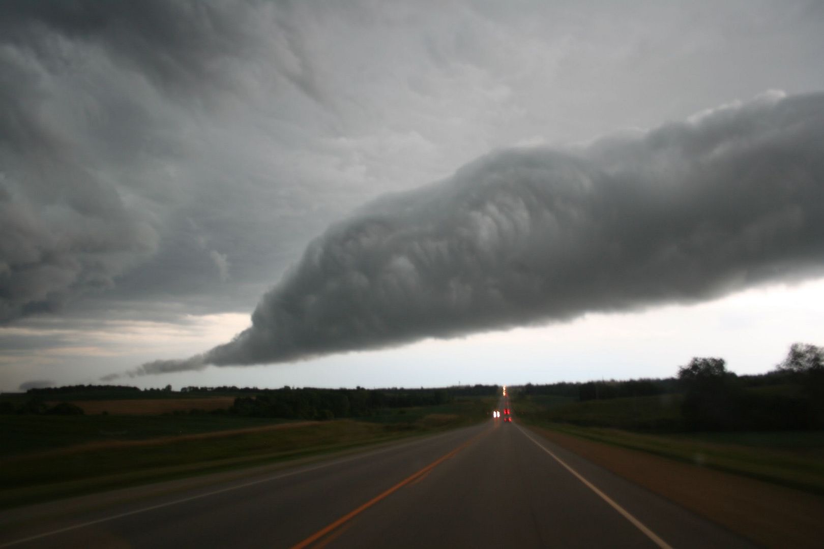
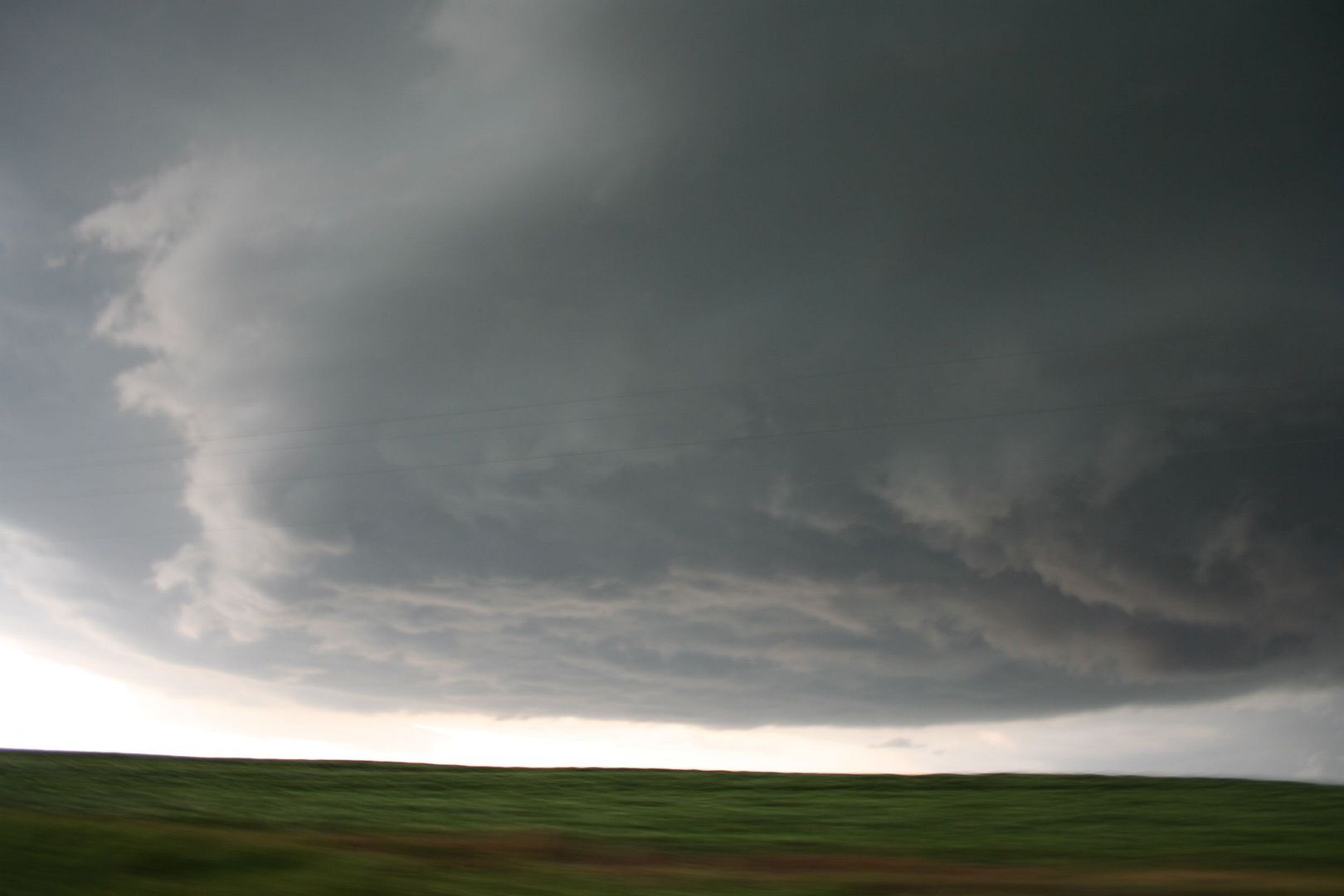
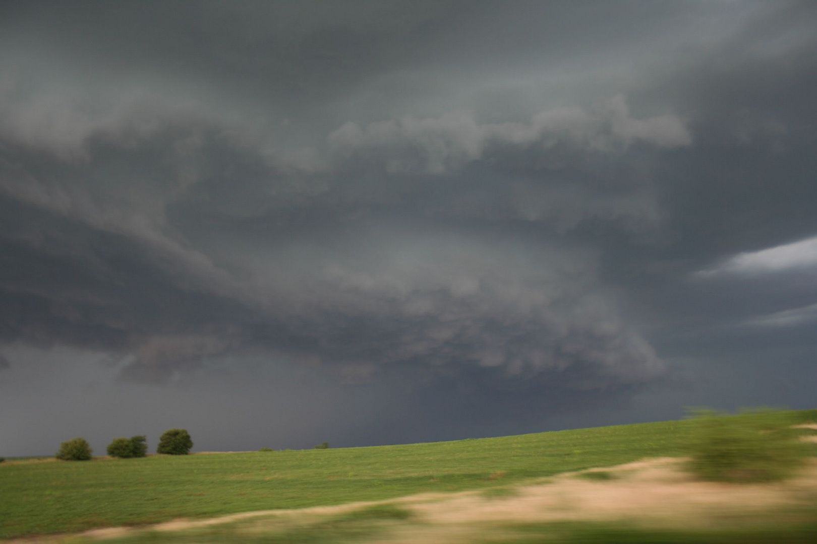
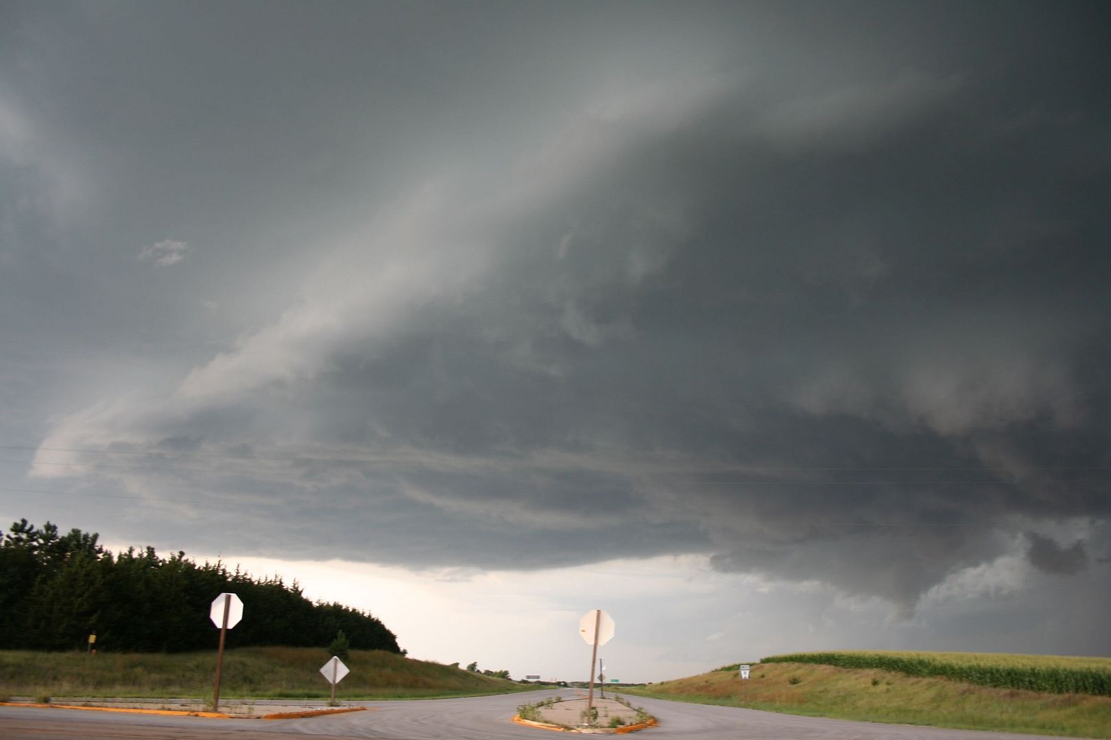
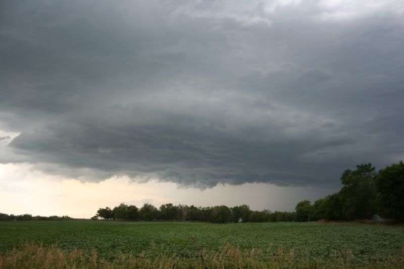
I'll post pictures and more info tomorrow but thought I'd toss this up tonight. I thought the storm was toast when I got hit in the face by cool outflow in a location about 1-3 miles south of the storm. I almost called Steve and Randy back and told them they may as well turn around and head back home, I really thought it was done for. This was just sw of Ericson on the highway that goes ne out of Ord. The storm was moving very slow to the ssw. I'm looking at it to my ne as it moves towards me when I get hit by the cool air from the north, in a location that wasn't all that near the base yet. I'd guess it was probably 5-10 minutes after that I hear this sudden roaring noise. First I thought hail, but it just sounded too much like wind. Then I can see a line of trees about 1/4 mile up the higway bending over to the west. I thought I'd quickly get hit by these winds since they were so close, but I didn't. They carried on like this for a bit, in this localized channel, while this elongated storm seems to seperate and organize quickly to the west. The updraft above begins to curl around hard to the ne with chaotic motions now happening in the base. I was like, this is going to tornado now! I wondered where the the tornado warning was since I could see the updraft rotating, then right then it came out. It was just very cool how that whole process worked before that storm took off, albeit for a short bit. It was amazing how strong and localized that wind was from the east and how as it happened the storm cleared away from the precip and the updraft began to rotate with strong vertical motions under the base. The bad part was the base wasn't very flat now, it was rarther torn up and looked like it was almost multicellular even if the updraft above the area was not. The base didn't look good, but the updraft above it started to crank around. Areas under the base would seem to get a decent sized cut and look to tornado before quickly losing it in that region. Then it would happen somewhere else. Pretty cool I guess.

The radar loop of this is interesting as well. Watch this radar loop of this. HERE

ODX on there is Ord. This event happens just ne of Ord. You can see it struggle, struggle, then bam it gets a hook and plows sw. Uggggg! So close to getting that crazy NE supercell in July. Change a little something about today and that probably would have offered some tornadic fun. I bet that boundary being too much e-w there might have been the problem. It looks like it was having a hard time latching to it(maybe it was just LCLs...it was 97/70 in Burwell at this time with winds gusting to 20mph from the ssw). You can see those cells popping off some e-w boundary and jumping east. Oh, the other cool thing about these are watching how other cells help them organize and get deeper. That cell north of it had to help it out with its bit of rain cooled air. I kept waiting for it to bump into this southern one as I figured that extra cold pool might be just what it needed. Heck if you watch the loop you can kind of visualize the bumping and gaining cold pools from those small cells on down the line till the big one goes. Well you can at least see the one north of it finally bump into it right before it takes off.

The more I watch that loop the more it interests me. Watch how that outflow boundary it is creating to the west really kinks in. It almost seems like the cold pools or rfds of the northern ones push that boundary south first and then that movement pulls the storm. You can see a weak push behind that main e-w bounday catch up to that boundary right when it really goes sw. The boundary certainly lunges sw BEFORE the storm did, right before. I guess if the cold pools bumping south helped that storm deepen, a stronger plume would create a stronger RFD which caused that kink. Then the kink would go maybe right before you see much for returns. It just looks strange to me I guess. It seems like the kink in the rfd/outflow boundary happens just a bit early and gives it more of a yank look, as apposed to a storm wrapping around and sending the rfd/outflow boundary out.

Maybe this fits more of a discussion, lol. I'm probably just being stupid and looking too much at this boundary/storm interaction.

For what it is worth this reminded me ALOT of June 20, 2005 in far se SD. That did something similar with a strong eastward push and a storm getting a hook like this and moving sw. THAT CHASE

It is 2 a.m....several hours too late to be staring at yanking rfds. Pictures to go with this later.

EDIT:

Something else about this storm. It is pretty darn freaky where that storm did that. It is essentially exactly where the one went July 12, 2004. It didn't go quite as long(but close) but where it went can't be a couple miles different than the one in 04. What are the odds of 2 storms tracking sw down a boundary like that in the same exact area(pretty much as close as you can get). Mesos tracking sw can't be very common to begin with, but to be so close would be very very rare. It crosses the highway west of Ericson exactly where the tornado did in 2004. It even lifts and plows s then se at the same location as the one in 04 did. The speeds were even the same for the locations, lol. It started off west of Bartlett not really moving. The 04 one even had a storm bump it from the north and "merge" with it where it started west of Bartlett. Too freaky.
 
This makes up for this years chases so far.. was at work when the first bow came through, is was cool seeing dirt getting sukced up/tossed into the air, and the trees swaying, and how fast the temp dropped! 30deg.. that cold air felt so good after hauling trash most of the day.. anyways the sky ahd a cool aqua green to it and dark blues, and some turbulence.. later on sitting at home, i see the radar and hurried up got the cam and went about 7 blocks and sat and watched as the shelf came through.. ( 120th and Sate St ) it was very awesome to see this come rolling in...( there were some braches down in Bennington and 1 large cottonwood but you could tell it was dead at the bottom) good thing it went the other way because otherwise it would of been on the house.

panned6_13_06omaha.jpg


panned6_13_06omaha2.jpg


panned6_13_06omaha3.jpg


Now we get to bake again in the heat for another week BLAHHH!!!
 
OAX radar loop of the Beatrice storm is very interesting as well. CLICK HERE These won't be available for very long. It wasn't much of a cell till the outflow boundary from the bow echo hit it. It crossed that and got its spin. The storm is the one just southeast of BIE.

Supercell in Thayer county also tried to grab and deviate for a short period of time as well. It had 3 inch hail reported with it. Interesing how they were all only able to root and deviate for a short period of time. Looping the Grand Island area radar will maybe show more of why that storm did it, perhaps another boundary in the area?

Edit:

Thayer county cell(near HJH/Hebron) is fairly interesting as well on the radar loop. CLICK HERE It maybe had a couple splits come off of it. Then the one looks like it collapses hard just looking at the speed that outflow boundary first pushes n-nw-w. That outflow push covers some ground in the first few minutes of the collapse. You can see the push right before the radar returns fade off and see the one that dies go racing ene. Definitely a cool day to look at the boundaries on radar and how storms interacted with one another.

Not sure there is enough to really discuss for this to be a discussion post.
 
Some images from yesterday's chase......just realized times below may be off an hour.


6:01 E. of Barneston looking N.

6:05 intersection State Highway 8 and highway near Pawnee city looking W/NW

5:46

2 mi. SE of Wymore 5:34 looking n/ne

Hail shaft looking south out of Beatrice 5:16 pm

Near Tecumseh....
 
Scott
Congrats .
You have some very picturesque shots .
I watched at home in Olathe, KS and then got my stuff together to do a mini chase and do some local watching the storm roll in from the NE while I sat in my wife's school's parking lot on 143rd st.
I shot some pics and video in Olathe on the 13th ( I will post some clips and photos).
I should have tried to go a little earlier North and South.
In Olathe , a lot of the clouds were boiling downward.
I thought more was going to happen but after "boiling down" they kept dissapating. Still cool thought.
No hail as I could see.
Did anyone see rotato or any other strange stuff in the approaching storms coming in from Olathe?
I will have to see sow of the pics I got in SW as the bright storm clouds bubbled up and the storms were moving in from the NE.
We had a lot of water here. I got a lot of rainwater for my carnivorous plants!
:lol:
 
Caught 3 storms on this day. Started out bad, but ended with probably the best storm structure Ive caught this year. Left about 1230 for West Point, NE, hoping to catch storms that had started W. of Norfolk, NE. By the time I got there was rather disappointed in what I saw.
As I was up N of W. Point, heard Severe warnings go out for Columbus, NE area. Decided to try and get to Fremont, NE in time and hopefully get a nice Shelf coming across. Didnt realize that EVERY highway in E. NE was having roadwork done what seemed like every 5 miles. Between the roadwork, and feeling like I was a magnet for every farm tractor and maintainer that was out, realized I wasnt going to make it to Fremont, NE in time. Found a place N of Fremont and took a few pics of the Shelf as it was coming/going over. Heres a couple pics of that storm. Wasnt a bad looking storm from here, but wished I could have made it farther down S. Sounded like it was more intense.[attachmentid=477][attachmentid=478]
3rd storm was a very short "chase". A total of about 8 miles to the point of where I took the pics, and the drive back home. As I said earlier, probably the best storm structure I have been lucky enough to catch this year. The pics were taken just N of Kennard, NE or about 15 miles N of Omaha, NE. [attachmentid=479][attachmentid=480][attachmentid=481]
 
Here are some pictures from my 7/13/06 chase:

Tornado warned supercell near Pawnee City


This second picture is of a possible funnel. Just one minute before this there was nothing under the base. The second picture is just 30 seconds later, suggesting some rotation giving the feature a laminar look.


Back
Top