John Farley
Supporter
I'm starting a thread for the mountain states region because the activity in this area seems separate from that occurring in the IA, WI, and IL. If mods prefer to combine threads, feel free to do so.
I saw an interesting feature in the Santa Fe, NM area today as a cluster of thunderstorms moved in. As can be seen in the picture below, it looked a lot like the dust devils that commonly occur in this area,
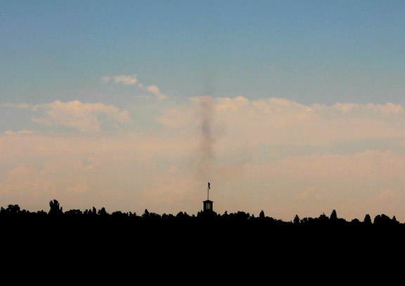
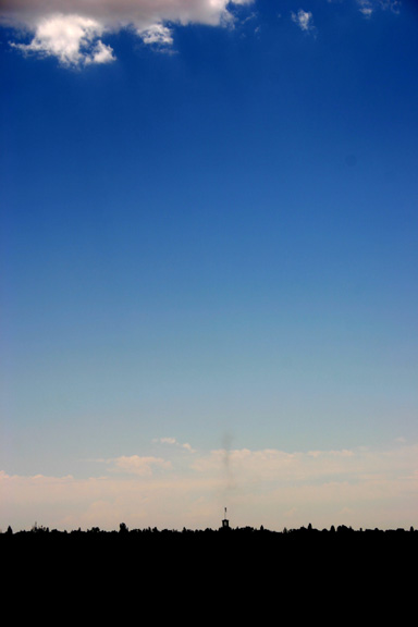
When I noticed this, it was already in the dissipating stage, as indicated by the rather diffuse nature of it near the ground but the tighter, vertical column higher up. Now, ordinarily, I would consider this kind of feature in this area to be a dust devil. But in this case, as can be seen in the following photo, it was under the leading edge of a cluster of thunderstorms that was moving very slowly down into Santa Fe from the Sangre de Cristo Mountains. Note the updraft base at the top of the picture, above the dust column:
For perspective, the picture below shows a wider view of the cluster of thunderstorms:
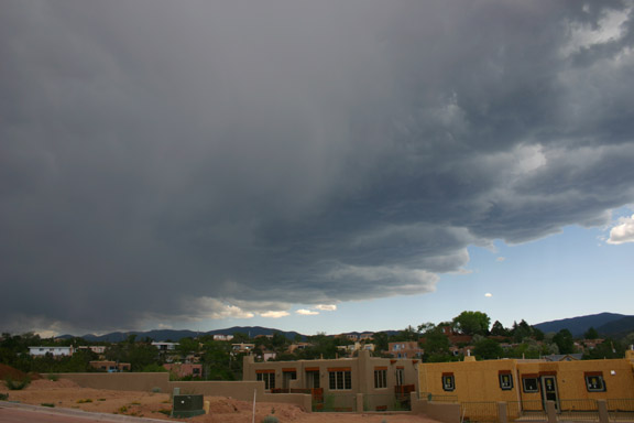
Given that this occurred along the leading edge of the storms, I am not sure whether it should be classified as a dust devil or a gustnado. But whatever it was, it was a little more than I was expecting to see when I walked to the top of a hill in Santa Fe to get a few pictures of the approaching storm.
Note: In the first two pictures, contrast is enhanced to better show the feature. No changes were made in the third picture.
I saw an interesting feature in the Santa Fe, NM area today as a cluster of thunderstorms moved in. As can be seen in the picture below, it looked a lot like the dust devils that commonly occur in this area,
When I noticed this, it was already in the dissipating stage, as indicated by the rather diffuse nature of it near the ground but the tighter, vertical column higher up. Now, ordinarily, I would consider this kind of feature in this area to be a dust devil. But in this case, as can be seen in the following photo, it was under the leading edge of a cluster of thunderstorms that was moving very slowly down into Santa Fe from the Sangre de Cristo Mountains. Note the updraft base at the top of the picture, above the dust column:
For perspective, the picture below shows a wider view of the cluster of thunderstorms:
Given that this occurred along the leading edge of the storms, I am not sure whether it should be classified as a dust devil or a gustnado. But whatever it was, it was a little more than I was expecting to see when I walked to the top of a hill in Santa Fe to get a few pictures of the approaching storm.
Note: In the first two pictures, contrast is enhanced to better show the feature. No changes were made in the third picture.