***photos have been updated***
*Tried* to sit east of the Big Horn county MT cell on 212. Took a glancing blow from the hail core (tennis to baseball). Stopped in Crow Agency where 212 meets I90, saw a lot of vehicles missing glass and heard reports of an injury also to a tour guest. No power so had to head up to Hardin for fuel.
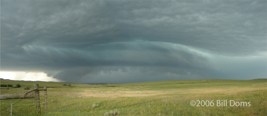
Headed up to I94 and flanked the Miles City cell just to the north of the highway. High based and a lot of precip. Semi blown over/hydroplaned and destroyed near Miles City, lots of minor wind damage. Got to Glendive, just before the bow hit. METAR ob showsd 63 g92 just as we got east...that was close. The Golden Valley county ND torn was a spotternado. Was on the phone with Eric Whitehill near Wibaux, MT looking east towards Beach, ND and made the comment "somewill will call that in as a tornado"...nice NON-ROTATING sharks tooth/scud thingy hanging off the leading edge of the shelf...POW, here came the torn warning. Wild day...
http://www.mnwxchaser.com/06june14.html
*Tried* to sit east of the Big Horn county MT cell on 212. Took a glancing blow from the hail core (tennis to baseball). Stopped in Crow Agency where 212 meets I90, saw a lot of vehicles missing glass and heard reports of an injury also to a tour guest. No power so had to head up to Hardin for fuel.
Headed up to I94 and flanked the Miles City cell just to the north of the highway. High based and a lot of precip. Semi blown over/hydroplaned and destroyed near Miles City, lots of minor wind damage. Got to Glendive, just before the bow hit. METAR ob showsd 63 g92 just as we got east...that was close. The Golden Valley county ND torn was a spotternado. Was on the phone with Eric Whitehill near Wibaux, MT looking east towards Beach, ND and made the comment "somewill will call that in as a tornado"...nice NON-ROTATING sharks tooth/scud thingy hanging off the leading edge of the shelf...POW, here came the torn warning. Wild day...
http://www.mnwxchaser.com/06june14.html
