Highlights: southward-propagating supercell, half-dollar sized hail (possibly larger), 69mph measured winds.
Gabe Garfield, Jana Houser, and I chased the southward-moving intermittent supercell that roamed the far part of western OK today. We were originally targeting Guymon, but that changed after looking at sat, radar, and surface obs. Unfortunately, the OK mesonet obs indicated a dry pocket of air in northwestern OK, with numerous stations reporting low- to mid-50 dewpoints! Oy! At the time, the winds in the eastern TX panhandle were veered, though expected to back with time... With the dry pocket where it was, a backing wind would have pulled that dry air west-northwestward, right into our original target area. Given this, we changed our target southward, not aiming for the Canadian-Perryton area.
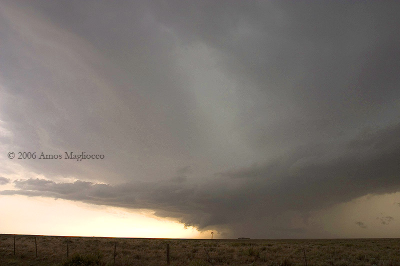
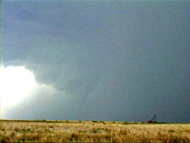
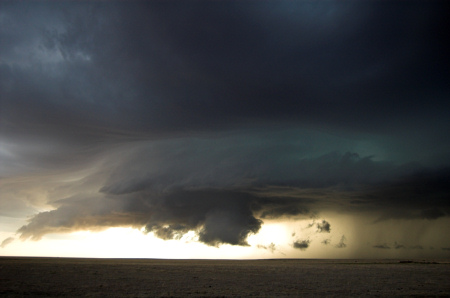
We filled up in Arnett (so 5/30 NOW thread), and decided to head to the 'tail-end charlie' that was persisting to our south-southwest. I thought the best environment was going to set up farther in the OK/TX panhandles, Tds were really suffering there (Canadian TX in the 40s? ugh). So, we opted to head southward to get a view of the updraft. Much to our pleasure, there was moderate cloud-base rotation when we go into view of the updraft base! A persistent rain-foot was indicating that colder outflow was trying to undercut the updraft base... Typically, this quickly kills the updraft. This storm, however, was very much propagating to the right, moving due south and SSW at times, which maintained the inflow of warm, unstable air from the south. We ran into a chaser from FL while taking some pics of this storm as we were about 5 mi NNW of Roll.
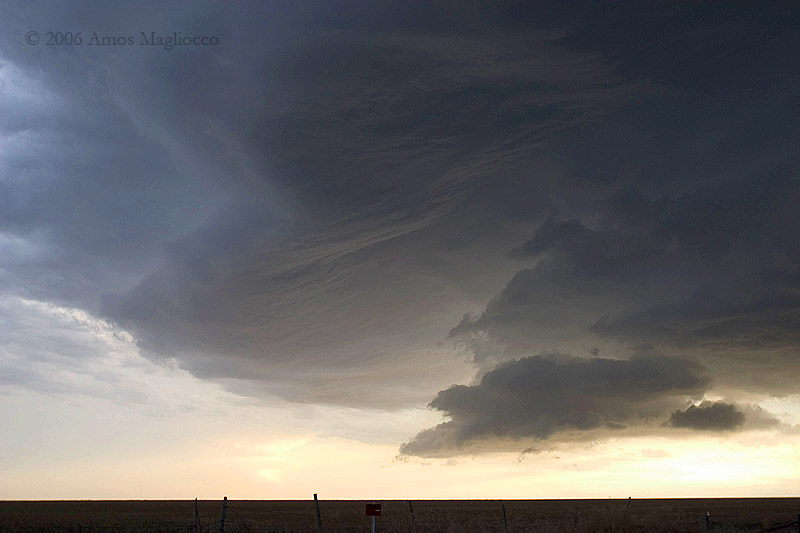
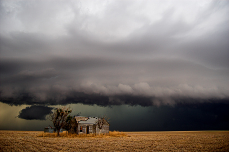
Over the next several hours, the storm showed occassional supercell structures (nice clean base, persistent cloud-base rotation, RFD clear slots, and so forth. As noted by the "occassional", the cell seemed to fluctuate between outflow-dominated crapvection and strong-inflow supercell. We were thinking about ditching this storm by late afternoon, in hopes that something discrete would come of the cells in the TX panhandle. As we were heading west on 47 south of Reydon, we got a new radar image, which showed the cell reintensifying... Hmm. Unfortunately, the higher reflectivity (65-70dbz) was situation immediately north of Hwy 47 at that time (between Reydon and Cheyenne)... Given the questionable road network, we opted to bite the bullet and cut across the southern part of the core. And hey, I hadn't really been in much year this year so far, so we figured it'd be fine to sample it. We experienced extremely heavy rain and hail, most of which was quarter in size, but some of which was more towards half-dollar or maybe ping-pong ball sized. In hindsight, I would have liked to have stopped to open a window and confirm that better, but the sound of hail hitting the car was so extremely loud that I just kept driving eastward. I'm sure there was hail larger than the half-dollar that was estimated, as numerous dents on my hood and roof would suggest. However, without measuring, I'm not confident in indicating any size greater than half-dollar. Regardless, we finally emerged from the core on Hwy 47 between Reydon and Cheyenne, after which time we dropped south on N1790Rd (towards Dempsey). New convection was developing south of this storm, and the collision resulting in an outflow-dominant looking storm. We kept with this storm until near Sayre, when we were thinking about calling it off.
Fortunately, we opted to head westward to watch it just a bit longer... The higher dewpoints mixed out through the day in the far western part of the state, leaving only 57-60F tds along the path of the storm. We were hoping, however, that the >63F Tds would get advected northwestward later on, thus we decided to stick with it a bit longer. We got some picks of the storm as we sat on the east side of Erick... Given SHAVE 2006, we decided it'd be 'fun' to head into the city of Erick and hide under a gas station canopy to sample whatever hail came our way (the sky was quite green to the north and northwest). On the way into the city, however, we were buffeted by very strong winds. We dropped south on N1750Rd, and measured 50-61mph winds about 5mi S of Erick. There was a ton of dust kicking up just to our south, so we opted to change chase mode from hoping for tornadoes to chasing some wind! We finally got back ahead of the outflow, and set up shop to measure what we could (using my handheld anemometer). And hey, standing outside in high winds is fun, assuming there isn't debris around and the winds stay <90mph. Gabe measured a gust to around 60mph right before we were about to get back into the car and drop south again. However, we were blasted with very strong winds again at this time, and I measured persistent winds in the 50-60mph range, with a max gust to 69mph. We dropped south again in hopes of getting ahead of the outflow to give us another chance of measuring the winds. Cell service was essentially absent by now (12+ mi SSE of Erick)... I was able to call Kiel Ortega back and ask him to relay the 69mph wind report to OUN (thanks Kiel!). Through the next hour or so, we tried to position back ahead of the leading edge of the outflow, but poor (and pure dirt) roads made this a little difficult. We called it quits pretty much near N1400Rd and N1840Rd to the southeast of the Sandy Sanders Wildlife Management Area (SSE of Erick). There was a huge lightning flash to our northwest at this time, followed by a huge plume of smoke and an orange glow. We headed back northwest to get a view of this... It appeared as though lightning ignited a small grove a trees, which then led to a grassfire. Unfortunately, the grassfire was no more than 100yds west of a house (we're near Plainview now -- east of the Sany Sanders). There were several vehicles there (looked like neighbors) and the heavy rain was quickly approaching from the northwest (thankfully), so we didn't stop.
Overall, today was quite a mix. I was very disappointed that surface dewpoints were again marginal, especially for the end of May! Cmon, is it really that hard to get >63F tds this time of year? Grrr. However, I loved the southward-propagating supercell, even though it had times when it was more of an outflow-dominant storm. I think the coolest part of the day, however, was the outflow winds south-southwest of Erick. Back in 2000, a friend and I measured a 74mph wind gust in northwestern IA... After that, however, this was the highest wind I have recorded with my anemometer. There was essentially nothing in the way of structures around, so I wasn't worried of significant structural damage... Most of the outflow (esp. in the strongest winds) was quite dry (not entirely surprising given the 30-35F dewpoint depressions), which made measuring much easier (since I couldn't find my rain jacket...). The strongest winds appeared, actually, to be just east of us when we measured our peak 69mph wind gust, and I wouldn't be surprised if there were areas of embedded 75-80mph winds, though I didn't measure any so that's entirely by observation.
Thanks to Gabe and Jana for chasing with me, and some collaboration with Dan/Robin/Howie. Thanks to Kiel for forwarding the high wind report to OUN as well!


") ).
).


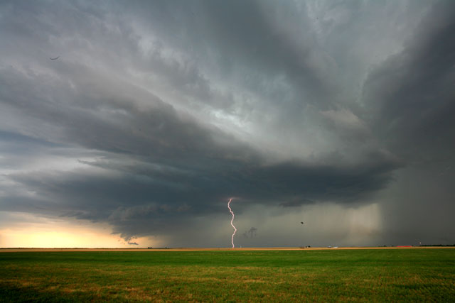
 Although, later last night the MCS that rolled through Lubbock made for some great lighting shots!!


