5/3/06 REPORTS: OK / KS / TX

Joey Ketcham

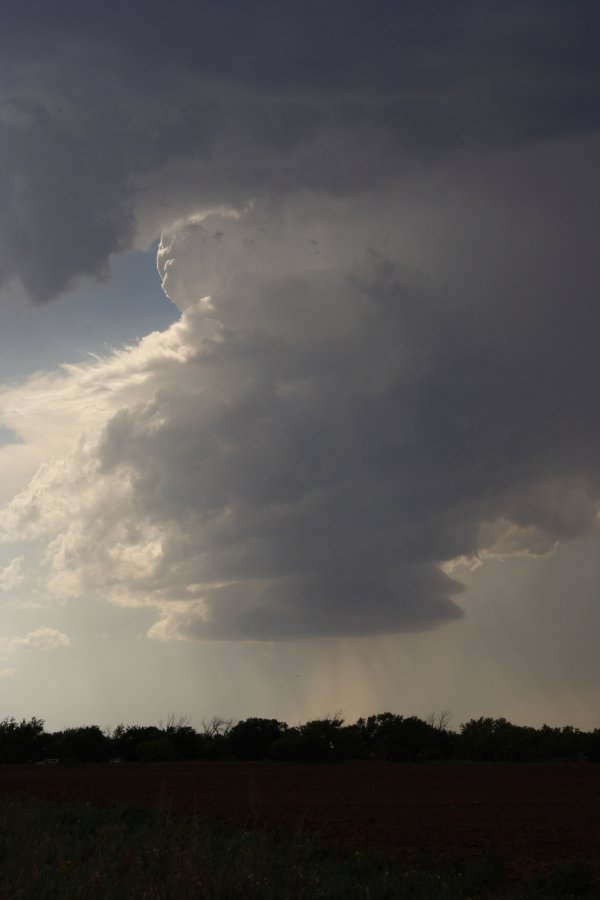
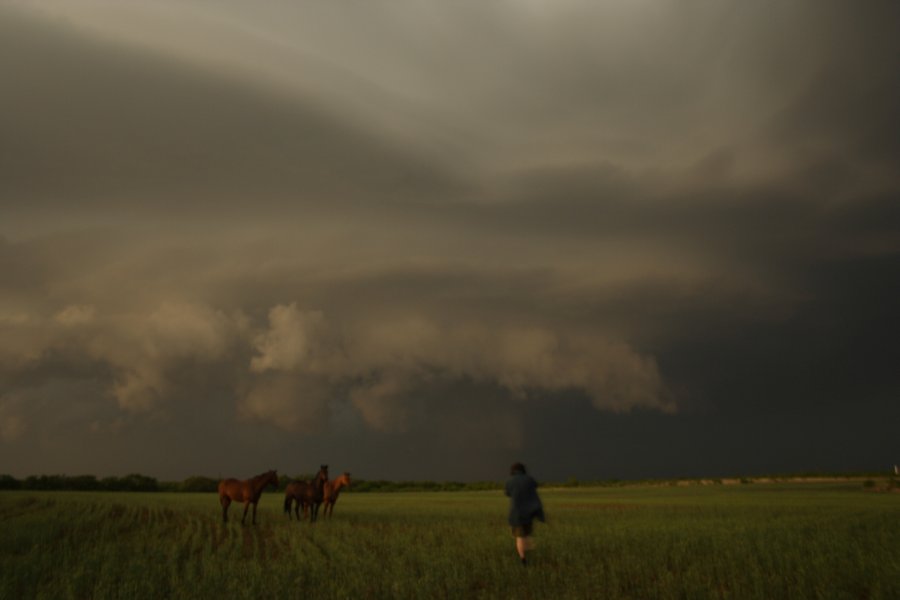
As the storms moved in towards Crawford and Bourbon Counties I headed north on 69 and positioned myself right off highway 69 where I observed a shelf cloud pass by and then later the wall cloud to the north. I ended up chasing into Missouri and met up with my chase partners Chris Wilburn and Tyler Costantini. No tornadoes, but saw wall clouds. Here's a few pictures.

bowall.jpg

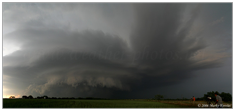
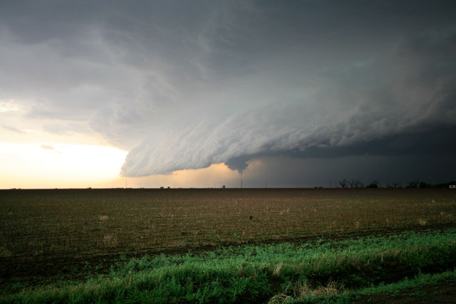
This was the first storm that went through Bourbon County producing a tornado warning. My other chase partner, Josh, took this shot. I directed him to Highway 7 and Highway 69 Junction south of Ft. Scott which is the area he took this picture in.

may3a.jpg

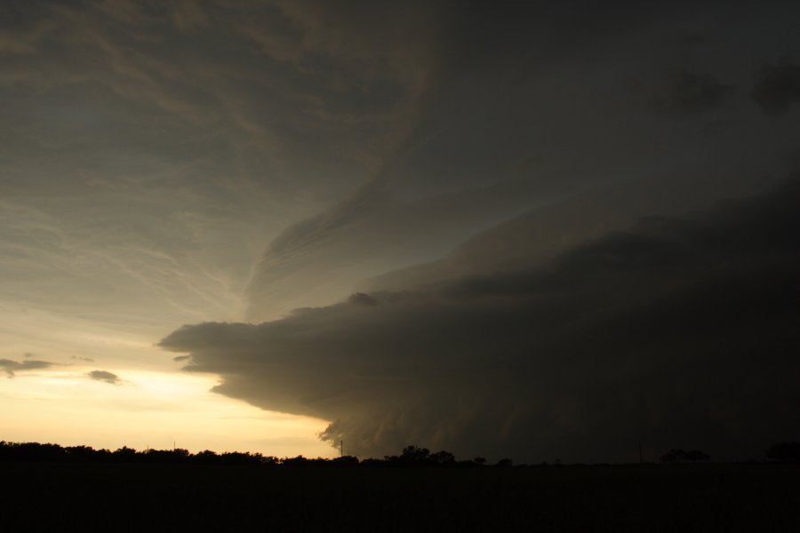
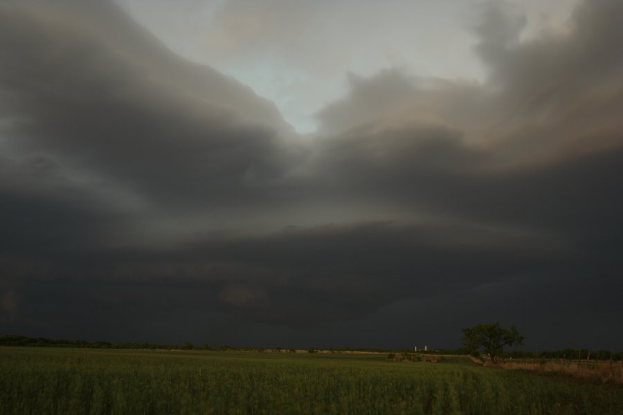
I took this picture outside of Arma KS looking north. This is a shelf cloud on the leading edge of the storm as it passed.
 
Bill Reid and myself watched the Kent County, TX supercell develop from a shallow Cu to a gorgeously structured storm. From our vantage (and we were under this beast during most of it's "classic" stage) it did not produce any tornadoes, but came very close many times.

050306_03.jpg

One of the many times the storm came near tornadoing

Other images

http://www.tornadofx.com/temp/050306_01.jpg
http://www.tornadofx.com/temp/050306_04.jpg
http://www.tornadofx.com/temp/050306_05.jpg
http://www.tornadofx.com/temp/050306_07.jpg
 
Dean Cosgrove, I, and my friend Steve were on the tail-end supercell in Kent County, TX, that organized itself into a huge, amazing, striated storm with reported tops to 60k feet. Dean got a capture of the WX-works screen that he hopes to post in the future that shows almost too many strong meso circulations to count. We half-circled the developing storm between Spur and Clairemont as it remained almost motionless for about three hours. It had strong inflow approaching an estimated 30 kts. over a wide area. It was an EBT (Everything But Tornado) storm, possibly due to weak upper winds. All the other classic ingredients seemed to be in place at various times, i.e. inflow notches, beaver tails, and we observed plenty of cloud-base level rotation.

As best we can tell, the extraordinary development of the storm may have been due to a mesoscale low that developed in the area as a very modest mid-level max passed across a sagging front and interacted with low-mid sixties dews ascending northwestward up the caprock. The result was a low level circulation center that became the focus for storm development.

We're currently in Sweetwater experiencing the evolution of the earlier storm into a persistent chain of storms firing across the sagging boundary. There is a severe warning still in effect for us. The earlier tornado warnings have expired.

All in all quite a spectacular show for a rather unimpressive set of parameters!
 
Basically the same report for us.

CoD was on the storms near Spur, TX

Was a great show but just couldn't get it's act together.

Looked to be a very high based storm and outflow dominate that kept crushing any action that got started.

http://www.allisonhouse.com/chasing/2006/CoD/day7/

Gallery is updated but the pictures with comments will have to wait until tomorrow morning. It's nearly 2am in Lubbuck.

-Tyler
 
Left Amarillo about 4:30 after looking at radar at the station. Saw the golfball reports in Roosevelt county and thought, what the heck, I'm going! Trucked it down I-27 toward Plainview and noticed a base to my distant SW as I neared the town of Tulia. It looked descent, but I was starting to pay more attention to the storm that was producing better features to my immediate south. As I neared Plainview this lowering was a few miles SE of the highway, so a couple of miles north of Hale Center I took a road going east. By this time I had a full blown meso on my hands with quite a few CG's. My chase partner and I were amazed at how fast this storm got organized which was most likely due to it riding right along the cold front. After the meso got wrapped in rain, we headed a couple of miles south of Hale Center and were treated with some amazing hail fog and flooding. After taking some video, we called off the chase and headed home. Overall, this was a great chase today because I had no intentions of really going anywhere, but I'm glad I did!


Meso a few miles SE of Plainview
dsc04697filtered7hc.jpg


dsc04699filtered1vo.jpg


dsc04700filtered5zm.jpg


Hail fog just SE of Hale Center
dsc047115ai.jpg


Almost 0 visibility on I-27 south of Hale Center
fogfiltered3ud.jpg
 
Chased with Jimmy Deguara and fellows in Kent county, we intercepted this incredible nice looking HP supercell at the sunset, lightning bolts were insane, so much power in the air! Not to mention inflow bands, man I love USA! :)

03052006493583.jpg


We also intercepted a nice LP supercell about one hour before in Motley county.

At the evening we were in Aspermont where heavy rain with gusty winds around 60mph hit the city.
 
Chased in Eastern Kansas yesterday. Storms were firing along an outflow boundary. Missed the Bourbon County tornado warned storm due to bad roads and an unwillingness to drive through golf balls. Decided to wait for the stuff to fire back West. Ended up on a decent cell with nice updraft and a wall cloud. Not a lot of rotation but it was nice to sit in the same area and watch a storm for 30 minutes. Some cells were moving as slow as 10 mph. Full report and more pictures are posted here. http://chasethis.blogspot.com

05-03-06-55_1.jpg
 
Back
Top