• While Stormtrack has discontinued its hosting of SpotterNetwork support on the forums, keep in mind that support for SpotterNetwork issues is available by emailing [email protected].

5/14/10 REPORTS: TX

Joined
Mar 2, 2004
Messages
2,444
Location
Northern Colorado
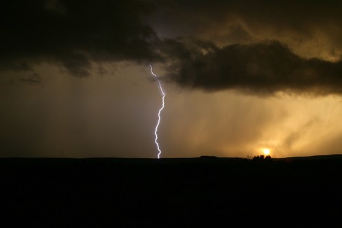
Myself and TWISTEX bagged a trio of tornadoes around the Notrees area just northwest of Midland/Odessa...

20100514_12.jpg


20100514_11.jpg


These tornadoes were of note for me cause it was 13 years ago to the day where I bagged my first tornado of my career (May 14, 1997 - Clarksburg, OH).

Semi-full report and video on my blog.

BTW, someone should tell Mike Bettis that his storms DID produce tornadoes.. :cool:
 
Started the day in Midland, Texas. Drove west on I-20 towards Pecos, Texas, when storms started to fire near Odessa, Texas. We got on them and observed various wall clouds. Eventually, we decided to play the southwesternmost storm of the bunch (which took its sweet time becoming discrete) and got some nice hail, structure and lightning.

4607595845_a52b88b1d3.jpg


4607602987_e54aae18cd.jpg
 
Started in Amarillo with a Chase Target of I-20 Corridoor - Storms Fired earlier than expected, blasted through the Tornadic Line between MAF & Odessa - The rest was Structure Heaven and letting the Supercell Slam the Hotel. Saw a Wispy Rope out stage which could have been the same area as Tony and Tim Samaras!

Paul S
 

Attachments

  • 140510 570.jpg
    140510 570.jpg
    7.7 KB · Views: 144
  • 140510 725.jpg
    140510 725.jpg
    11.1 KB · Views: 153
We started out in Amarillo and were a bit late to get on the Odessa cell, but got on the the cell to the east near Stanton. Where the underpass was completely blocked by cars trying to avoid the quarter size hail.
We managed to stay mainly on the west and south-west side of the cells and were treated to a photogenic shelf cloud.
The video of the day was captured by Mark Rees of lightning striking a windmill near Stirling City.
http://www.cloud9videos.com/show.php?Id=104
051410a.jpg

051410b.jpg

051410c.jpg
 
Had an excellent chase day in SW Texas.

Left Abilene at around 1100 and headed to Midland where strong convection was already firing just to the NW of Odessa at around 1330 from memory.

Attempting to target the now TOR-warned storm became hard as chasing through cities is never fun and the other storm rapidly intensified right over Midland which brought about flash flooding. The hail was increasing and we needed gas so it worked out well to take shelter under there, whilst getting drenched as my CC wouldn't work at the pump so had to go in.

Started to head south to target the back building storm to the SW of Odessa but was really taken by a magnificent shelf cloud on the old Odessa cell.

(Pics open to large...)


Then headed south and was met with a distant wall cloud (largely dissipated in this pic)


SR 385 became perfect to ride the storms southward of Odessa and escape the hail multiple times.

Photos up to Crane.


And photos up to McCamey where we called it a day and headed back to Midland. CG's with these storms were INTENSE! Little LP updraft here trying to get it's groove on.


Never chased this area and it was sure interesting smelling crude oil through the AC. Very impressive landscapes also. Digging that explosion shot above!
 
Back
Top