Andrew Pritchard
EF5
Don't really feel like writing a huge log right now, but I chased the sup in central Illinois earlier this evening near Bloomington, IL. When I intercepted it, it had a large wall cloud/tail cloud (closer reports said inflow was so strong it was pulling dust off the saturated fields) striations, and inflow bands feeding into it. I pulled into a farmers access road to a barn and wound up deep in mud. Spent 10 minutes trying to get out before I figured I was done for as the supercell approached me and figured I may as well get my camera out, but I don't have any shots from the best part of the storm though Dan Dimitroff apparently does (not sure if he's even a member here). I about gave up and ran to the farmer's house before I got slammed before stopping, getting in my car and trying aggresively one more time and finally wiggled my car free. Wasn't too long after that though that the cold front undercut the storm and eventually killed it off.
First storm near Ludlow, IL:


Finally getting a shot of the main supercell (though its losing its organization somewhat)

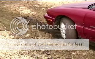
And my car...
More photos here:
http://www.geocities.com/pwxchase2007/2007march14.htm
Put up a quick video as well that includes my feelings on the situation...
http://www.youtube.com/watch?v=zFer1KrgL2w
Blah... at least now I have my "stuck in the mud" experience out of the way. I really don't know why I thought it would be a good idea to leave pavement since we just melted 20 inches of snow, and had several multiple inch rain events in the last 3 weeks or so.
First storm near Ludlow, IL:
Finally getting a shot of the main supercell (though its losing its organization somewhat)
And my car...
More photos here:
http://www.geocities.com/pwxchase2007/2007march14.htm
Put up a quick video as well that includes my feelings on the situation...
http://www.youtube.com/watch?v=zFer1KrgL2w
Blah... at least now I have my "stuck in the mud" experience out of the way. I really don't know why I thought it would be a good idea to leave pavement since we just melted 20 inches of snow, and had several multiple inch rain events in the last 3 weeks or so.
