I was not able to watch things unfold “live” last night, and it’s a good thing or I would have been going crazy for not being out there

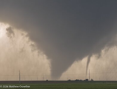
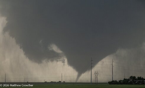
But I’m having trouble getting my arms around what happened. The YouTube video showing the two tornados says one chaser was in Nardin and the other in Blackwell. Those towns are only 10 miles apart. So I assume these were from two mesos in the same complex? Was this a Pilger type situation? If so, why were the two tornados not close enough to be seen together?
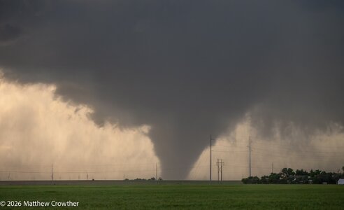
And that was not the same supercell as the one that produced the tornado in Enid, correct? There are clearly two different tornadic supercells by about at ~8pm CDT on the archived radar, one in Enid and one near Ponca City. Based on archived radar and SPC storm reports, it looks like the Enid storm had not even formed at the time the northern storm produced, but I’m not sure of the exact time of those dual tornados.