Luke Penney
EF1
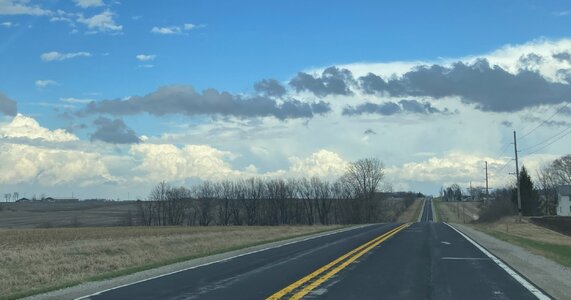
Andy and I targeted an isolated supercell that formed in the dry slot in south-central Iowa and traveled northeast to until it passed Iowa City, where it got absorbed into a line of storms as they caught up with it. This was very likely the storm of the day, being a supercell that remained isolated longer than any other, and certainly had the most reports that I saw in Spotter Network and mPING.
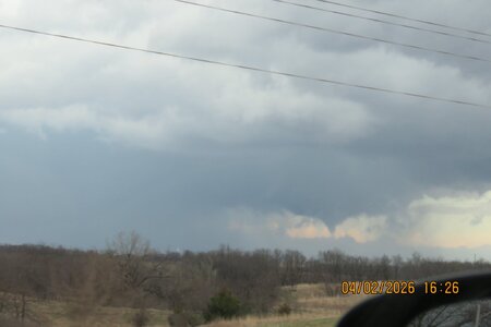
While there was a dramatic RFD front, visibility was often tricky, due to rain and low contrast. (And, uh, getting into the hail core. Whoops.)
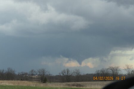
Between West Branch and West Liberty, the storm produced a funnel cloud - or quite possibly my first tornado! The SPC has a report of a "rope tornado on the ground" at 4:44 PM, and one of my first photos of the "funnel cloud" was at 4:45 PM.

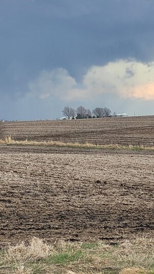
The consolation prize for not knowing for sure if this was a tornado is lot of impressive storm views. (Neither my phone camera nor my DSLR camera really did justice to them, but here's a selection of photos anyway, some of which I was admittedly a little lazy about editing.)


While there was a dramatic RFD front, visibility was often tricky, due to rain and low contrast. (And, uh, getting into the hail core. Whoops.)
Between West Branch and West Liberty, the storm produced a funnel cloud - or quite possibly my first tornado! The SPC has a report of a "rope tornado on the ground" at 4:44 PM, and one of my first photos of the "funnel cloud" was at 4:45 PM.
The consolation prize for not knowing for sure if this was a tornado is lot of impressive storm views. (Neither my phone camera nor my DSLR camera really did justice to them, but here's a selection of photos anyway, some of which I was admittedly a little lazy about editing.)