Jesse Risley
Staff member
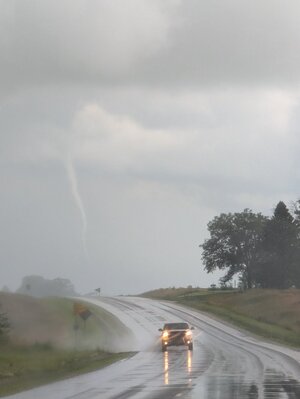
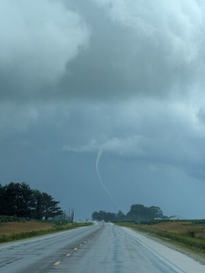
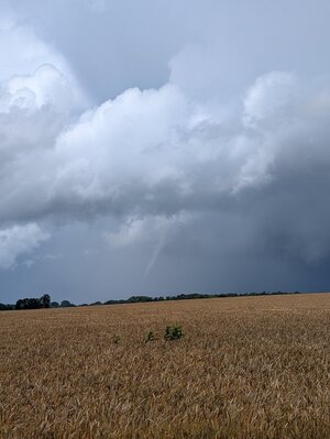
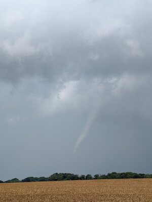
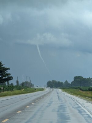
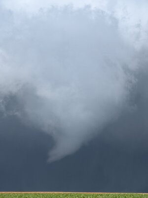
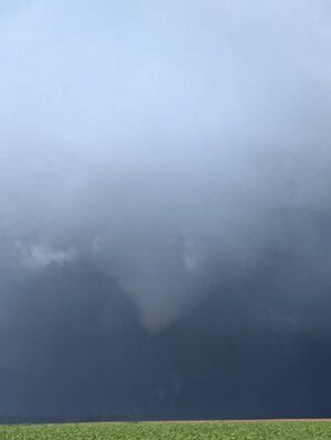
Ethan Schisler and I were originally targeting eastern Illinois as a MCV pushed into the mid-Mississippi River valley by mid-morning Wednesday. There was a noted triple point about 60 mi NW of STL. I suspect that there may have also possibly been an OFB from earlier convection that lied somewhere from Pittsfield, IL - Jacksonville, IL to near Petersburg, IL but I am unable to retrieve surface data at this time. Noticing poor lapse rates in that region we hung back in the Macomb area and blasted south on US 67 towards Beardstown as the first tornado warnings were hoisted for Pike and Morgan counties in west central Illinois. We headed southeast in IL 125 with a target of Viriginia, IL when the tornado warned storm that had struck Jacksonville was approaching with a visible clear slot. While that storm was recycling a gorgeous white rope tornado appeared out of nowhere and crossed Illinois 125 in front of us between Philadelphia and Ashland. As we moved north to follow that the Jacksonville cell put down another tornado simultaneously to our WNW a few miles just south of Newmansville. This tornado continued for some time in various forms NNW of Petersburg. The storm recycled and dropped several more weak tornadoes up to near Atterberry, IL. Once the cell near Mason City, IL started to get more organized we headed for it and caught back up to it near San Jose, IL on the US 136 corridor and witnessed 1-2 more tornadoes from a distance between Minier, IL and Mackinaw, IL just south of I-74 before calling the chase and heading to Bloomington for lunch as the storms had clearly weakened and the tornado threat had ended. I know we saw at least 6-7 tornadoes total and some of them were not fully condensed at times but weak debris fields were visible visually. All of the photos were of active tornadoes even though full condensation was not occurring from our vantage point at that moment. This day over performed by my expectations!
.png")

Attachments
-
 PXL_20250618_172603188.jpg60.2 KB · Views: 6
 -
 PXL_20250618_172631638.jpg55 KB · Views: 6
 -
 PXL_20250618_174113182.jpg150.2 KB · Views: 6
 -
 PXL_20250618_174118016.jpg65.3 KB · Views: 7
 -
 PXL_20250618_172641117.jpg66.3 KB · Views: 8
 -
 PXL_20250618_173836109.jpg37.7 KB · Views: 8
 -
 PXL_20250618_173737138.jpg32.7 KB · Views: 8
 -
 PXL_20250618_214821586.jpg279.5 KB · Views: 8


