 Obviously a pretty good day in NE - Summary:
June 16 was one of those chase days that will be remembered for a long time, with an incredible tornado intercepted in west-central Nebraska, up there in the top storm intercepts of my storm chasing career! The SPC had an enhanced-risk in two areas, one in Minnesota (distant and not a viable target), and locally near me from western to central Nebraska. The wind and hail probabilities were both 30% in Nebraska, and 15% and 30%, respectively, in Minnesota (both hatched for significant). The latter had a 5% tornado probability, with 2% elsewhere. I remained in Ogallala off I-80 until late afternoon, checking out late, and working on my IT job remotely, since the atmosphere was capped most of the afternoon (convective inhibition). I wrapped up IT work and spent some time at the Lake Mcconaughy State Recreation Area north of town for a bit. I saw some tornado reports from Minnesota, which was discouraging, but the plan was to wait and see locally in Nebraska.
By late afternoon, the upper wave and support passed overhead, marked by thin high clouds, with small cumulus bubbling up to the east near North Platte. It was time to head east, as this most probably was cap erosion, and in an environment with backed surface winds, a nearly stationary boundary, and 5000+ CAPE. The SPC issued mesoscale discussion 1315, then severe thunderstorm watch box 424, valid until 11 PM CDT. I headed east on I-80 to North Platte, and Highway 83 south from there. A supercell storm explosively developed and acquired LP characteristics in Lincoln County near Wellfleet. This storm became a prolific tornado producer, with a large, highly visible set of tornadoes northwest of Wellfleet and near SR 23. The largest of these tornadoes was observed at very close range, albeit the tornadoes remained over open fields. Hail, up to baseball sized, shattered the right side of my front windshield. I wrapped up chasing via headed back to Highway 83 south, towards McCook, then west on Highway 34 to SR 25 south, into Kansas, and finally into Colby for the night.
Storm Details (intercepts):
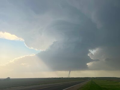
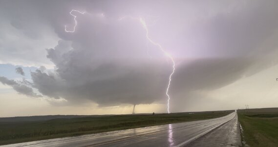
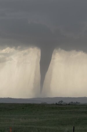
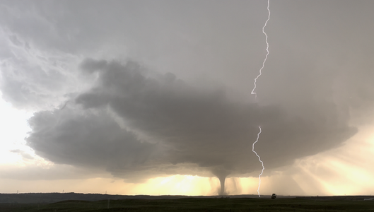
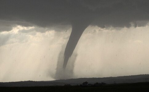
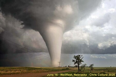
June 16, 7:30 PM - Observation and penetration of an extremely severe and tornadic thunderstorm in Lincoln County, Nebraska to the northwest of Wellfleet and Highway 83, and near and south of SR 23. The storm was a violent cyclic LP to classic supercell storm. At least 4 tornadoes were observed with this storm, with the last one being a significant slow-moving stove-pipe which remained on the ground for at least 20 minutes. Hail to baseball sized was also encountered north of the tornadoes on SR 23, with another shattered left windshield as a result. The first tornadoes were under an LP supercell base, with no visible RFD, and looked like a funnel with dust swirl under it. At one point a second tornado was observed west of the main one. Then next two were elephant trunk tornadoes, and finally the stove-pipe. The tornadoes did not hit any major structures, and remained over rural areas. Some ground scouring, debarked trees, and snapped powerlines were observed after the main last tornado roped out. A wooded area also was completely stripped to bare tree stumps. Other conditions encountered were frequent lightning with many close hits, light to moderate rain, and 60 to 70 MPH winds (mainly RFD). This storm also had a very striking visual appearance, with a "stacked-plates" or "mother-ship presentation. The RFD cut came in during the latter parts of the storm cycle, with evolution to classic mode and rope-out of the large tornado. Conditions causing the storms were surface heating, a stationary frontal boundary, low pressure trough, and an upper trough. Documentation was digital stills and HD / 4k video (including time-lapse). A 2022 Jeep Renegade was used to chase the storm. A severe thunderstorm watch was also valid for the area until 11 PM CDT.
June 16, 10:30 PM - Penetration of severe thunderstorms between Atwood and Colby, Kansas along SR 25 in Rawlins County. The storms were part of a multi-cell cluster of strong and severe storms. Extremely frequent to continuous lightning was observed with these storms, as well as nickel-sized hail, heavy rains, and 60 MPH winds. An unusual heat burst was also encountered with a dry downdraft from one of these storms north of Atwood, Kansas with temperatures going from the low 80s to low 90s (unusual for late night). Conditions causing the storms were surface heating, a low pressure trough, and an upper trough. Documentation was HD / 4k video. A 2022 Jeep Renegade was used to chase the storms. A severe thunderstorm watch was also valid for the area until 11 PM CDT.
Video link to the event:
Gallery for this event:
 Above:
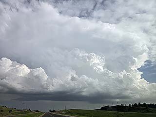
 The upper level support arrives, quickly eroding / negating the capping inversion aloft, and explosive supercell development ensues along the boundary. This is looking south out of North Platte during the late afternoon. This storm will quickly become an incredible tornado producer.
 Above:
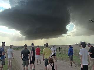
 Storm chasers / research students admiring the rapidly developing LP (low precipitation) supercell northwest of Wellfleet in Lincoln County.
 Above:
 Myself in front of the tornado looking south. My skydiving helmet came in handy, as hail to baseball sized was falling at the time.
 Above:
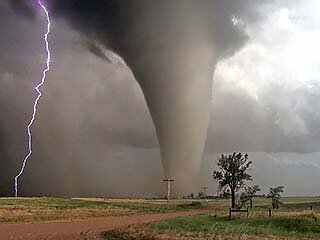
 No, this is NOT AI nor "Hollywood CGI". This is the way the tornado looked in real life. Here I am looking southeast, as a rainbow and lightning strike occurs left of the tornado.
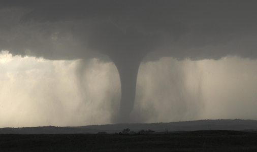
 Above:
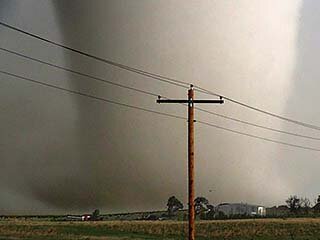
 Zoomed-in view of the base of the tornado and ground circulation as occlusion is imminent. The view is to the south and southeast.
