Dan Robinson
EF5
This day was a deja-vu closely resembling my May 15 chase. I had decided on targeting this system close to home instead of the more potent environment down south in Kentucky and Tennessee. Vorticity near the surface low and a warm front would be the main players in Illinois. The warm front was slightly more favored for tornadoes, but was another 2 hours away, and I wasn't feeling like it was quite enough to be worth having a 4-5 hour drive home afterward. I instead settled for the much closer cold frontal cells that would be firing along I-55 about 60-90 minutes from home.
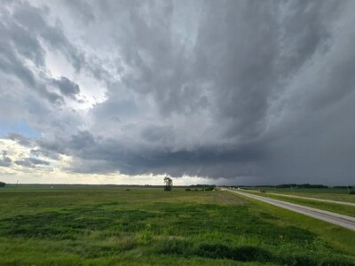
I started out watching new convection try to get going near Litchfield. This didn't last, so I headed up to Springfield to intercept a string of three supercells that had been rapidly strengthening. The northernmost two weakened as I approached them on the north side of Springfield. This was the middle cell in the line just west of Sherman as it was becoming outflow dominant:

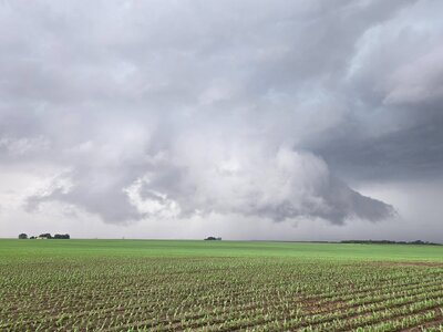
The southernmost storm was maintaining strength and prompted several tornado warnings. So, mirroring the May 15 chase sequence, I stayed ahead of the storm eastward along I-72. While the RFD surges were strong, inflow at the surface was weak and the storm remained outflow dominant. Despite the constant warnings, I didn't see any signs of it being close to producing a tornado while I was on it. This is looking west in front of the storm at Buffalo:

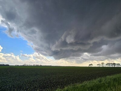
While storm speeds weren't crazy today, they were fast enough that I couldn't stop for very long. After the storm's character hadn't changed in 40 minutes, I finally decided to let it go south of Latham with this view looking north:

Another supercell was organizing to the southeast over Decatur, and it appeared to be the next in line to become dominant:

This new storm was high-based and didn't have any look of organizing much in the low levels. I expected it to just be a repeat of the last one. Since following it farther would just lengthen my drive home for just more of the same, I decided the continued pursuit would not be worth it. I turned toward home at 3:30pm, bringing an early end to the chase day and this recent string of active severe weather in the Plains and Midwest.
I started out watching new convection try to get going near Litchfield. This didn't last, so I headed up to Springfield to intercept a string of three supercells that had been rapidly strengthening. The northernmost two weakened as I approached them on the north side of Springfield. This was the middle cell in the line just west of Sherman as it was becoming outflow dominant:

The southernmost storm was maintaining strength and prompted several tornado warnings. So, mirroring the May 15 chase sequence, I stayed ahead of the storm eastward along I-72. While the RFD surges were strong, inflow at the surface was weak and the storm remained outflow dominant. Despite the constant warnings, I didn't see any signs of it being close to producing a tornado while I was on it. This is looking west in front of the storm at Buffalo:

While storm speeds weren't crazy today, they were fast enough that I couldn't stop for very long. After the storm's character hadn't changed in 40 minutes, I finally decided to let it go south of Latham with this view looking north:

Another supercell was organizing to the southeast over Decatur, and it appeared to be the next in line to become dominant:

This new storm was high-based and didn't have any look of organizing much in the low levels. I expected it to just be a repeat of the last one. Since following it farther would just lengthen my drive home for just more of the same, I decided the continued pursuit would not be worth it. I turned toward home at 3:30pm, bringing an early end to the chase day and this recent string of active severe weather in the Plains and Midwest.


