cdcollura
EF5
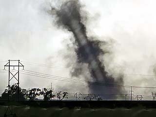
This is a summary for a landspout tornado chase in Nebraska (near Hersey west of North Platte)...
Summary:
May 14 was a long range but very successful chase day, targeting an area from McCook to North Platte in SW Nebraska based on forecast data. This would be the leading impulse for a fast-moving system that would later affect the upper Midwest and Great Lakes on May 15. I left Wichita during the mid-morning, mainly focusing on IT support via mobile internet (working from on the road). I headed up north on I-135 to I-70 west all the way to Oakley, then north on Highway 83 into Nebraska by afternoon. The SPC had an upgraded tornado probability of 5% in a small area, in a slight-risk. Hail and wind probabilities were both 15%, with the hail hatched for significant. By afternoon, agitated cumulus was noted over SW Nebraska denoting the target area was verifying and initiation was taking place. The SPC issued MCD 778 and subsequent severe thunderstorm watch box 247, valid until 11 PM CDT. I passed McCook, Nebraska along Highway 83 north towards North Platte. Supercell storms were encountered in this area, one of which produced a long-lasting landspout tornado, fully condensed from a high cloud base to the ground SW of North Platte! I wrapped up chasing at dusk, heading east on I-80, and spent the night in Grand Island, Nebraska.
Chase Details:
May 14, 7:00 PM - Observation and penetration of a very severe and tornadic thunderstorm from south of North Platte (near Wellfleet), Nebraska and Highway 83 in Lincoln County and westward near I-80 to the south of Hershey. The storm was a merger of two supercell storms, with the western storm becoming tornadic. A persistent landspout was observed south of Hershey, which lasted at least a half hour. Large hail to golfball sized was also encountered with the storm core(s). Another large funnel was also noted north of the landspout in the notch of the supercell west of North Platte, with the landspout tornado descending from the flanking line. The storm also had a striking visual appearance (stacked plates effect). Frequent lightning and heavy rain was also encountered. No damage was observed since the tornado remained over rural areas. Conditions causing the storms were surface heating, boundary interactions, a dryline, low pressure system, and an upper trough. Documentation was digital stills, audio, and HD / 4k video. A 2022 Jeep Renegade was used to chase the storm. A severe thunderstorm watch was also valid for the area until 11 PM CDT.
Video Link:
Gallery:
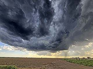
Above: Developing LP supercell north of McCook and south of Maywood, Nebraska. This will produce large hail near highway 83. The view is to the southwest.
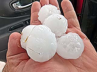
Above: Large hail stones collected near Maywood, Nebraska.
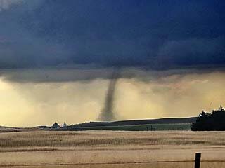
Above: A landspout tornado forms on the flanking line of another supercell / southern end of an MCS well to the west in Lincoln County, Nebraska as the hail producing LP storm down-scales. The view is to the west.
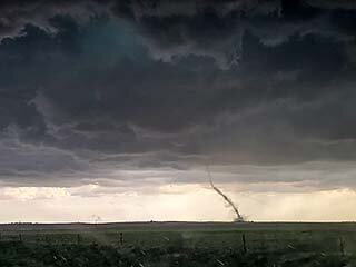
Above: Wider view of the landspout near Hershey.
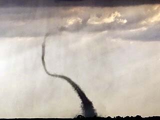
Above: Zoomed in view of the landspout while heading west towards Hershey, Nebraska on I-80. The view is to the southwest.
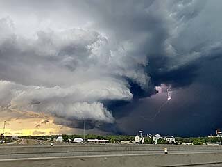
Above: After the landspout weakened and dissipated, the southern supercell storm briefly intensified and passed to the northwest of North Platte by evening. The view here, with lightning, is to the northwest.
